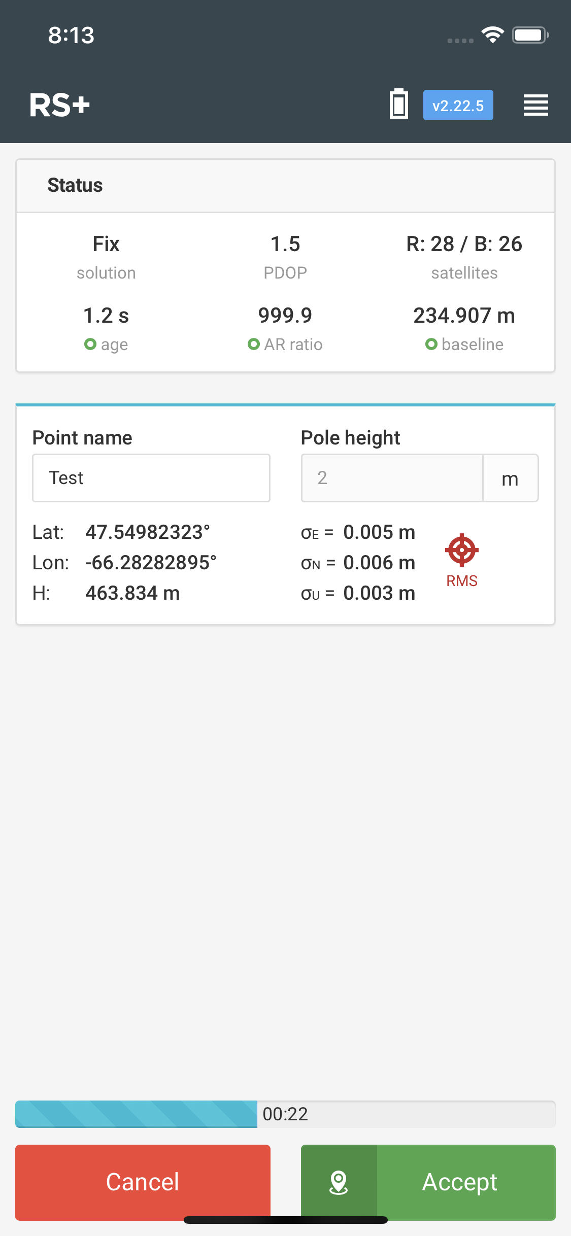
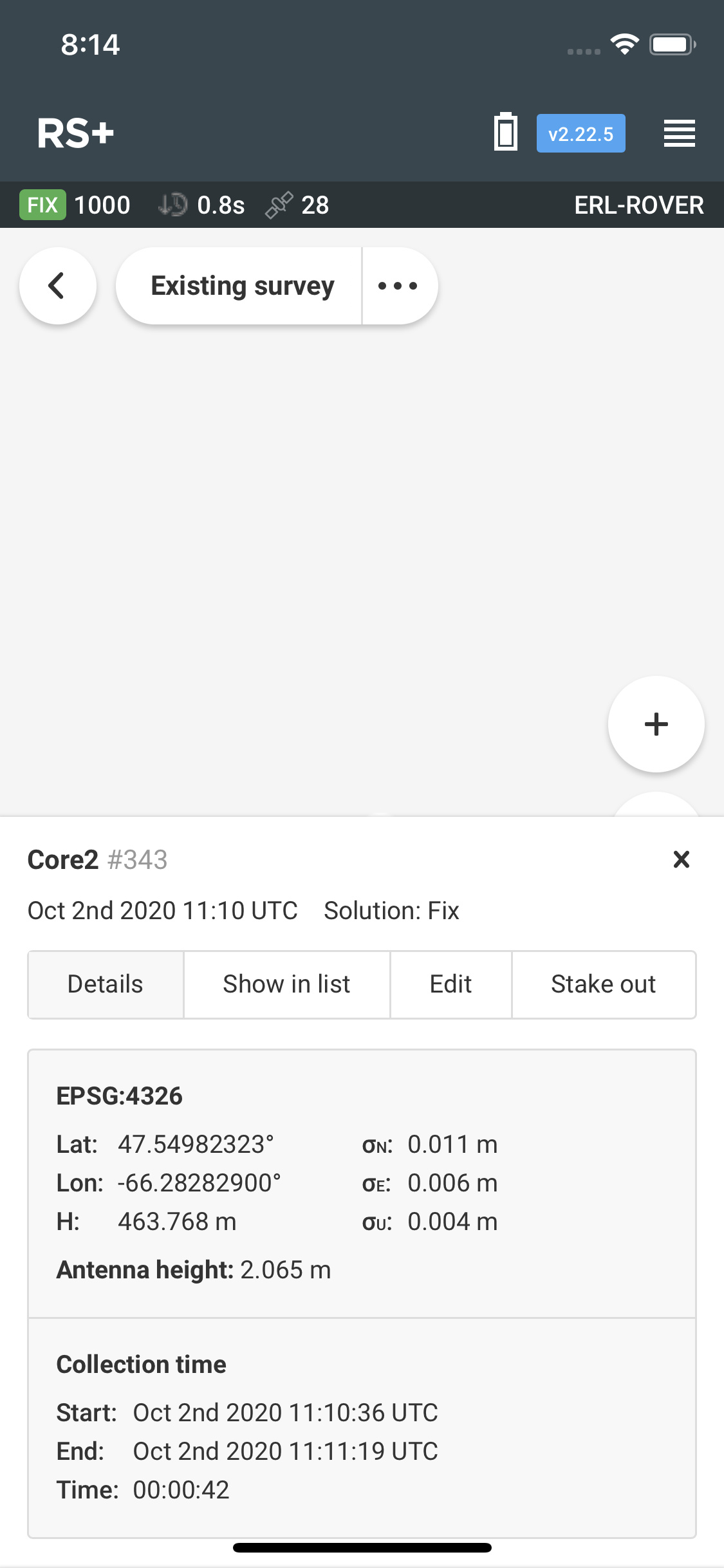
I am trying to stake out elevations on the fly by simply using the elevation value that is shown when in point staking mode however the value in on average 5-7 cm higher than the final point value that gets recorded. See pictures below. When creating the point the elvation showing was 463.834m but when I go look at the point data is was recorded as 463.768cm, a difference of 6.6cm. See pictures below.
I see that total observed time was 42 seconds. Maybe the final value is the average of all recorded Fix values? Not sure, maybe better to wait for someone from Emlid to chime in.
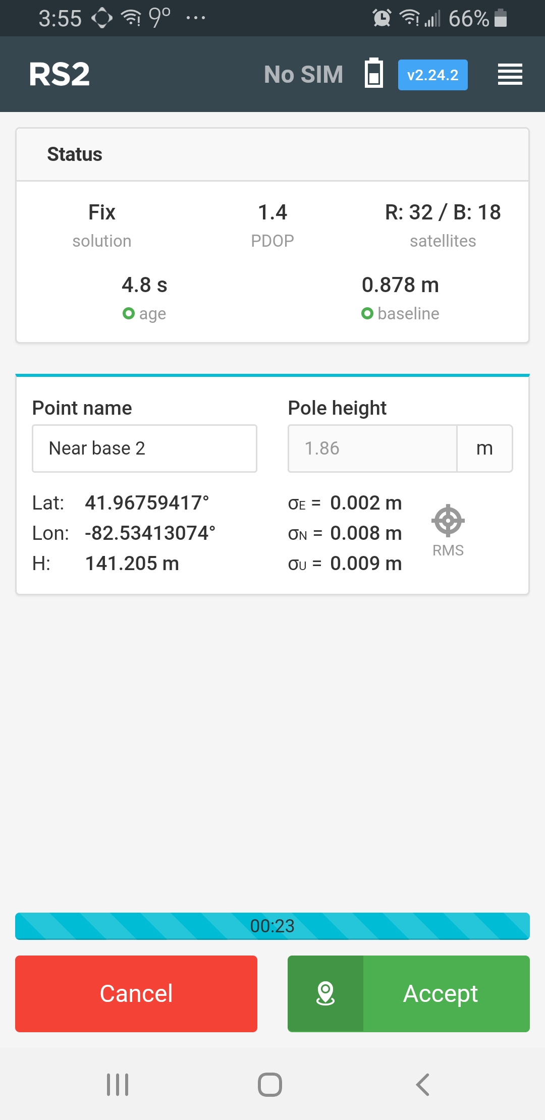
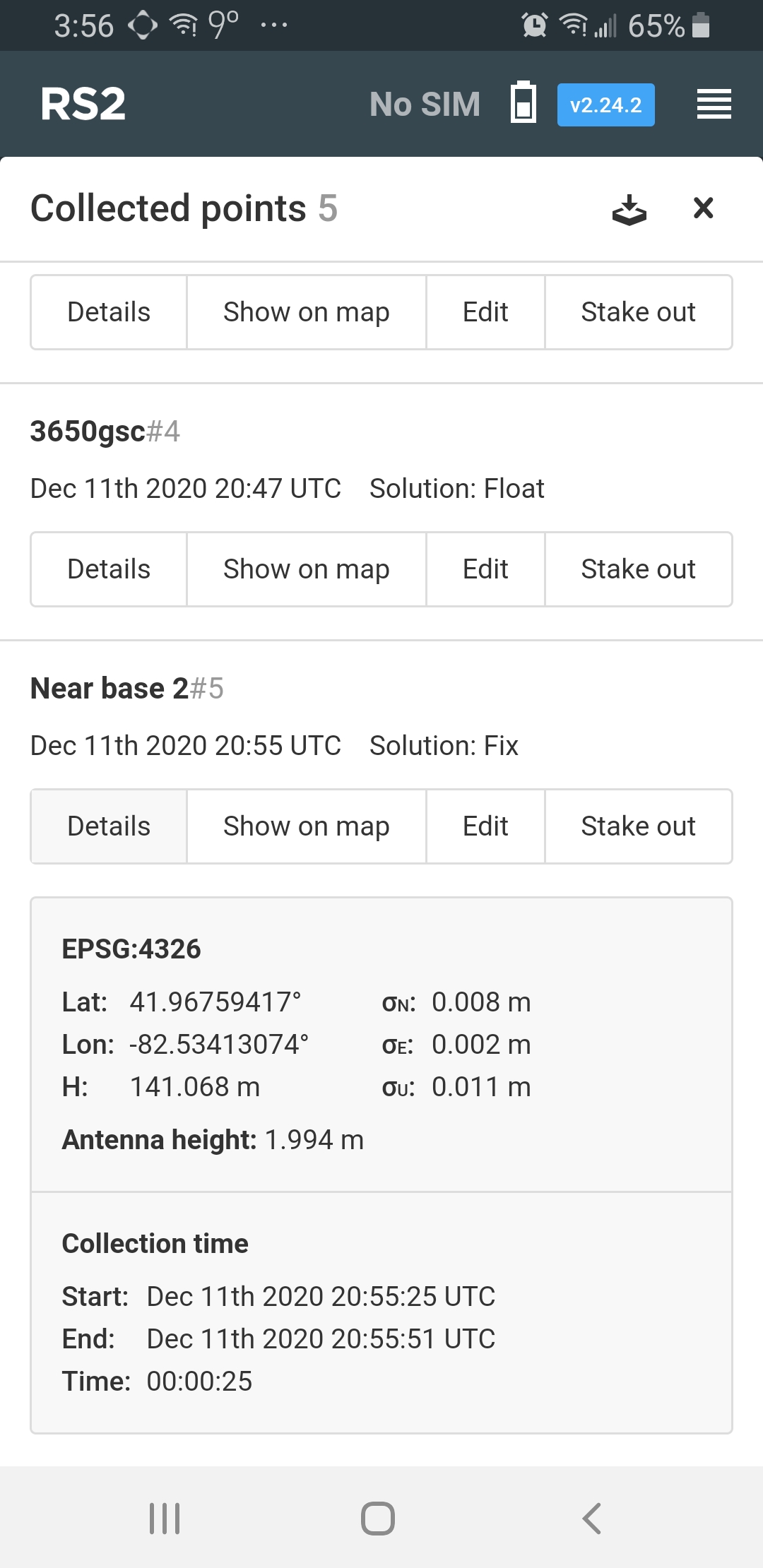
I performed some testing to and took points at the same location over longer periods of time and the elevation when taking a point is exactly 6.5 cm higher than actual recorded point elevation. Not sure if this is related but 6.5cm the the height from the base of the unit to the centreline if the gps antenna.
As you’ve noticed, a 6.5 cm offset is the antenna height. Our Survey tool includes the automatic antenna adjustment feature. So, the antenna height was automatically added to the result.
During the survey, the height is displayed with only the pole height applied. The antenna height offset is applied after the point is collected.
Thank you for this information. I noticed this exact same problem yesterday and it was a real head scratcher for me. The forum is great, here i found the answer. I will download reachview 3 and try it out! In my case it was the RS2 antenna offset that wasnt inclided during the survey.