


Good morning, just purchased a set of RS2 receivers. Trying to get familiar with using the app, is there a way to have to direct you using compass directions like in traditional survey collectors? Also is there a fast way to store stakeout points? Thanks
Hi Justin,
Welcome to the forum! 
Not sure I fully get your request. I’ll go one by one.
When you go stake out, the ReachView 3 app can show you where you are relative to the desired point. Do you use this info? Is there anything that’s missing for you?
Storing the stakeout points seems interesting. Don’t think you can do it now in the app: you just use the project data you collected and go with it. Do you mean storing them as a way to separate the ones that’s been staked out already?
Good afternoon
I understand what you are saying about staking out a point, I played with the app this weekend. Im just use to using a more traditional collector with GPS. What I mean by that is normally when I am staking out a point using GPS the collector tells me how to get there relative to north. Also, normally in stakeout when you stake out a point in surveying when we get to the point we shoot it and get a stakeout report showing use how close we were along with the cut/fill. We store this data that way if a contractor or client claims we didn’t do something or if a stake gets knocked down we can go back to the data and see what should be on the stake.
2 Likes
so kind of like a waypoint app.
Justin,
Got you, thanks for the details! The stakeout interface of ReachView 3 is currently under revision. So we’ll take your thoughts into account!
Storing the data of how well the points were staked out is something we haven’t yet considered. I see how it can improve your workflow with the app. So I’ll pass it to our devs right away.
Just want to add here that you still can use Reach with 3rd-party software. Just connect them via Bluetooth on Android or TCP on iOS. Here we have a step-by-step guide about it.
1 Like

I am familiar with various other surveying apps in the field of surveying, so I can understand Justin’s question well. Setting out points in ReachView 3 could be much more convenient.
The differences between the current position of the receiver and the target point should be displayed in relation to the north direction, as Justin has already suggested. Alternatively, a display of the differences in relation to the current position of the sun would also be very helpful.
Take a look at the attached screenshot of another app. In this case, the position of the receiver has to be changed approx. 0.52 m towards the sun and 1.17 m to the left, for example. Reaching the destination point is much easier with this type of stakeout.
2 Likes
Hi @stefan.carels,
Love your refs! That’s a very conscious feature request, thanks for that
I can see the main points here. I’ll let our devs know about them. That’ll be a thing to consider: how to make all of the necessary info look cute in the app.
4 Likes
This topic was automatically closed 100 days after the last reply. New replies are no longer allowed.
Hi everyone,
I want to let you know that we have released a stakeout report feature in the Emlid Flow 10.1. It contains Cut/Fill information as well.

You can also collect a staked point in the application.
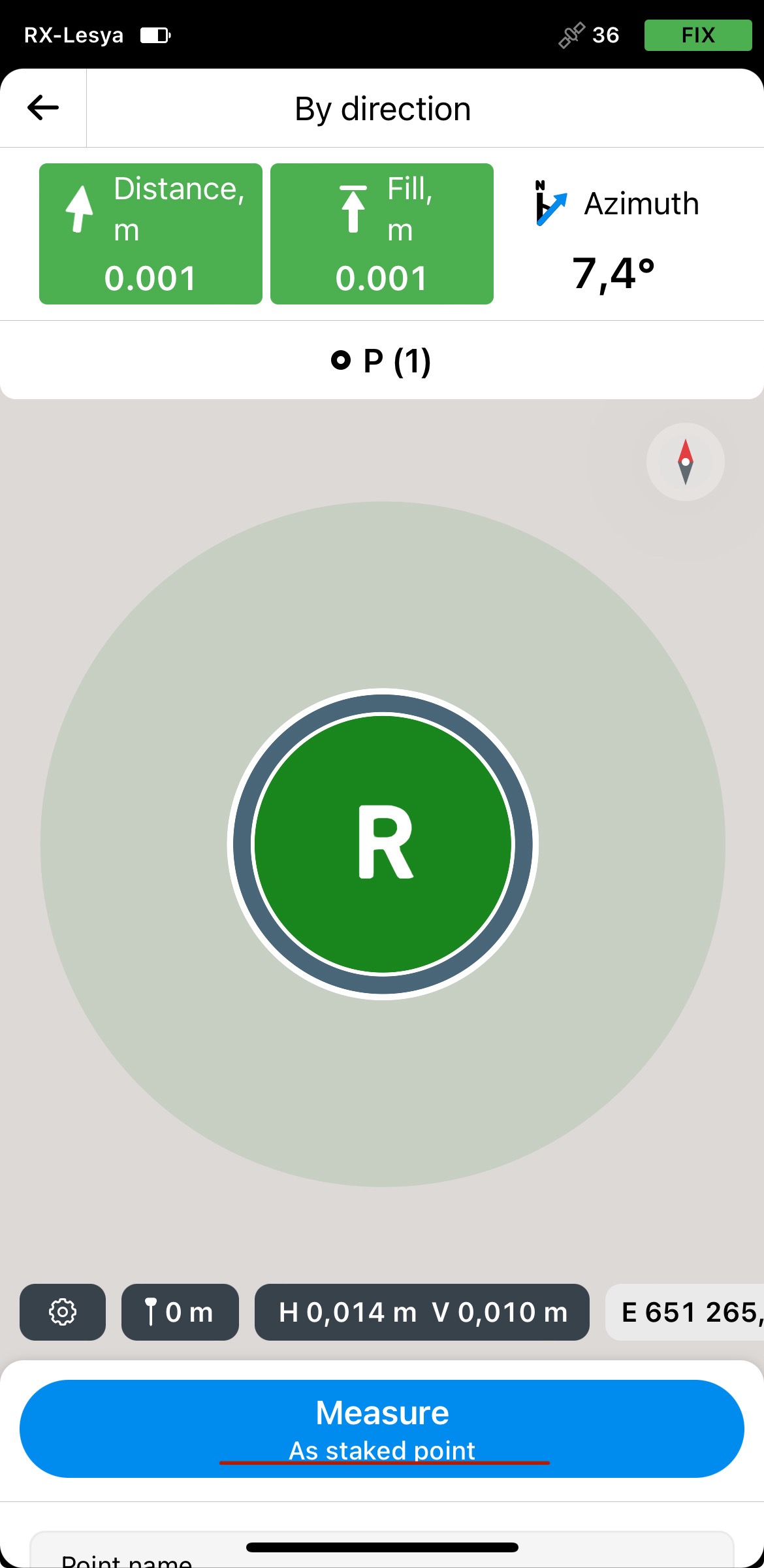
It’s available under the Survey plan. If you’d like to give it a try, you can get a free 30-day trial of the Survey plan. We’d love to hear your feedback!
4 Likes
Awesome stuff ,Thank You
2 Likes