Hi EMLID Team,
Thanks for all the updates you have been providing on the software, fantastic development and listening to the users. So infrequently we find that happening in busy times.
I have a suggestion/request, which I hope may be possible to implement:
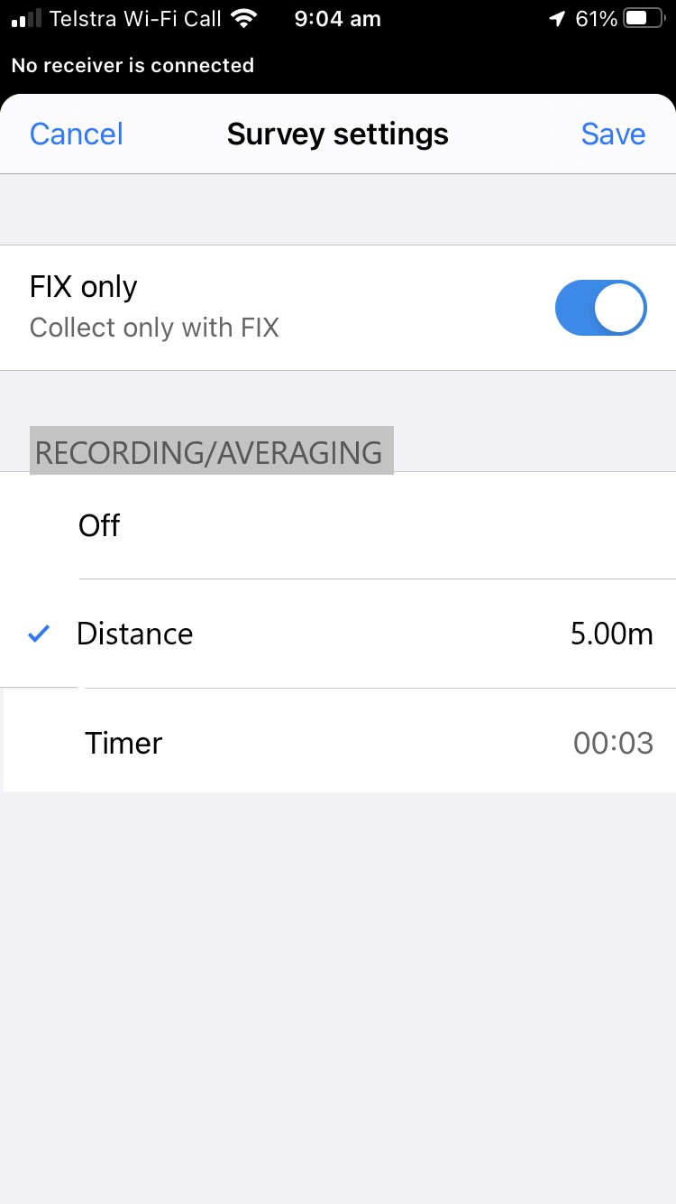
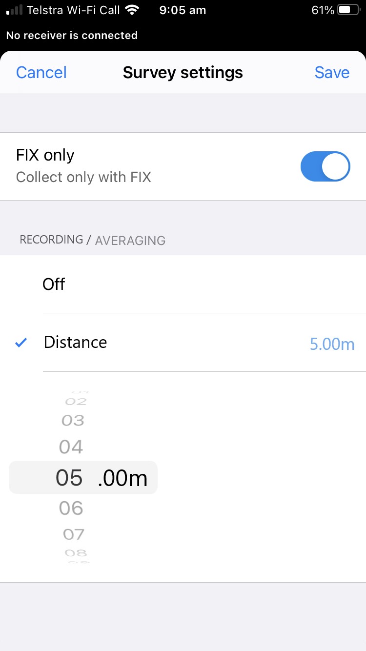
Recording of location on a timer - similar to what can be done in “continuous topo” on other Survey software packages. This is useful when undertaking terrestrial survey over large areas, where accuracy is not as important and could be implemented by using a 1s averaging in the background of the Application point storage, and allowing the user to select the distance increment they wish to use between measurement epoch in their survey area/grid?
Yes - a drone could also be a solution - but if driving/walking the terrain at an even pace, where the recording of 1s epoch measurements will suffice…would allow more users to access such a feature who are inhibited from drone purchase?
I attach a couple of screen mockups of the proposed - based in the timer screen settings area.
Thanks for any consideration you make.