Hi Fam. To @tatiana.andreeva, and whoever it may concern at @Emlid . There is an issue with coordinate output in reachview 3 v6.0 (latest version). In other to be clear enough, let me go step by step.
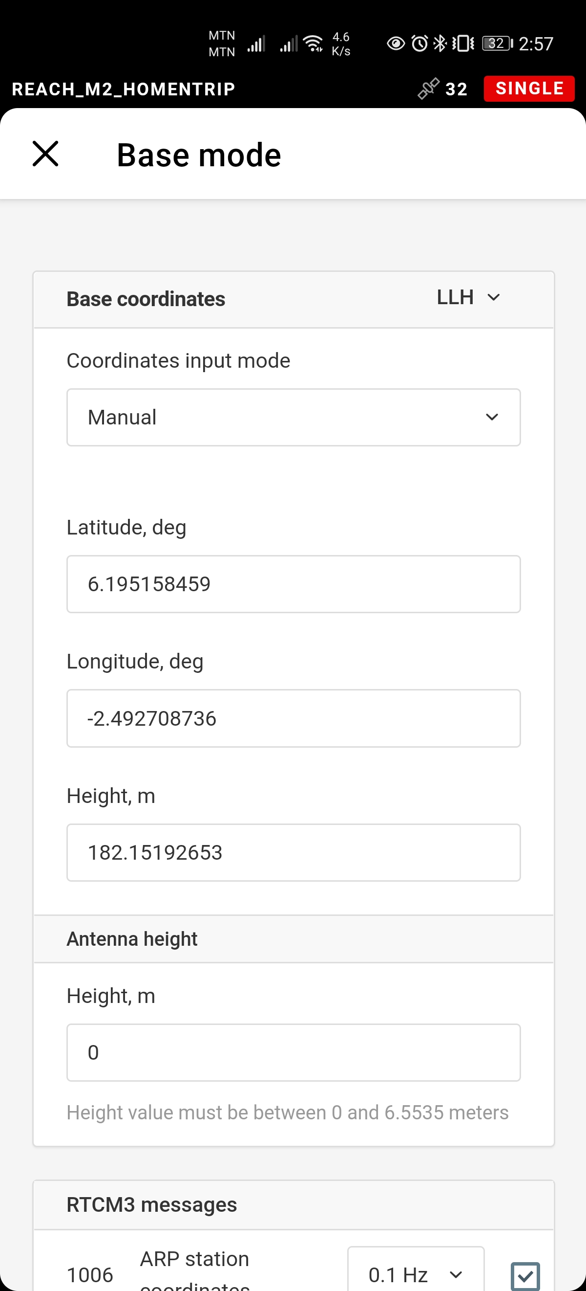
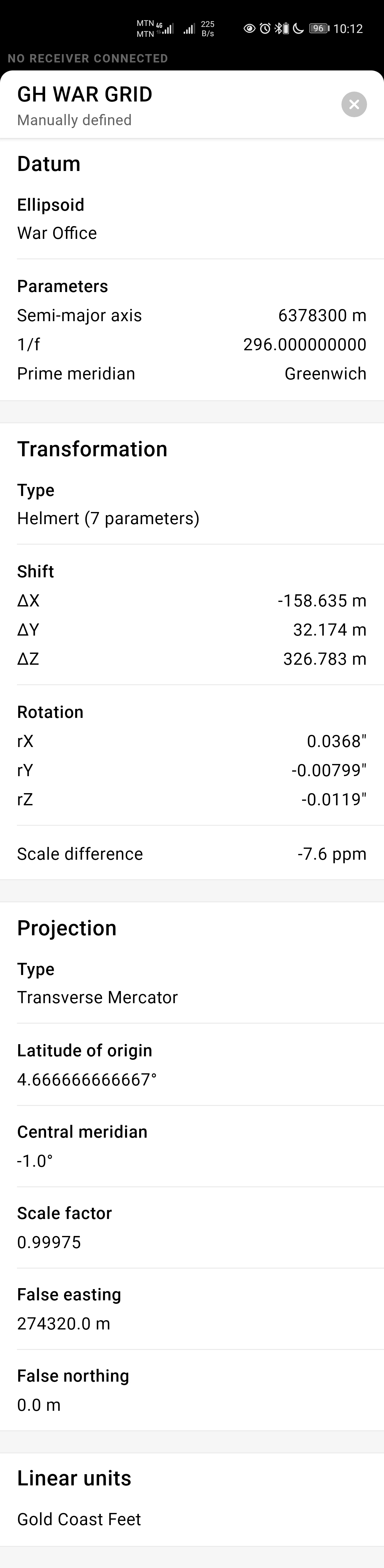
So the 2 attached images shows my permanent base station’s coordinates in WAR Office coordinates and WGS84 (which is my input into the “base mode” settings) respectively.
Now, the next file (pdf) is a report for a point I collected with WAR Office custom projection with my phone. I collected the point near the base (about 16ft to 20ft away) so I’m expected to obtain a coordinate with at most 20ft difference in both the easting and the northing. This is not the case. You’ll notice the base coordinates in the pdf is not near the correct one contained in the first image above. Kindly assess the data given and let me know if you need further details and clarifications. WAR GRID TEST.pdf (61.9 KB)
As I can see, the height entered in ReachView 3 doesn’t match the ellipsoidal height of the known point. Could you please clarify how you calculated this height?
Please note that the base position should be entered in the same datum that is used for your projection. If your projection is not based on WGS84, it might cause a shift.
If your coordinate system uses the datum that differs from the base’s one, but you have the transformation parameters, you may enter them in the Transformation screen.
the Z(height) in the reachview was an averaged height, the X & Y on the other hand are the actual coordinates.
OK. Understood. But what’s the timeline for the rollout of base mode in same datum as that in the survey tab on the rover? What I’ve noticed is the graphical representation of my position on the map is exact but the coordinates that is been output are wrong because the base coordinates in my datum indicated in the survey csv file is shifted about 2000ft.
Such are results are indeed weird. It seems we need to sort it out from scratch. Could you please answer some of my questions regarding your custom coordinate system:
Why did you decide to average height instead of using the one you have?
Did I get correctly that transformation parameters are described the transformation from WGS84 to WAR?
I’ve noticed that we have the following coordinate system in ReachView 3 app: