This may be a dumb question and if so I apologize in advance. However, I am looking to interface a Reach RTK system with a Pixhawk and am excited about the potential. I’d like to be able to export an accurate GPS track file (GPX or similar).
Is there an easy way to do this? My initial thinking was to simple find a means of converting the dataflash logs on pixhawk to a GPX track - but there doesn’t seem to be any means of doing that in a simple manner?
Any input is appreciated!
Thanks
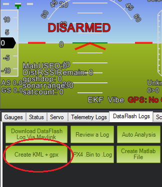
Wait, I may indeed have asked a dumb question. In Mission Planner, I found a
“Create KML + GPX” function from Dataflash logs.
Can anyone confirm this is will work?
Hi!
What about setting Reach to log solution to a file and download it later?
That would work. I’ll be ordering a Reach kit in the next few days to learn - but am not yet sure of it’s capabilities.
When I set it to log, is that saved to internal memory, or an SD card or similar?
Thanks for the input!
Yeah, you can download it later via ReachView
Great, thanks. Can’t wait to start playing with these!
1 Like


