


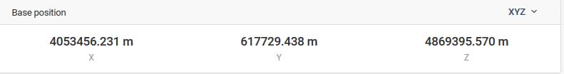
While checking coordinates in Reach View I found out that there are XYZ Coordiates in the Base Position field which are different from the original coordinates from this base station.
But look:
Mounted to NTRIP Caster FFMJ which is the roof of BKG (Bundesamt für Kartografie und Geodäsie).
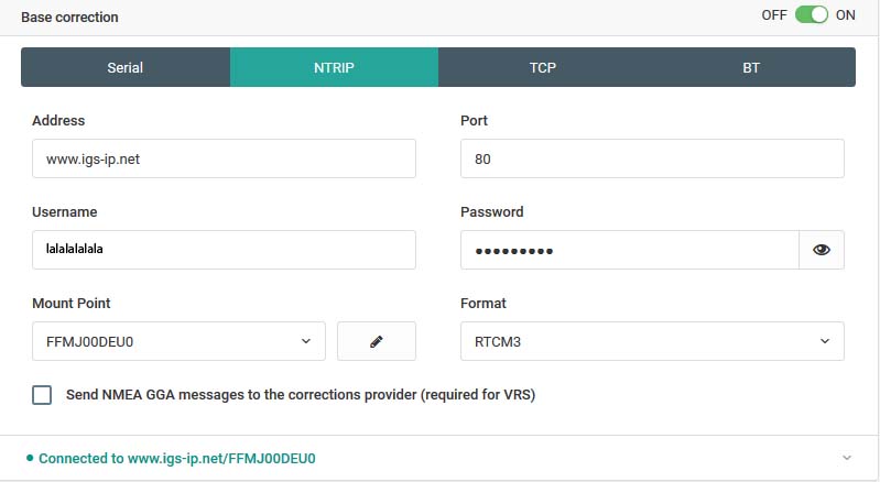
The Reach Views shows these Base Station coordinates:

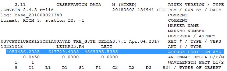
Reach log file of corrections shows these XYZ coordianates which are slightly different as in Reach View:
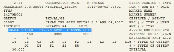
But the Rinex Header of an observation file of this Base Station FFMJ shows different XYZ coordinates:
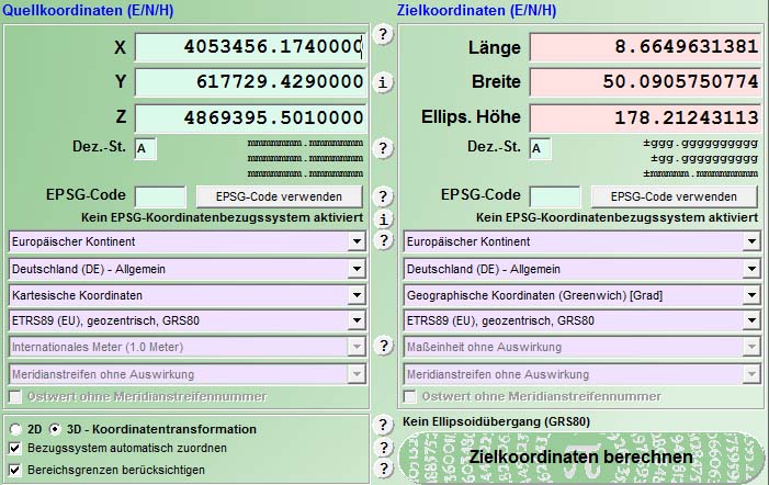
And now comes the magic. Both XYZ coordinates converted with TRANSDAT shows the same LLH coordinates:
At first the coordinates from station FFMJ:
And now coordinates from Reach:
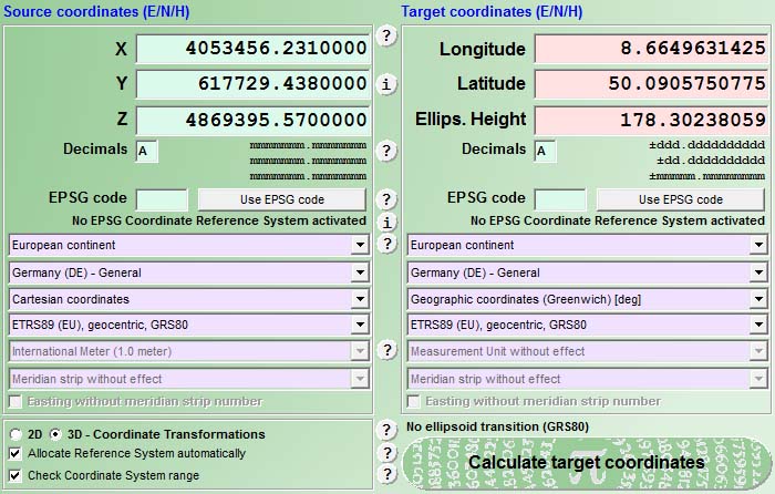
Both times the same position but about 10cm difference in height.
Who can explain that to me…