Greetings,
We recently purchased a Reach RX that we are using to survey coastal wetlands, and we are having issues with the output file. For example, it says the elevation is -27 meters, but we are definitely not in a sinkhole. I was able to connect to the Alabama DOT base stations and get points to Fix, but I’m also noticing that the base station elevation says it’s -17 m. My guess is some of the other settings are off, but I’m not really sure what to do from here. The first 3 points that I measured seem reasonable, but everything after that seems off. For the first 3 points, I was connected to the Alabama DOT AL50_MSM4 and for the remainder, it was ALDI_MSM4. I have the output file, but I cannot attach it because it says I’m a new user and it’s not allowed.
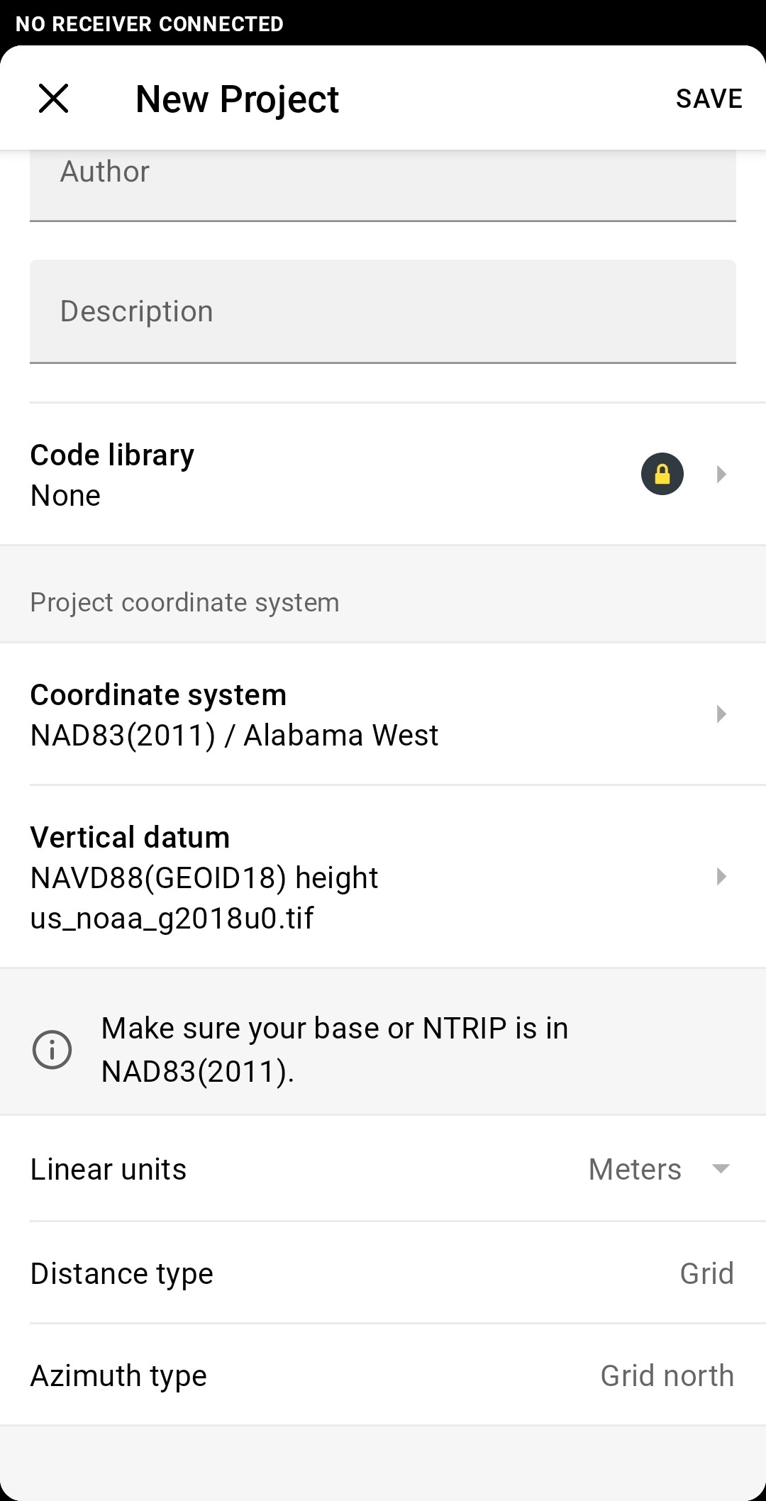
The coordinate system I am using is NAD83/Alabama West. I’m not sure if this is correct and someone mentioned using NAVD 88, but I did not see this option when setting up the project. In any case, any help with this would be greatly appreciated.
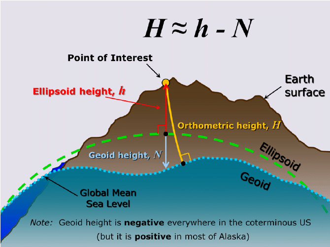
It looks like it was measuring on Ellipsoid height. We are also measuring right along the coast in salt marshes so we expect all of our measurements to be pretty close to 0 meters elevation (+/- a few meters, possibly negative). The numbers shouldn’t be so negative and neither should the base elevation. Thanks for your response though, the graphic is really cool!
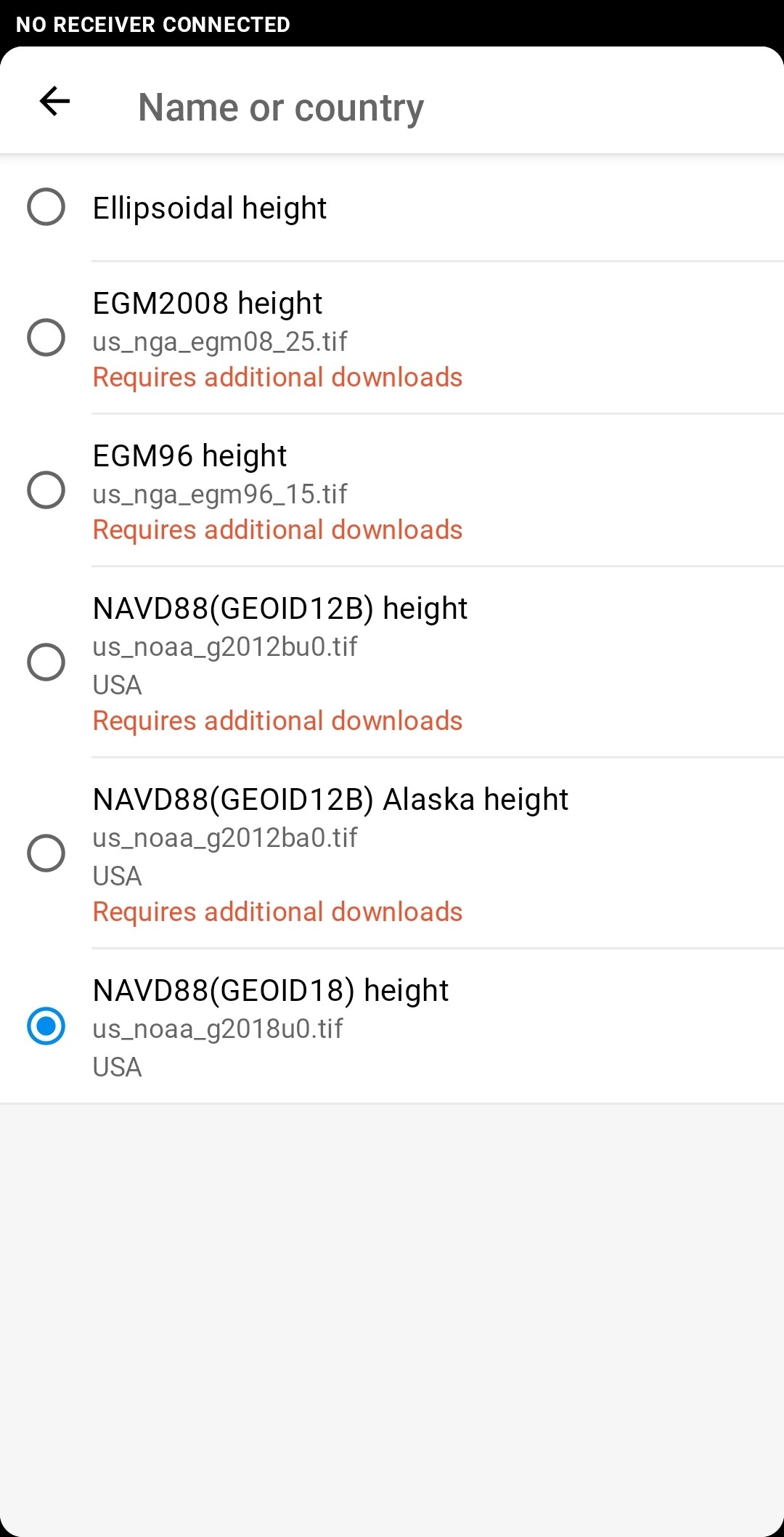
I may have found a solution. After watching a youtube video I saw under the Projects menu that someone set the Vertical Datum to NAVD88 height. Mine was set to Ellipsoidal Height. I created a new project and changed the Vertical Datum to NAVD88 height (EPSG:5703) took some points at a site with ALDI correction and the measurements taken had elevations of what I’d expect (0.1 - 0.6 meters). I took the same measurements under the old project and got -27 meters again, so I think adding the NAVD88 height has helped!
I’m not sure if this is the “best” or “right” solution or if there is anything else I need to change at this point, but I think this is a step in the right direction.
Yes, correct. If you want Orthometric Height (distance from MSL to your observation point), you need to assign the NAVD88 datum (GEOID18) height at time of coordinate system set up. Otherwise as you experienced, you will just get Ellipsoidal height.
Hi Jerry,
Please type the word “Alabama” for the Coordinate system option and choose the first one. It has an USA tag under the CS’s name. It comes from our registry. After that, you should have the option to choose the NAVD88(GEOID18) for the Vertical datum.