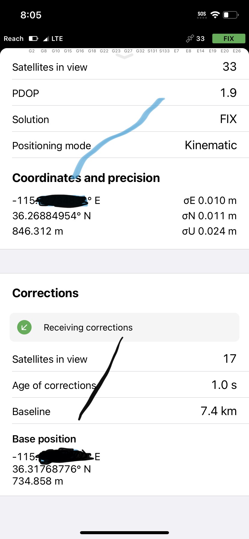
Hello everyone, I just started using my reach RS 2+ with firmware version 30.1. I was able to create a local Entrip network with my autel my autel RTK drone. I live in Las Vegas Nevada. When I select the average float for five minutes, it ends up giving me the correct North but the longitude is correct in the numbers but it gives me and easting! It puts me in CHINA. I have even taken the manual numbers and made sure to input a positive number so it could depict a west longitude, but it automatically puts a negative on there and makes it in easting longitude.
It is connected to my local NRIP network that is maintained by to water company. I am at a loss. Any help would be appreciated.
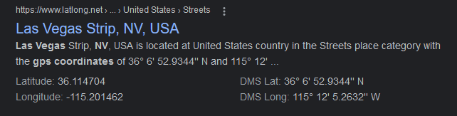
So, even though there is an E in the longitude, just reference the minus symbol, and that depicts that it is a westing? This is so thank you so much for responding and answering. Such a newbie question.
Just wanted to confirm what @PotatoFarmer said. The ‘E’ at the end of the line only indicates the positive direction. So with a minus sign, you get 115 degrees west.