


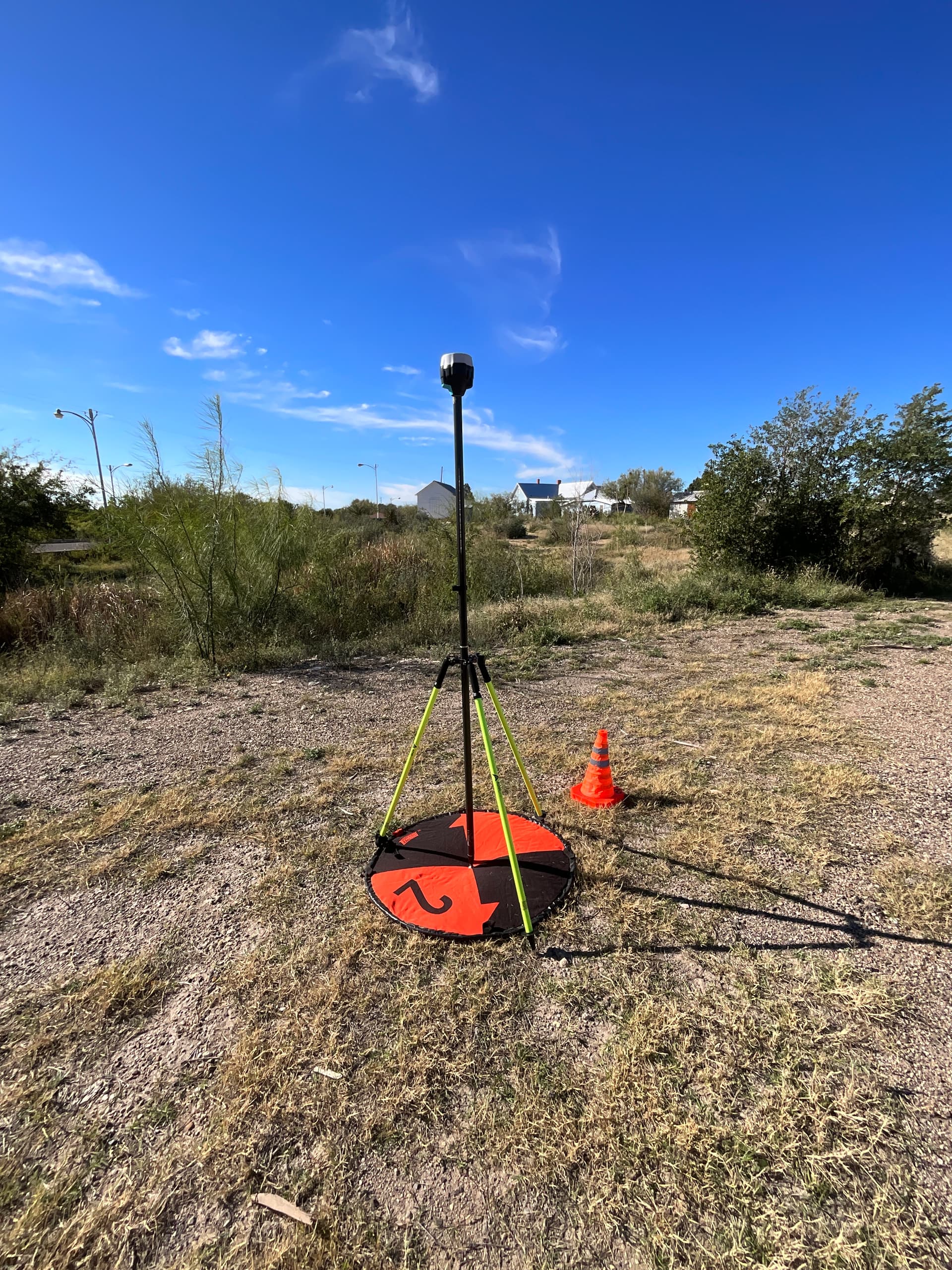

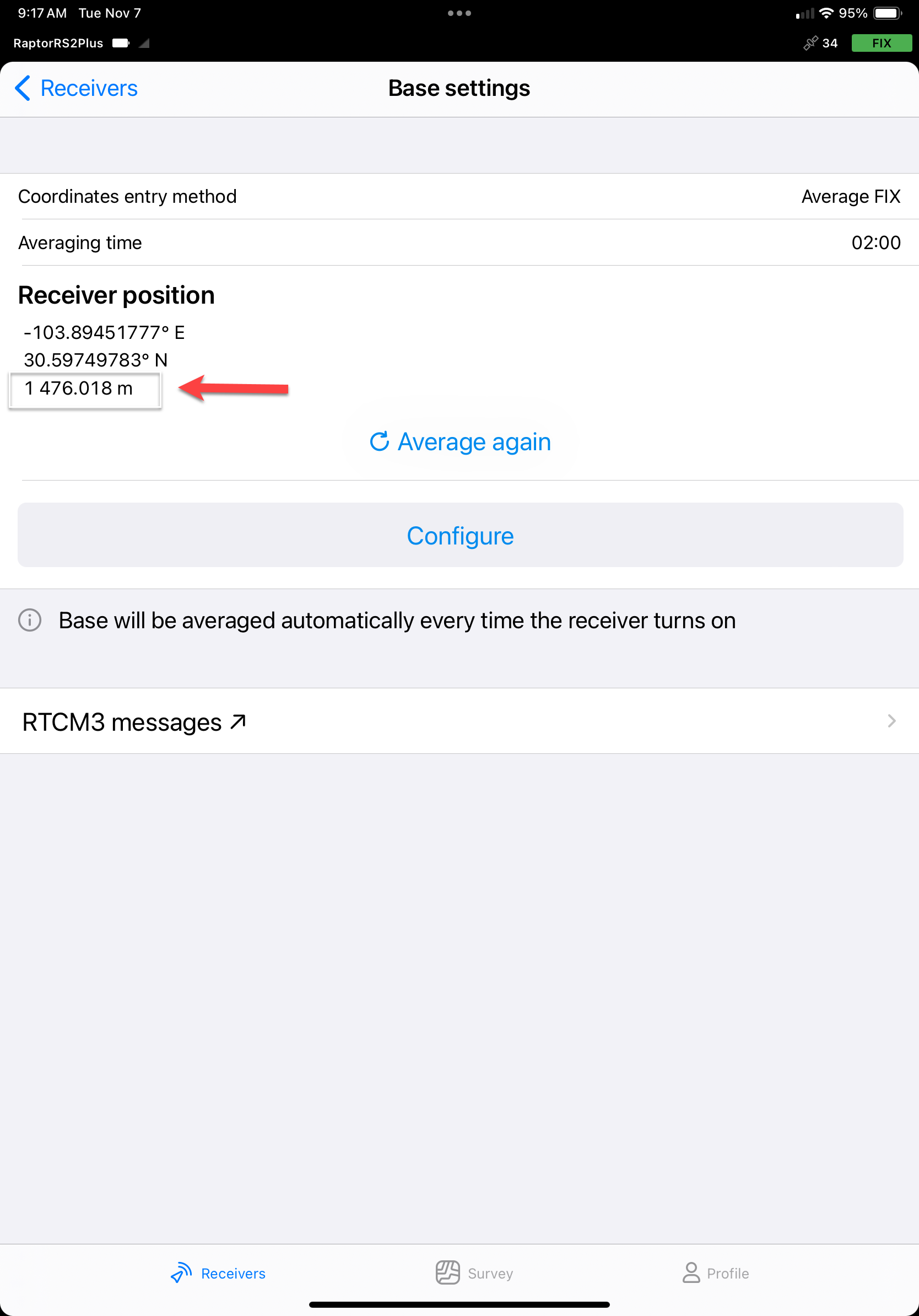
I am starting to use the Emlid Reach RS2+ to survey GCPs for drone surveys. The attached photo shows my typical setup of the RS2+ receiver over the GCP of interest. My question is regarding the receiver position height. When determining the ellipsoidal height of the GCP laying on the ground, do you have to subtract the antenna height (2.134m) from the heights shown in the screen captures?
1 Like
Hi Mike.
In your first screenshot (base settings) tap the Configure button.
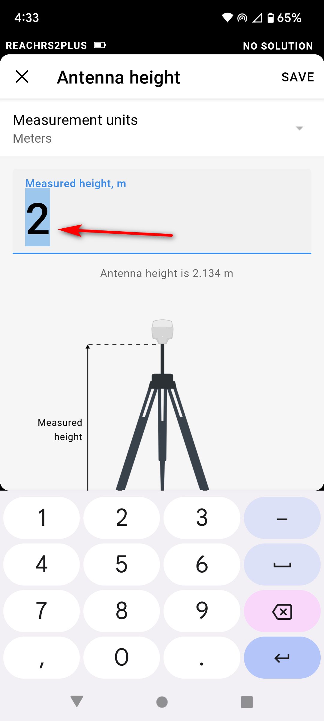
Tap on Antenna Height and enter your pole height. The software will automatically add the .134
Then the points will be referenced to the ground.
When you export the .csv containing your points, the antenna height that was used will be listed for each point.
2 Likes
Dave,
Thanks for your note.
I do all of that when using the receiver connected to my drone. Steps below.
FIX
Configure
Average FIX for 2 min.
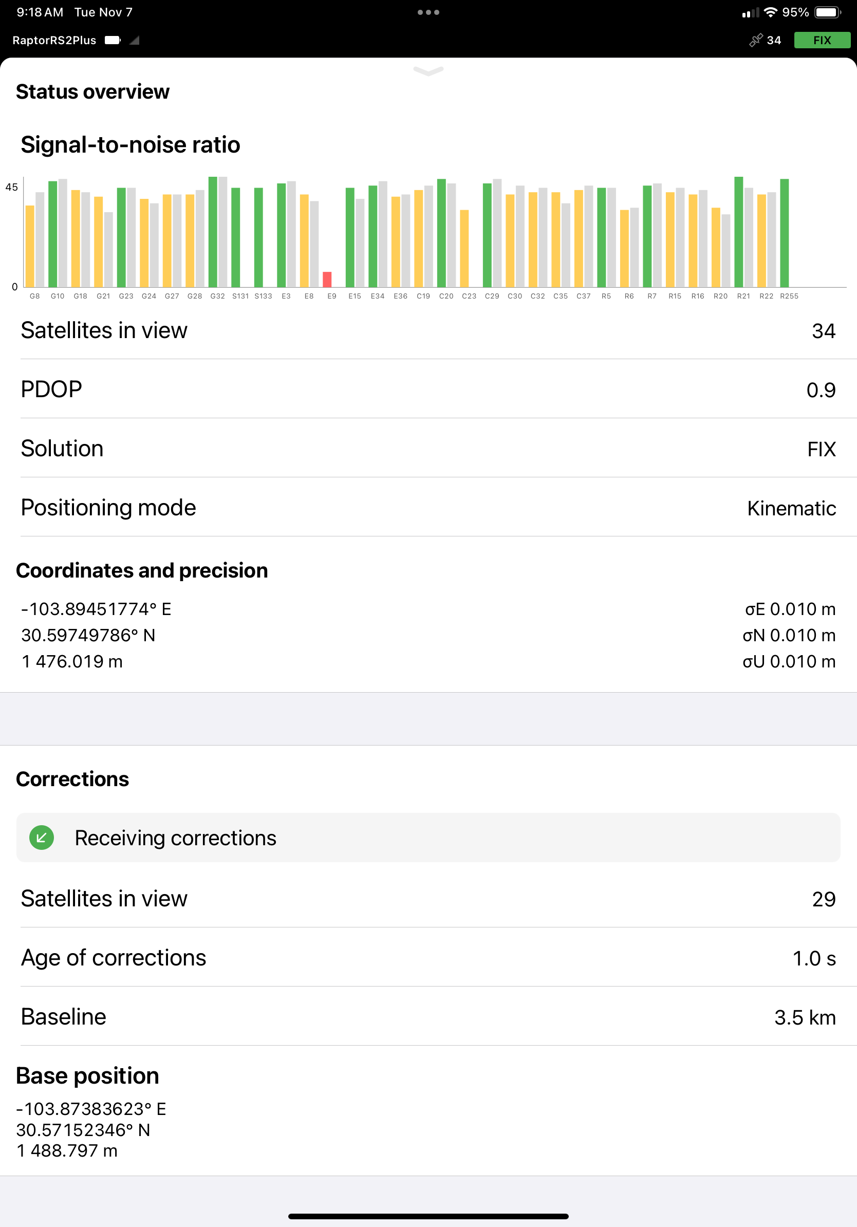
Screen capture resulting coordinates
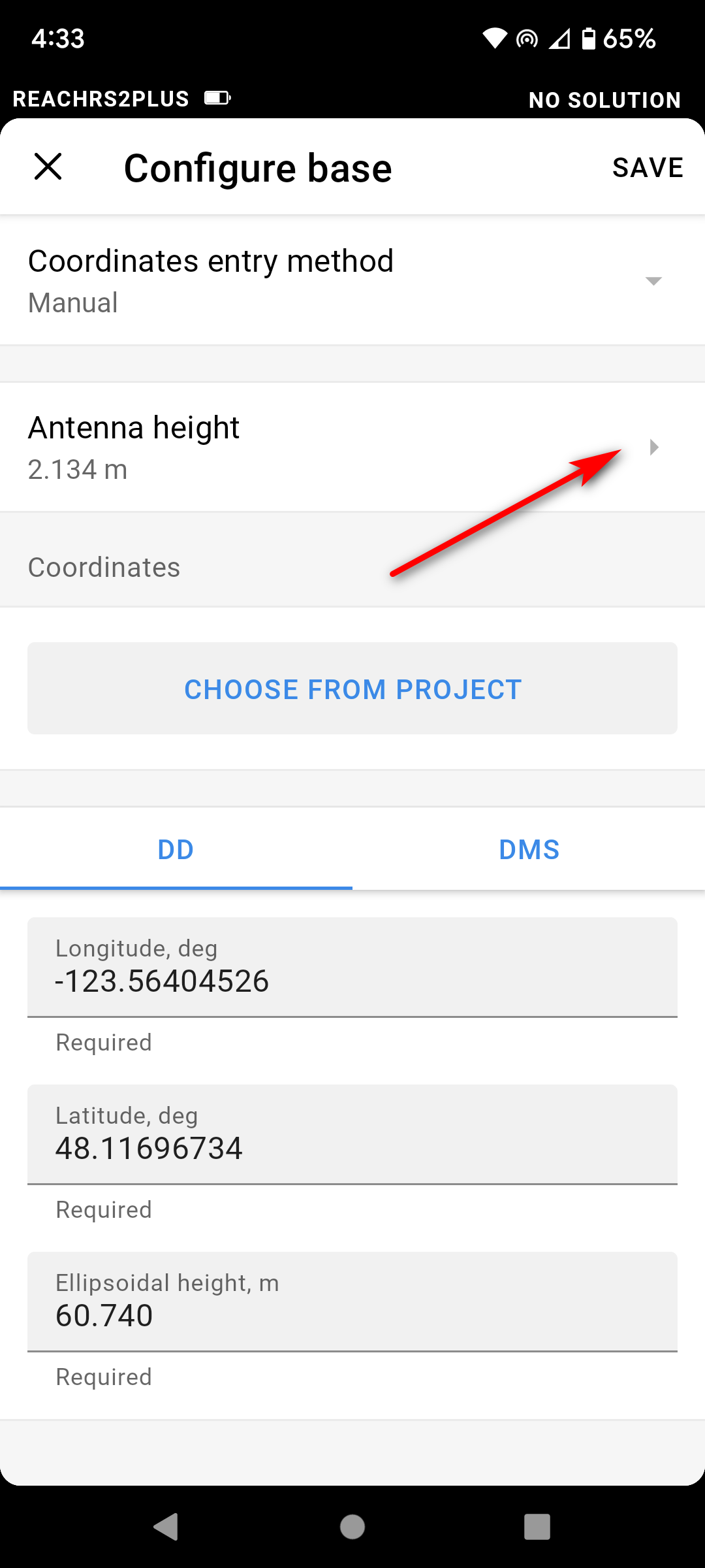
Configure
Switch to Manual
Input Antenna Height (2.0m) or 2.134m total
Save
Input Longitude from screen capture above
Input Latitude from screen capture above
Input Ellipsoidal Height from screen capture above
Save
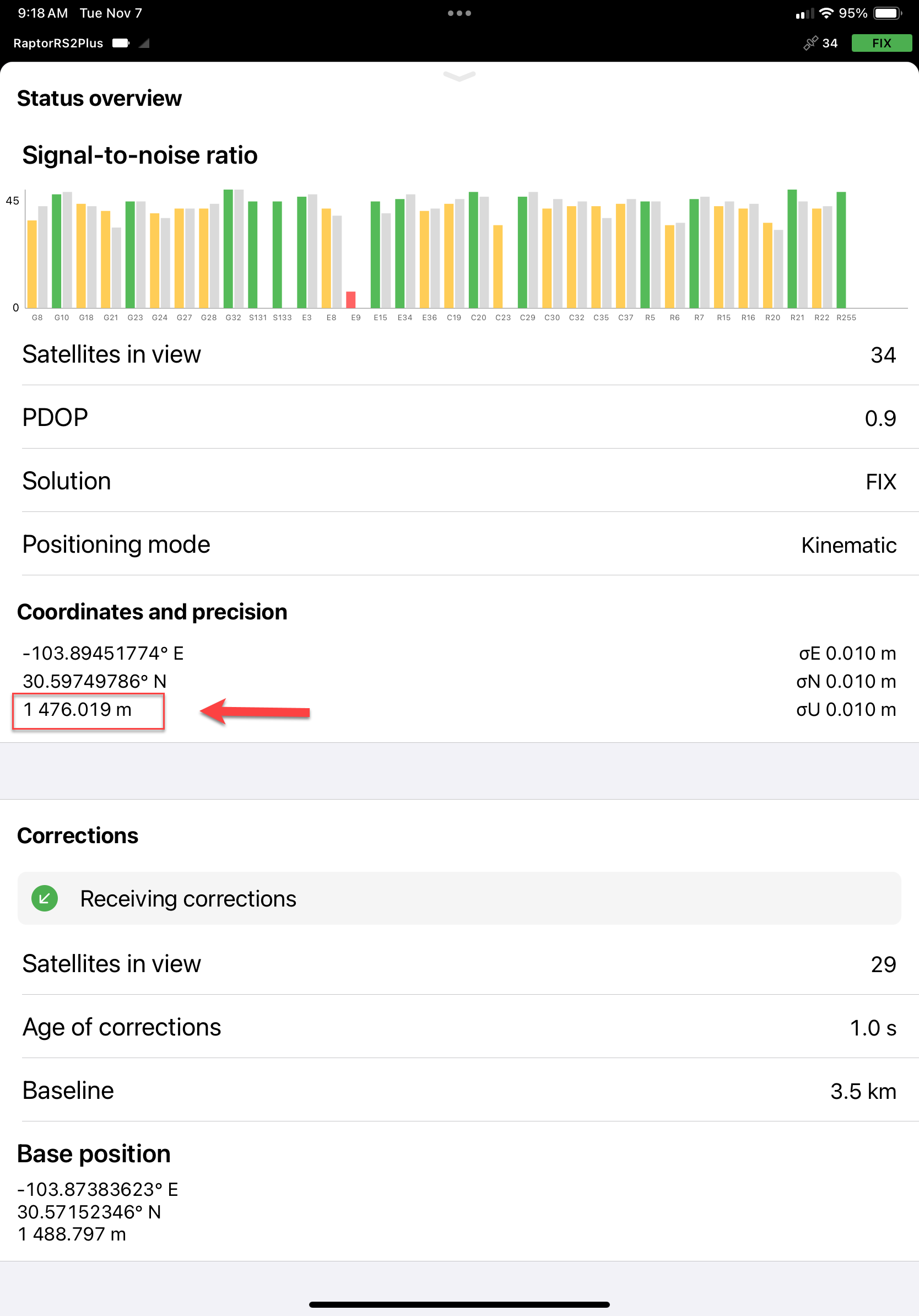
My question is regarding the receiver position height. When determining the ellipsoidal height of the GCP laying on the ground, do you have to subtract the antenna height (2.134m) from the heights shown in the attached screen captures (see red box and red arrow)? I am trying to understand what this height represents – height above the ground at the receiver or height of the point on the ground directly below the receiver.
Mike
Mike Allison
832-242-4406
1 Like
Mike,
Whether you collect a point from the base settings page, or adding a point from a project, Flow will use the antenna height that you specify in either case and the point will be the elevation on the ground.
Looking at your steps above, are you setting the antenna height before you average? You need to in order for Flow to subtract it.
Any time you collect a point, an antenna height will all ready be subtracted from the resulting coordinate so long as you have set one. You can compare the elevation of the point to the elevation reported on the status screen and you should see the difference.
In no case do you need to enter the collected coordinate by hand. If you collect a point by averaging in the base settings, that coordinate can be used if you send corrections to another device. To use it, you need to wait till the averaging is finished, tap on Configure, and select Manual. The app will autofill the Latitude, Longitude, and Ellipsoidal height fields with averaged coordinates.
An even better approach is to collect your base point from a project. Then, in the base setup page, select Configure > Manual, and then Select from Project. Select a point and it’s coordinate will populate your base settings. No need for manual entry in either case.
3 Likes
Mike, reading back over your comments, what device are you using and which version of the app? On the current android version, the specified antenna height is listed right on the base settings page. It is not on your screenshot is why I ask.

2 Likes
Hi Mike,
I agree with Dave. If you are using Emlid Flow, you don’t need to do any additional calculations. With the latest firmware and app version, if the height is specified, it will be subtracted. So, you’ll see the point position on the ground plus the stored antenna height.
In the Status tab, you see the height of the Reach antenna phase center. To collect GCPs, I’d recommend checking the points’ positions in a project. If you collect GCPs in a project, the antenna offset plus pole height is subtracted, so you get a point on the ground right away
2 Likes