Reach RS2 and FieldGenius for Android in Mortgage Surveying

Reach RS2 is a handy companion for land surveyors around the world, as it can be easily implemented into existing workflows. Reach RS2 works smoothly with various field software including MicroSurvey’s FieldGenius for Android. Check out how Jon Campbell from Ohio applied Reach RS2 and FieldGenius for Android in his daily business.

Background

Jon Campbell’s family has worked in the survey industry for almost 50 years. His grandfather started the business in 1979. Today, Campbell & Associates is a full-service land surveying firm with over 50 employees. The company’s main focus is on mortgage location surveys.

Jon has been working in the field full-time since 2003 and has experienced tremendous advances in technology. The most significant change, he said, was widespread RTK GNSS systems that ensure accuracy and ease of use.


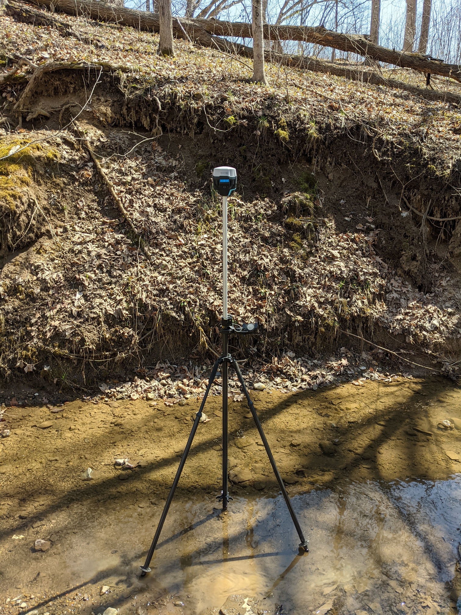
Mortgage survey with Reach RS2 in Ohio, USA


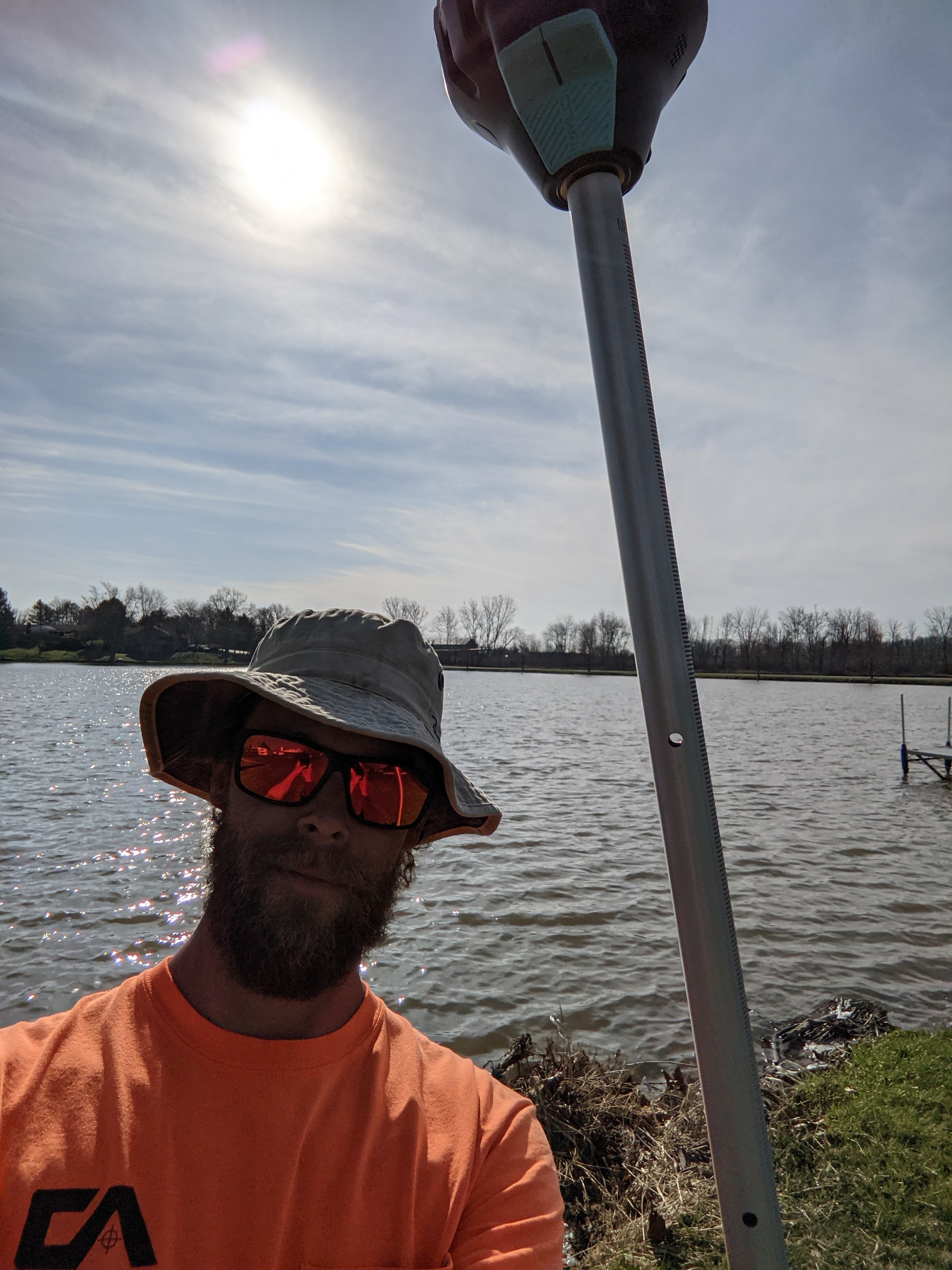
Jon Campbell surveying with Reach RS2

Reach RS2 for Mortgage Surveys

A title insurance company usually requests a mortgage location survey to confirm the legal description of the property. It requires an on-site field survey of the property boundaries. To enhance productivity, Campbell and Associates use RTK GNSS receivers. 

Employees use Reach RS2 with FieldGenius for Android to locate property corners. Technicians also locate major improvements to the property, such as auxiliary buildings, fences, and driveways, and make sure there are no property encroachments.

After the measurements are taken, the file is exported from FieldGenius and emailed to the office, where the data is processed, and plans are prepared. Also, technicians use Reach RS2 and FieldGenius to stake out calculated points and perform boundary surveys.

While surveying, technicians can go anywhere from small city lots to deep in the woods. With Reach RS2, they report that the coverage is noticeably better than with other receivers. What’s more, Reach units are compact and lightweight.

“I was very impressed by the Reach RS2 coverage before the leaves returned. It would fix almost anywhere it seemed. The units are weather resistant and work great in most weather conditions. The battery life is perfect. The units go weeks without needing a charge, the way we are currently using them.”

Jon Campbell from Campbell and Associates

Gear Setup

When surveying in southeast Ohio in areas with unreliable cell service, technicians use two Reach RS2 units, set them up as a base and rover, and connect the units via LoRa radio. With this workflow, they appreciate high accuracy and simple settings in the Reachview 3 app.

For the most part, surveyors use a single Reach RS2 unit with FieldGenius for Android and receive the NTRIP correction over the Internet. This bundle is straightforward to connect and start collecting data.

Accuracy and Ease of Use

For Campbell and Associates, using Reach RS2 with FieldGenius for Android is very convenient. It removes the need for a separate data collector. The program can be installed on a tablet or phone, then employees follow the Emlid tutorials on YouTube to get started with the receiver.

“Reach RS2 with FieldGenius is very intuitive and easy to use, even for older techs that can seem reluctant to try new technology. But Reach RS2 with FieldGenius is winning over a tough crowd. The coverage and accuracy of Reach RS2 combined with the usability are helping all of our guys feel confident and most importantly accurate," shared Jon Campbell.

With Reach RS2, the surveyors receive reliable and accurate results, with centimeter accuracy (within one-hundredth of a foot).

“I have set several control points with Reach RS2. Then, when I set up the total station and check those points, they are precise, down to the hundredth of a foot,” commented Jon Campbell.

Fleet Expansion

Currently, the company is working with seven Reach RS2 units over five crews and planning to expand the number of Reach receivers to be used by all survey crews. The accuracy, coverage, and price of the Reach units are key factors that influence their choice.

“It's hard to stress how amazing these units have been for what we are focused on. We never have to send a technician back to a site because it was too complicated. We save time and are more accurate because of Reach RS2 and Fieldgenius! What more could you want!”

Jon Campbell from Campbell and Associates
6 Likes

I’m guessing localization to the property corners was used?

1 Like

Can they explain in further detail this process? How they are getting their points where they need to be, back in the office from start to finish when there is no cell phone reception?

Does FieldGenius for “Android” have Localization or GNNS Local Transformation features yet?

Yes. You can localize using NTRIP or by an averaged “I’m Here” point. You need at least 3 points for horizontal and 4 for vertical but you can choose which aspects of each point are used.

2 Likes

Hi!
The technicians used LoRa for RTK communication and the ReachView 3 app. The project was just stored locally on the phone with the app.

1 Like

Yes, that is obvious. But what are they doing to get their BASE/ROVER observations in the field corrected after the fact when there is no cell service for NTRIP CORS RTN?

Two approaches would work here: either post-process a base position before RTK data collection with the rover or set up a base station over the survey mark.

2 Likes

Or in the case of a mortgage or land title surveyor the absolute global position doesn’t matter because it’s all about the improvements in relation to that specific property.

How were they verifying the positioning of the pins? Just off CAD?

Did they match the plat or did they have to correct it?

When done with a total station you do a resection and a check, but with GNSS you localize the site to the plat/CAD points.

4 Likes

Sounds about right, thanks! Though we can check these details with the users.

1 Like

Thank you. I guess what I am trying to understand is, if one did NOT do either of these 2 procedures beforehand?

What is the procedure AFTER the points were collected via BASE and ROVER (no cell reception) as obviously the BASE is SINGLE autonomous mode with non cm accuracy, but much higher non-usable accuracy. So all the measured points are shifted at whatever the BASE averaged its own coordinates.

EDIT:
So what are others doing in this case after (or Jon Campbell in the article)? Do they bring the point data into AutoCAD that has coordinate system capability such as Map or Civil? (or use survey specific software such as MicroSurveyCAD) Then SHIFT all the points? What is the proper procedure typically used to perform this shift? Obviously if using just (1) receiver via NTRIP CORS RTN, all this can be avoided… but just curious the procedure when this isn’t the case…i.e. NO cell phone reception in highly wooded areas.

2 Likes

Seems like allot of unnecessary work for a standalone mortgage survey.

2 Likes

They really don’t need to localize, and they were not localizing last I spoke to Jon. They just need to find out where the boundary is and just locate everything in relation to the boundary.

5 Likes

Localization is the process of making the GNSS data and CAD match the condition of the control on the ground. While it’s true that they may not need localization in those terms they still have to do the same calculations in order to fix or reset any property corners so if you can do it with the GNSS then it’s a win-win. It was really frustrating drawing Plats, topos and Land Title Surveys that were on an arbitrary basis like 5000,5000 and then putting it on the SPCS after the fact if it was for Engineering.

3 Likes

In the case of a wooded lot and no cell reception our technicians will use a total station.
Our drafting department I receives a .txt file from the technician, when they get back to decent cell reception, and the drafting department imports the file and rotates the points in to the provided plat or legal discription.
If the technician uses a base/rover set up, the procedure is very similar. The Reachview3 app, made by Emlid, is used to collect the points. Reachview3 works great, just only gives a .csv file, and the drafting department likes .txt files.
The correction is provided through the application. Reachview3 has a lot of options for state plane correction.
You should really just buy 2 units and watch the YouTube videos, then export some data, and check it out in CAD. The Emlid better then the name brand units. I’ve used them both and crunched the numbers.

5 Likes

Welcome! Thanks for the response! Much appreciated!

Do you (or others here) ever use higher powered radios (beyond built-in LoRa)with the Emlids when tromping through the woods where there is no cellular reception? If so, what set-up are people using when total station not an option $$$?

Thanks!

1 Like

Yeah, no need to crunch the numbers, typically BOGO right off the bat for the receivers at the very least! ; )

1 Like

Hi there,

Thanks for the discussion!

To calculate its position, the receiver needs to track satellites. In the forest, under the dense vegetation, it becomes harder for the unit to receive satellite signals and calculate a solution. In such a case, it’s not possible to neither get the position with the receiver nor send corrections via LoRa radio.

However, as Jon pointed out, it’s possible to use the total station in a wooded area with no cellular reception.

1 Like

This topic was automatically closed 182 days after the last reply. New replies are no longer allowed.