Today I am downloading Survey project from ReachRS and am will convert it into CSV file containing height elevation.
Software - QGIS, Microsoft Excel
It’s possible it could all be done in QGIS but I am taking a very simple approach for absolute beginners. As tb_rtk said, for the “kindergarten” level ![]() No scripting or expressions required.
No scripting or expressions required.
Step One.
Download your survey from within the Reachview app.
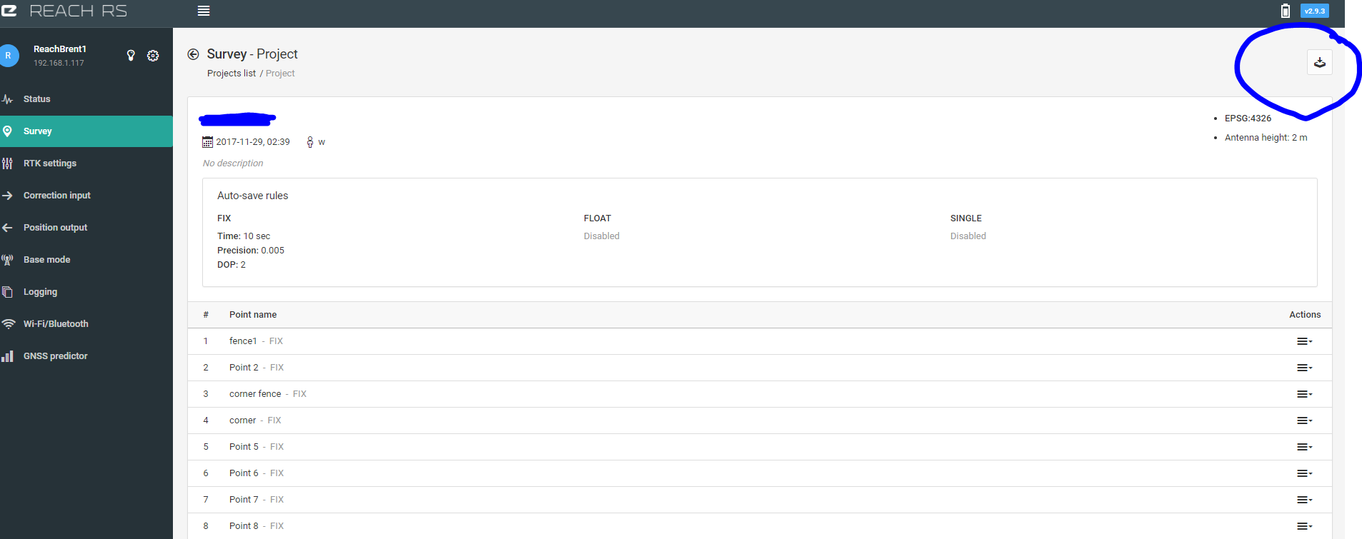
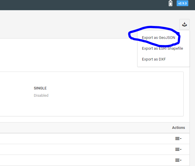
Choose the first option - GeoJSON
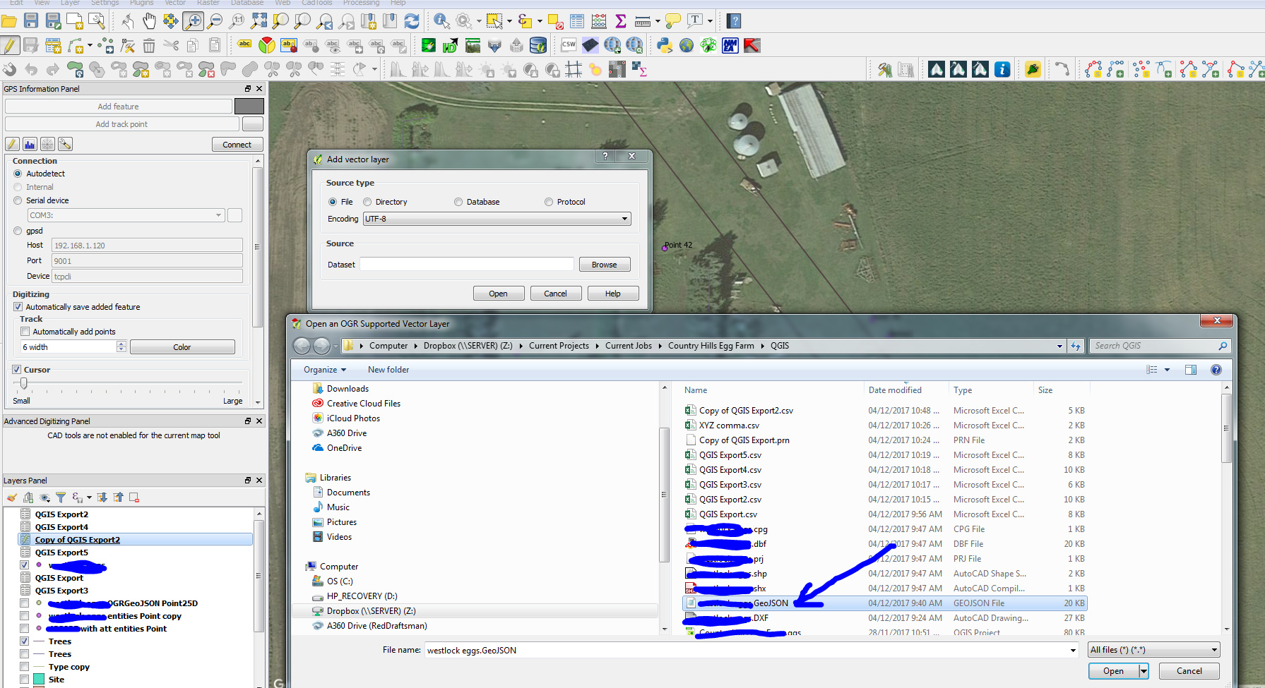
Unzip and open in QGIS. Do this by selecting “add vector layor”
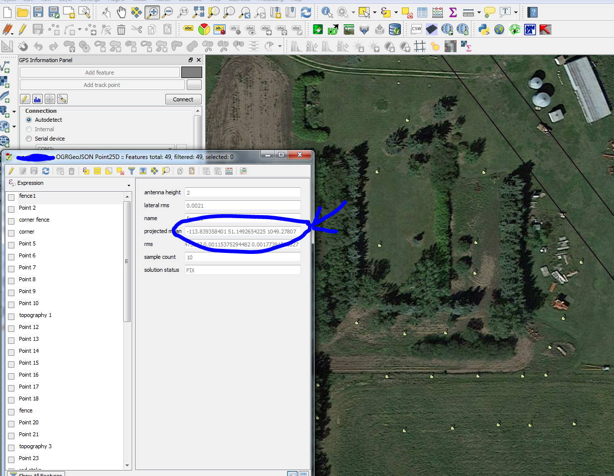
By Opening up the “Attributes Table” for this new layer in QGIS, we can see that the elevation data is contained in the same column as the lat and long. We are going to separate this column into three separate fields in Excel.
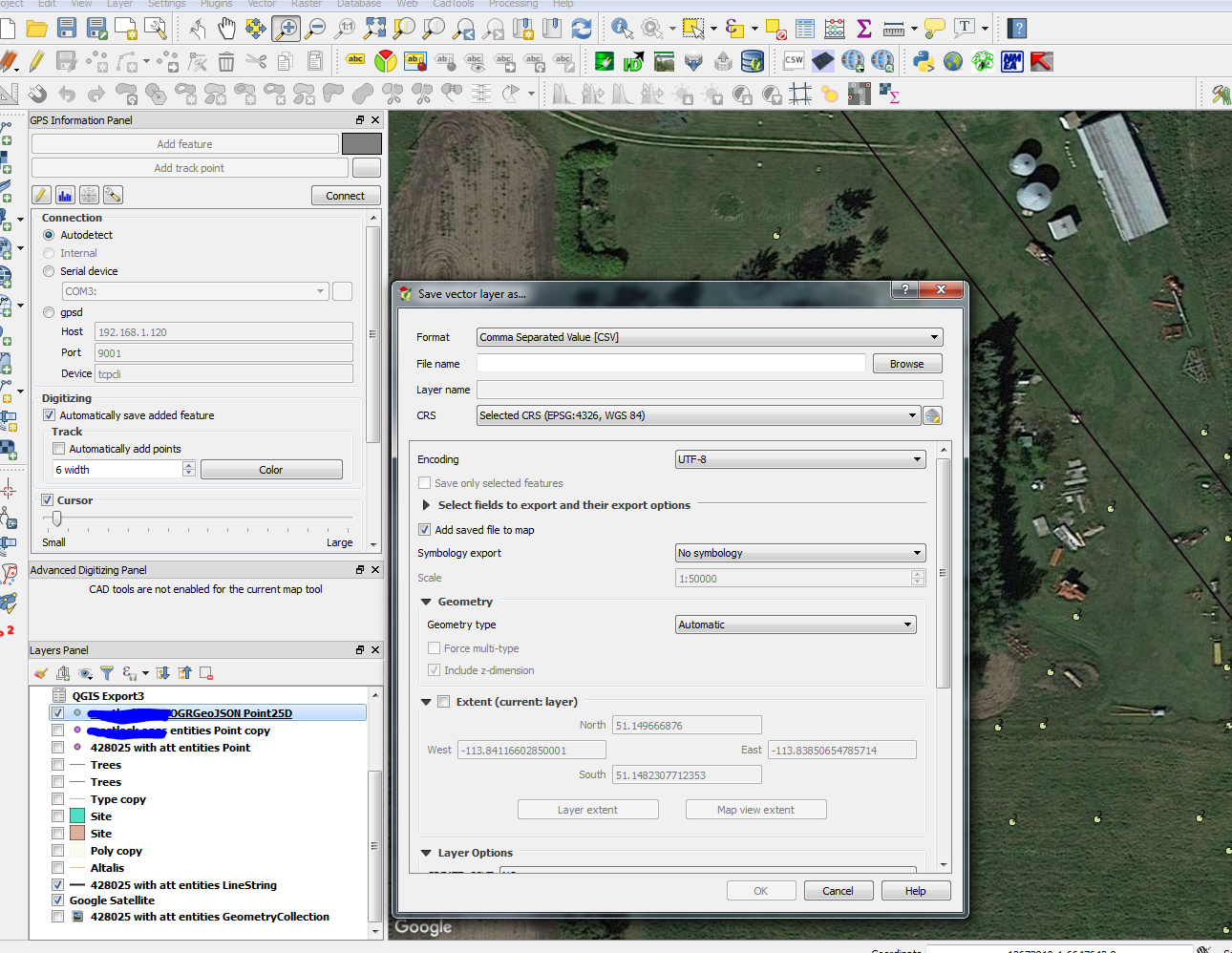
With the GeoJSON layer highlighted, right click and save it as as .csv file.
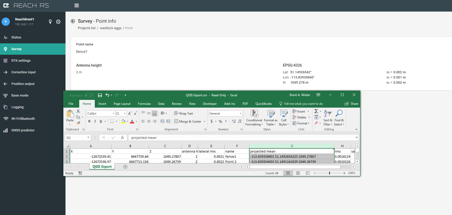
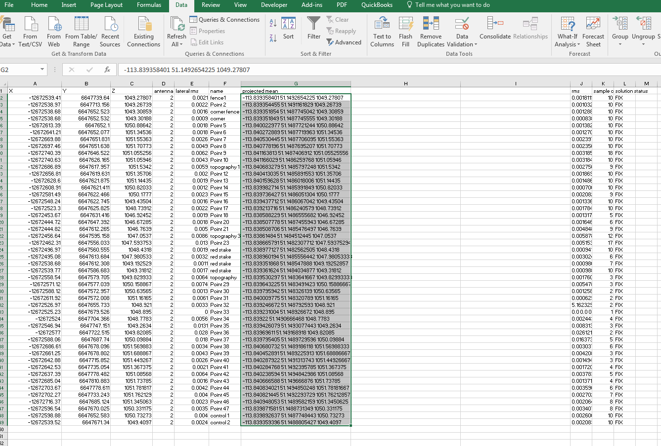
Open this .csv file in excel and view the data. See how the lat, long, and height are in one column. You can compare with your Reachview app to confirm data is still the same.
Instert two columns on the right side of “projected mean”
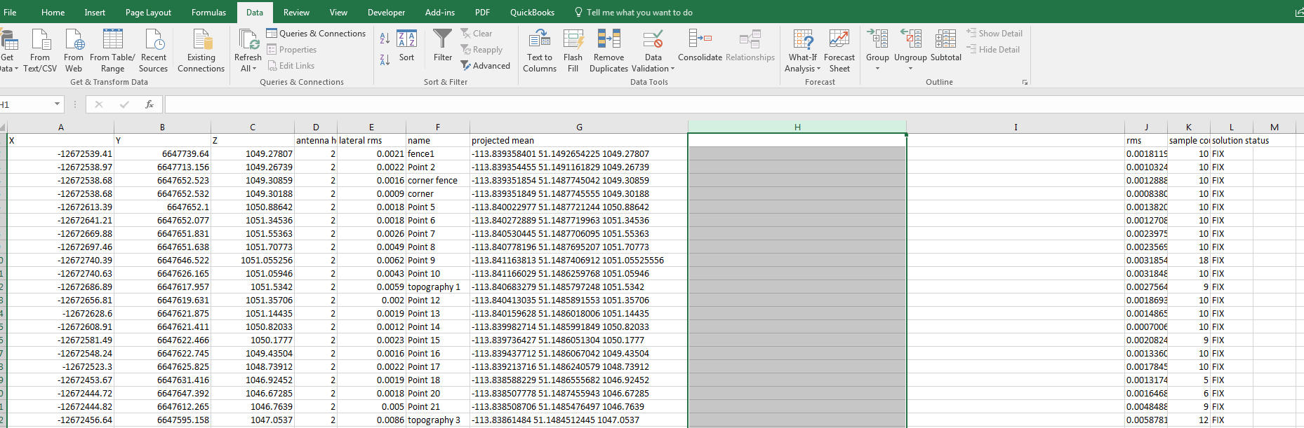
Select all the data under “projected mean”
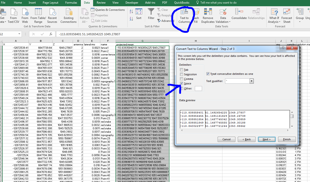
With this still selected, choose “Text to Columns” under the Data tab. At step two, choose “space” as the delimiter.
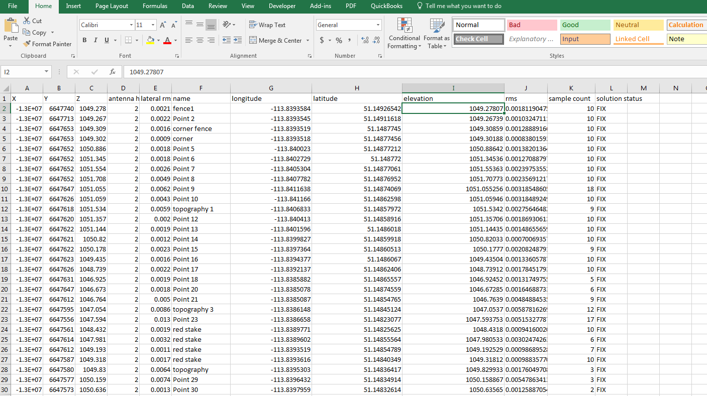
Assign the columns the appropriate new names.
Now let’s save and add it back into QGIS. From QGIS add a “delimited text layer”
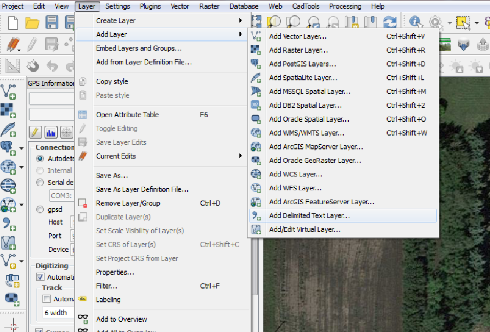
Select file and choose the appropriate fields for QGIS to choose for point coordinates.
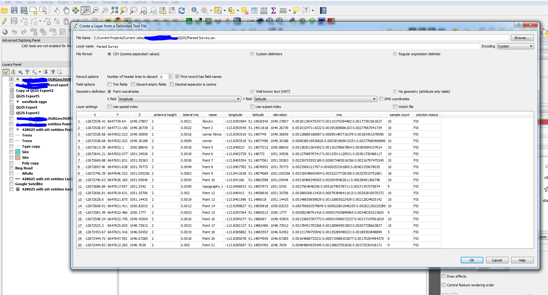
Select the appropriate coordinate system.

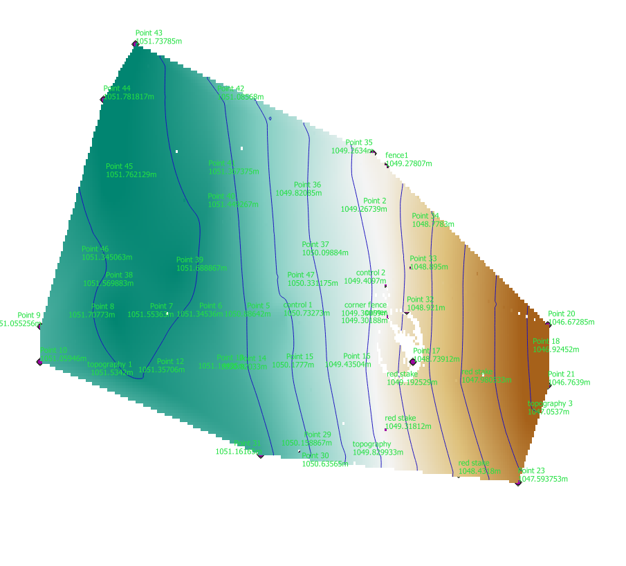
And we can see we’ve got in in the correct position with the labels set to show name and elevation.
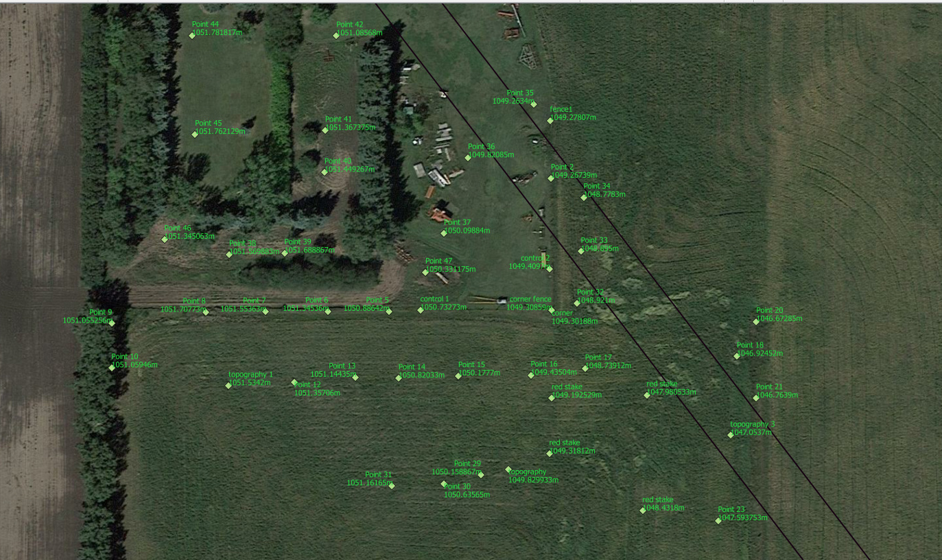
And once we’re in QGIS, the possibilities are endless!