


I think if it was a general problem, we would have many threads on this.
Maybe it’s a hardware problem with your specific receiver?
There are so many potential errors sources in this.
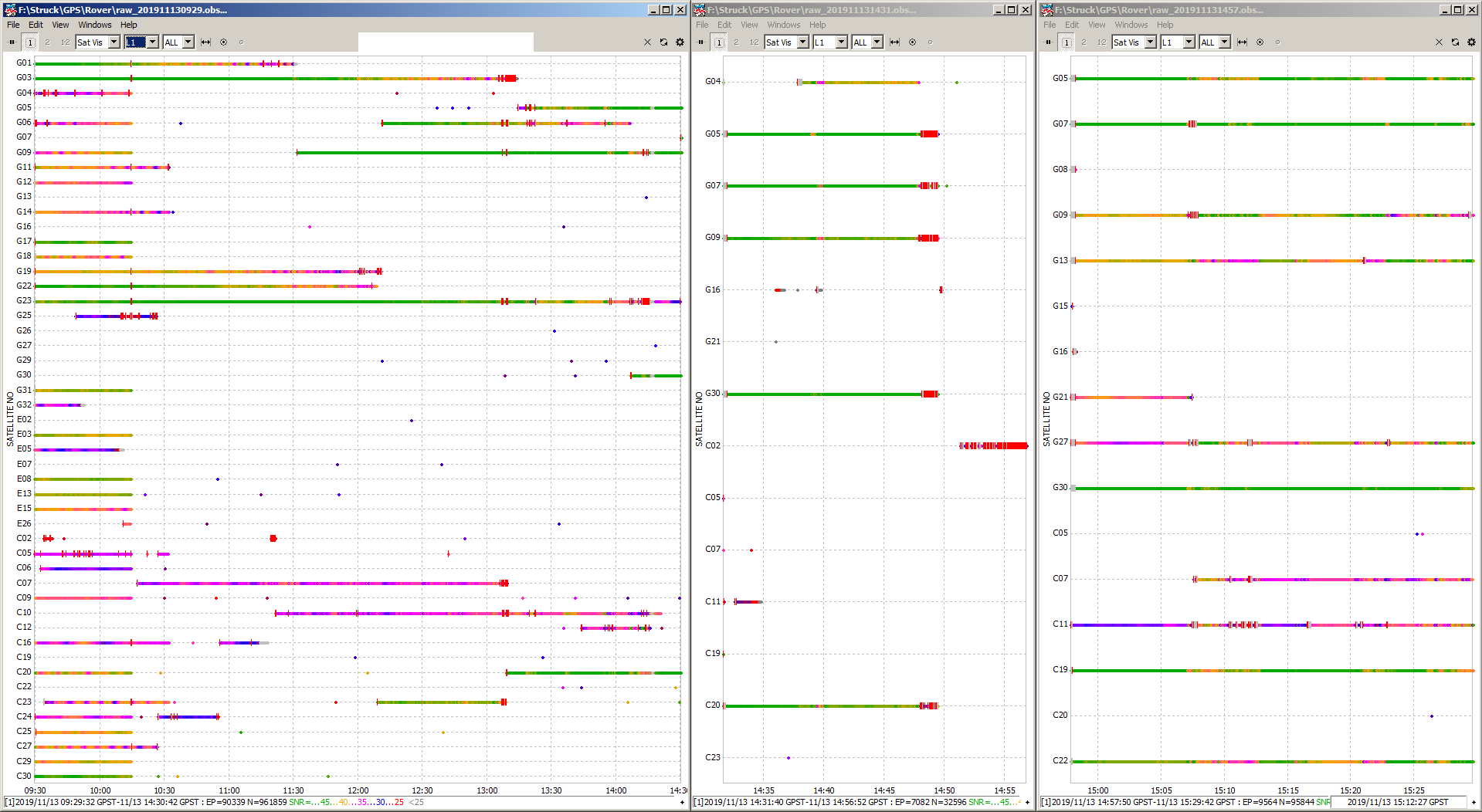
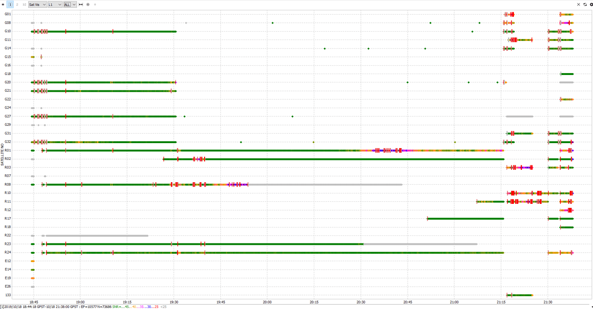
What makes me doubt that it is hardware connected is that @RTK_Hunter has exactly the same issue. If you conpare the plots it is strikingly similar.
But it might be a hardware problem, I can send back the unit which is only a week old.
But I think if that is not the case its an serious issue which should be analyzed before others loose money too.
1 Like
Hi Tobias,
Been tracking BeiDou for a while, no problems. (i did have 30s or so of missing data once recently but I’d put money on it having nothing to do with any constellation). I don’t track QZSS or SBAS anymore as I think they contributed to make an unstable logging configuration. I would recommend you turn off anything other than GPS+GAL+BDS.
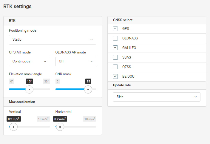
This hasn’t got anything to do with your missing data, but I also recommend you log satellites down to 10° on all receivers in all situations to give you more chances to get fixed flights and fixed survey positions. This elevation mask is standard (Trimble & Leica) for kinematic operation. You can still post-process at 15° later on but it’s good to have more data if you need it.
Tobias,
Was your original Reach mounted in the exact same area as RS+?
Are you sure there were no sources of interference or jammers around?
Hi Nick,
hi @dmitriy.ershov,
thank you for the reply, which unit are you using?
I have been tracking GPS, GAL and BDS only (nothing else is turned on). I do that for a while and I have 3 original Reach units which do not have any problems. I used them for mapping at least 1.000 ha and for probably 100 logging hours (the sum of all three).
Now I have this RS+ and used it the first time. While all other devices had no problems (including a UAV flying above the RS+ and a base station in some 100 m distance) the RS+ is doing fancy
@RTK_Hunter did not log BDS when he got the same behavior so its probably a wrong hint to blame BDS.
If that was a jaming or interference thing I would not expect single satellites to have a SNR above 45. I also think that would not be the case if the unit is faulty. Especially because there are reemerging satellites with a SNR above 45 after reboot.
I actually don’t use the RTK mode (actually my original Units are set to single) and I think that the elevation mask is only for the internal RTK mode and no for logging (I check later but I think that I have sats below 15° in the raw data). During post processing I use a mask of 10 to 12.
Tobias,
I’m just using the M+. I thought you had QZS on in your RTK settings, which are the settings I always use for logging. At least, all the constellations I tick in the RTK settings are logged, and the ones that aren’t ticked aren’t logged. Perhaps SNR and elevation mask are ignored for logging?
Hi Nick,
you are right, QZS was enabled. I actually thought that that is BEIDOU ???
RS+
positioning systems:
compass: true
galileo: true
glonass: false
gps: true
qzs: true
qzss: false
sbas: false
REACH RTK
positioning systems:
compass: true
galileo: true
glonass: false
gps: true
qzs: true
qzss: false
sbas: falseTobias,
My understanding is that Compass is BeiDou second generation of satellites. I don’t know the difference between QSZ and QZSS.
Hi Nick,
Ok, than I have learned something and I think I have no option in ReachView to disable QZS, whatever it is.
Hi Tobias,
We’re looking into your data currently and I have a couple of additional questions. Is there any chance you tested the unit in another environment?
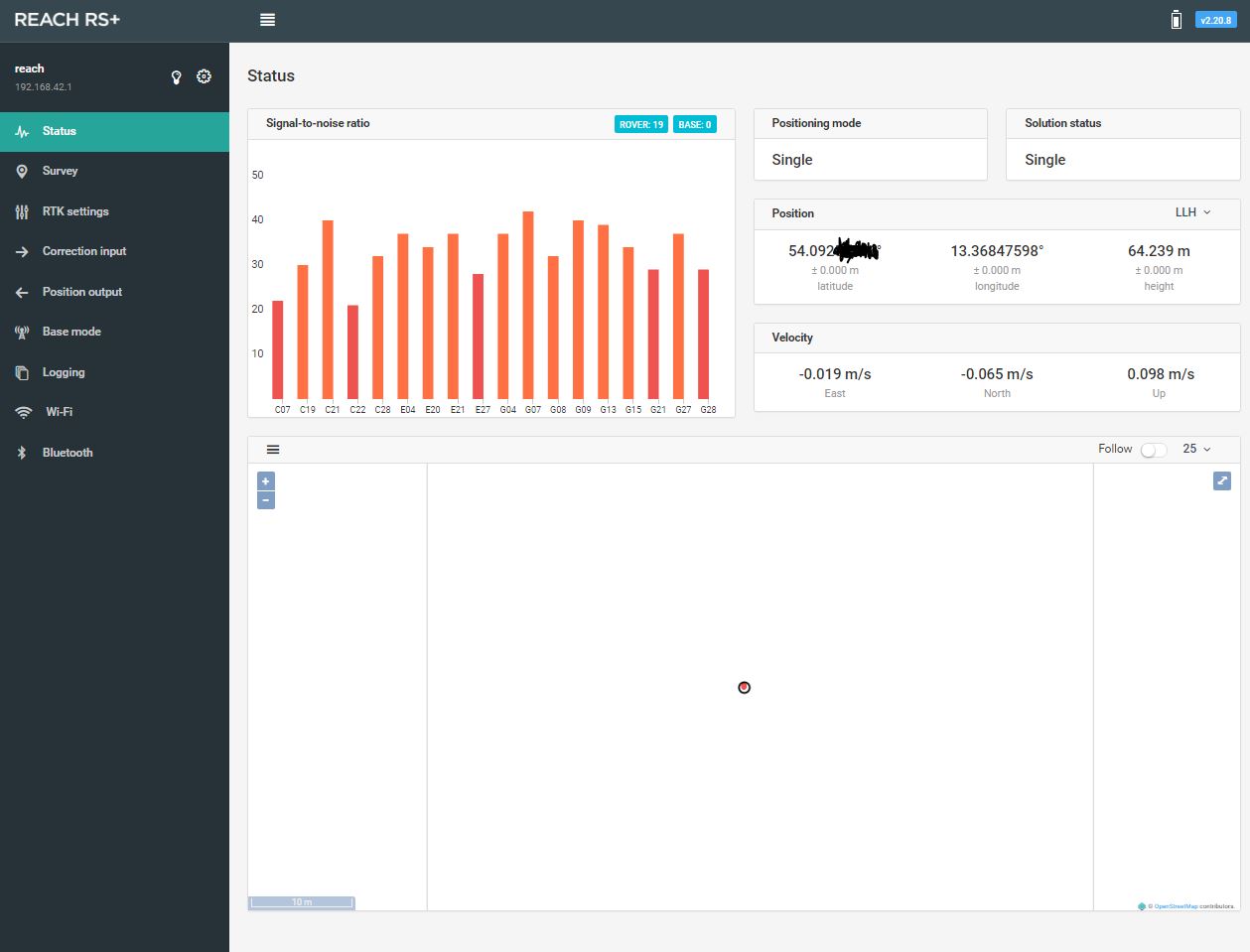
Does the unit continue to log the raw data in that way now? If yes, what are the SNR values of the satellites Reach’s tracking in the ReachView status tab?
Hi Tatiana,
I only can provide SNR values at my window for now. The look the same for my RS+ and my M+.
I did send you another raw file with the window opened (at least…).
I think it is a random behaviour. If you have an idea how to perform a test I can do so.
Tobias,
Can you share logs from both RS+ and M+ so I can compare them?
Thanks!
I can give you the logs from my Reach RTK from the day with the reception loss, ok?
Its the file: raw_201911130846_UBX.zip
Hi! Sorry for this. The new naming of the field is qzss. qzs is a left-over and doesn’t do anything now. If you reset you settings to defaults, this field will be gone in the Simple System Report as well.
Hi Tobias,
I checked the data you shared. Unfortunately, there is not much we can understand from them.
Would you mind conducting one more test? Please record the 20-minutes raw data logs on both Reach RS+ and Reach M+ devices in an open area. It’d be great if you can make a screen recording of the Reach RS+ Status tab so I can compare SNR you’ll be getting in real-time with SNR recorded at the log.
Thank you!
Is my case similar to @tobias-dahms ? Would be helpful if sent my logs?
Hi Tatiana,
I will do so tomorrow or on Saturday.
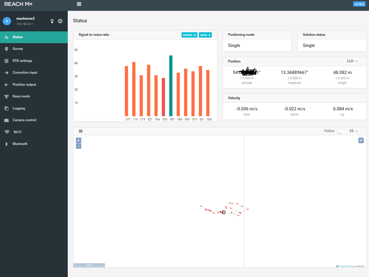
Which firmware should be on the M+ (its 2.16.2 currently)?
Do you have any good shots that you are confident in? This is why it is always a good practice to put paint at shots you take. For survey it is good to let you or the next person know where you have been and especially in the case of UAV mapping to use them as GCP’s in processing.
*Apologies if I repeated. I saw some similar replies as I scrolled through the thread. ArcGIS and QGIS are your friend.
I mostly work in wet nature conservation areas. Its not allowed to put paint somewhere or leave the markers.
Its very time consuming to spread the markers, do the survey and collect the markers again. My assistant and I walked 9.5 km each day. I would love to use something which can stay there.
I do not understand that.
There’s got to be something that is biodegradable or something of that nature that you can get approved. I understand this is a unique situation so it may have not been possible, but I still advise people on this board to do something of that nature to CYA in the future.
As for GIS software it makes it very easy to make GCP’s and or scale/shift a map. You can run the map without GCP’s and re-georeference it in the GIS software. The point cloud and 3D data is another matter, but all would not be lost.