HK Government provide free VRS correction date and we have account , so we want to use one reach as RTK .
we can get the correction date from base , but reach never get fixed , wonder some setting of it that i have done is wrong
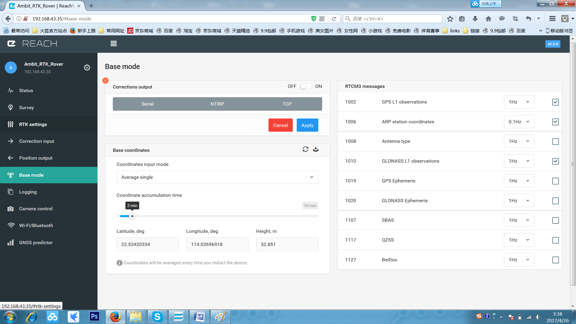
below are some pics to show the setting of reach . for your renference . oh our reach connect to pixhawk through UART 4/5
appreciate your help in advance !
is it because the single ,or something else ?
There are couple of things i see:
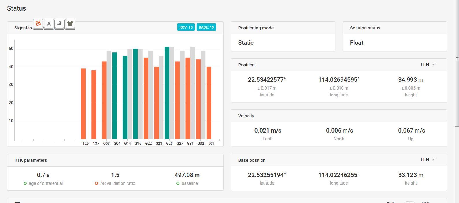
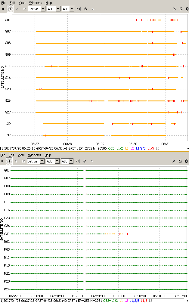
1.Low amount of satellites with SNR above 45, and many of the sats visible to base is not visible to rover.
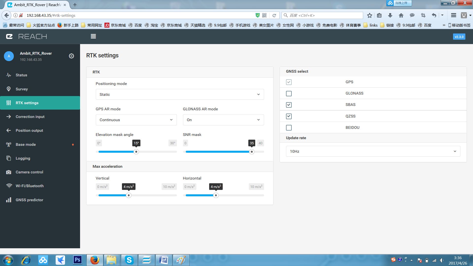
2.Do not use AR glonass with base other then Reach. For your case, turn it off
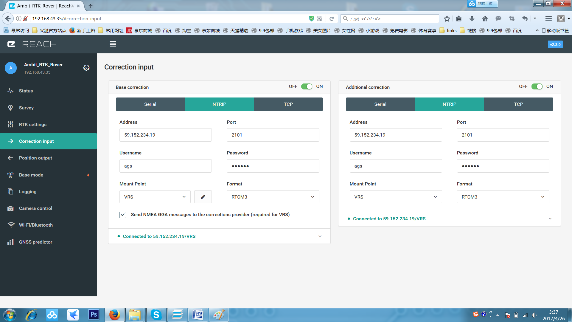
3.Disable additional correction, i can not see why you should use this as it is from the same service
4.Disable base mode
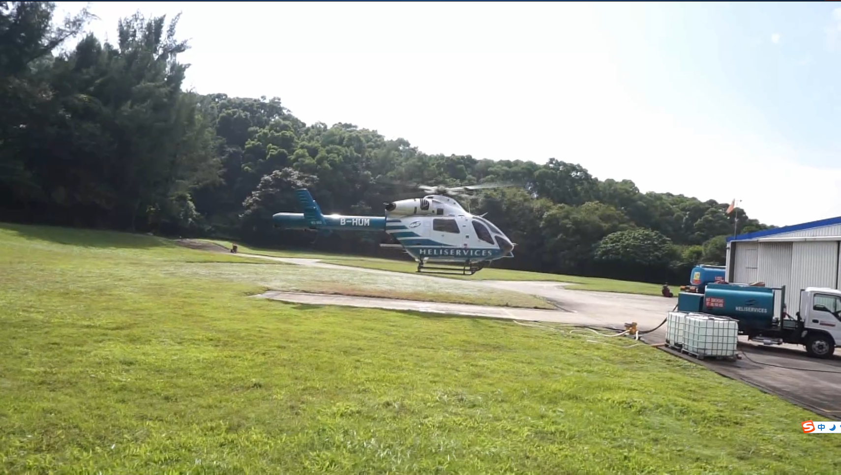
Could you show us a picture of your Reach and antenna?
Also, when you are using Reach, are you outside in a clear area, or are you beside trees or buildings? (you could also show us a picture of the area where you are using Reach.)
With my GNSS eyes, I see vegetation in one direction and a building in another. If the other two sides are similar, then your test area looks quite good. There are only a small amount of obstructions and they are very low on the horizon.
If you can share your log files from a test, please do. Include the raw log, the base corrections, and the solution file please.
log duration is too short. only 4 minutes of usable data. 10 or 20 minutes or even longer would be better. although, in ideal conditions, 4 minutes should be enough time to acquire a fix.
base is only using GPS and SBAS constellations. this is fine for acquiring fix and for troubleshooting, but if you add additional constellations (GLONASS) then it will hold the fix better.
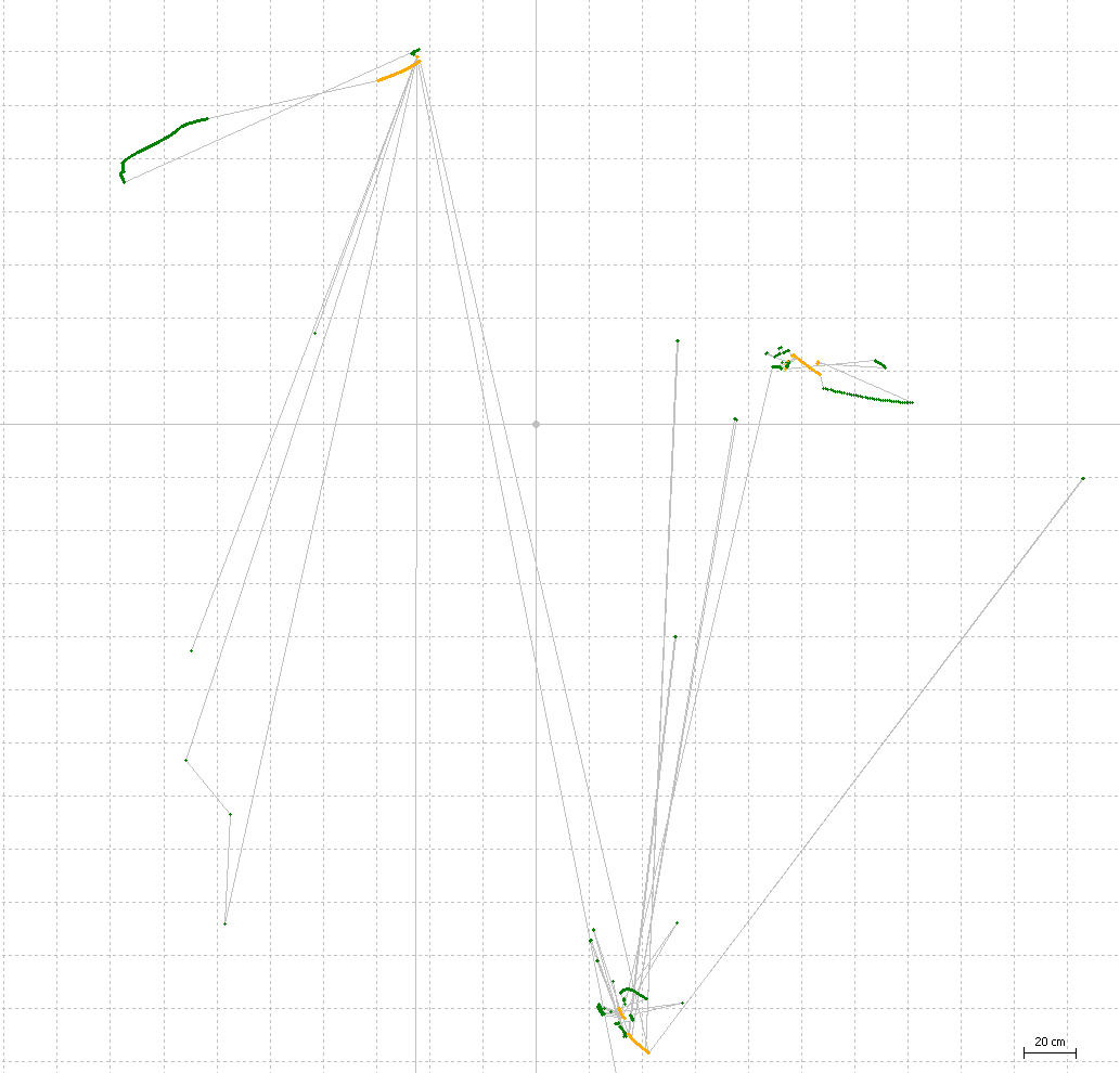
In this pic, the rover is at top, and the base is at bottom.
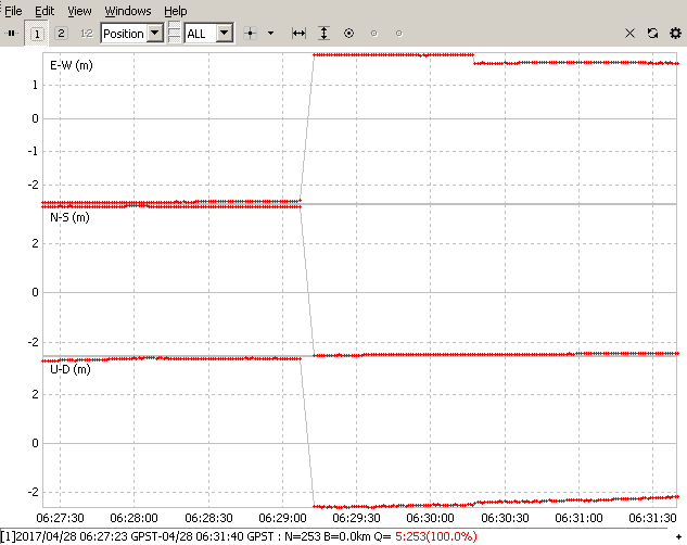
connection was lost to VRS after ~2 minutes, base coordinate changed location. ambiguity resolution must start over. this makes it take longer to achieve fix
the only way to get a good amount of fixed points with these super short segments of log file was to use Fix-and-hold. The following plot is the result of post-processing 3 log segments. One for each of the VRS base coordinates: