Maybe a noob question. I purchased 2 Rover RS+ One base and and a Rover. Setup up according to the Emild tutorial, no problem. Got fix soltion on all the GCP. I did a test in Photoscan and reality Capture. Everything with the bounds. When I import the tiff into QGIS and then the Emlid markers as GeoJSon/DXF they do not line up. I used WSG84/EPSG4326 Same as the drone and the default Rover datums. Qgis setup for 4326 as well
This is after you included the GCPs in the map processing? Did you have an RTK fix on all of your shots? And did you do any post-processing on your GPS data?
Hii, Yes I had a Fix soltion on all the test GCP. No post processing of GPS. I used the fix solutions from the Stake out project. Once Pooints saved. I exported the project, and used the points
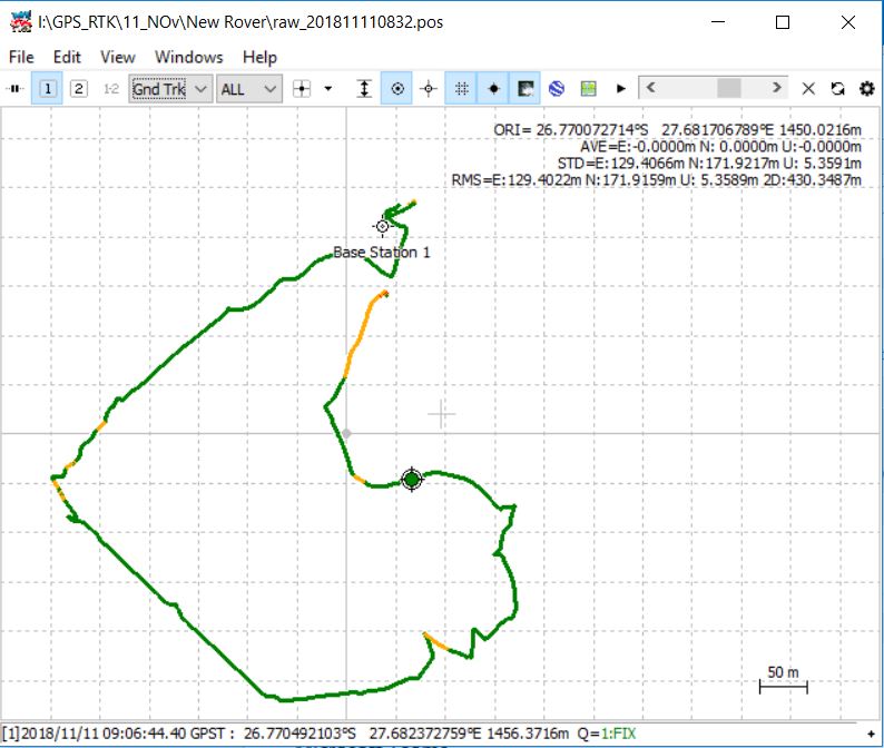
Hi. On a tripod. It was standing stationary for about 2hours before I stated collecting points with the rover. Not on a know pointRover.zip (8.3 MB) Base.zip (4.9 MB)
First some questions.
Are all GCP’s offset by the same amount, or just one.
Are they all offset in the same direction, or multiple directions.
if they are of variable size and direction then look to your camera calibration and scale of the final geotiff.
Did you fly the survey with the camera pointing down (90 deg) or slightly forward (80 deg) the latter is preferable as it does vot allow the final geotiff to correct for camera calibration error by squishing the grid. This is seen as fish bowling of the elevation.
Did you flu cross lines at a different altitude? 30% different. This again constrains the SFM software.
In short most likely this is a drone map creation problem, not an Emlid GCP creation problem.