Hello good morning.
I have to integrate in my geological survey project a new GPS RTK system. I will use the system in “static mode”. A Reach used as Base and another as Rover. Fixed in the same position. I need to calculate any change in position. I can have windows of measurement of 1 hours because after this the power consumation of Reach is incompatible with my stand alone outdoor survey system.
What vertical accuracy do I have to expect in these conditions? Any indication?
You can add power to the reach via the USB or the DF13 connector so unsure why your window is limited to 1 hr. If you plug the reach into a 20,000MAH battery pack it will run (practically) forever.
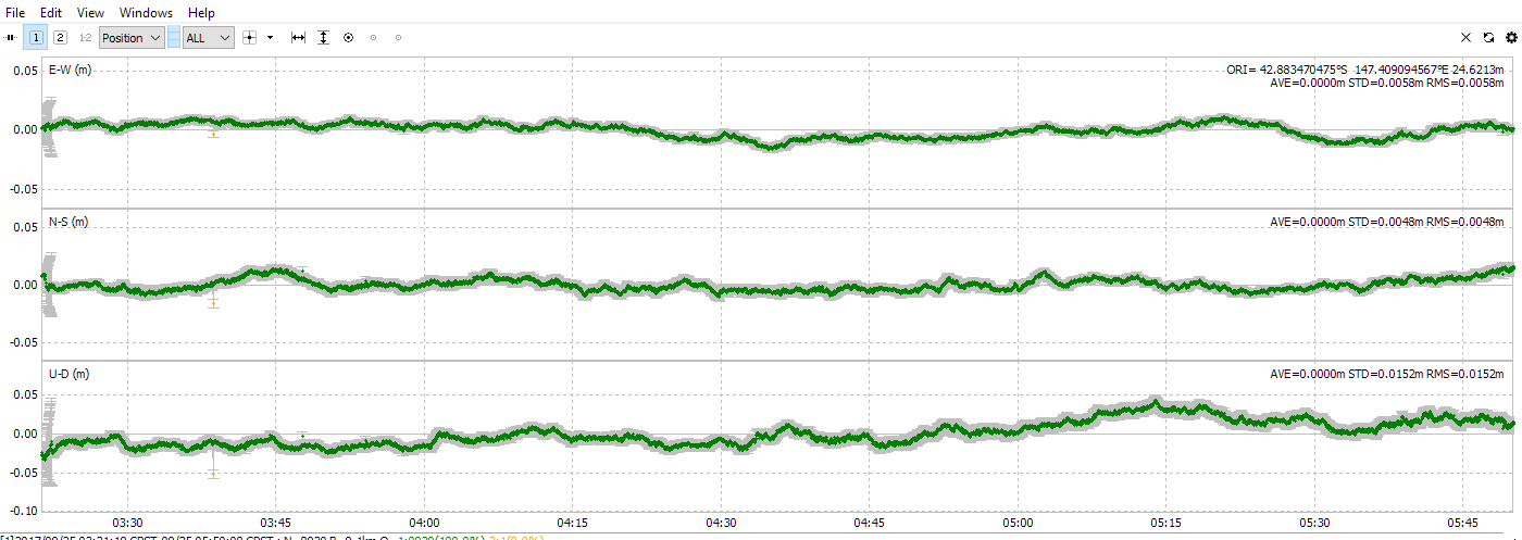
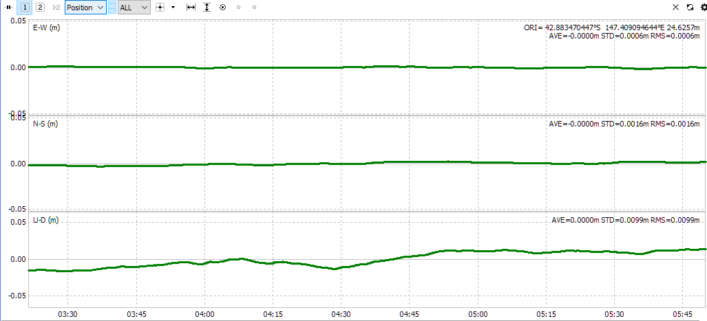
In one hour I would expect +/- 1cm using a geodetic reference station within 10km.
Data below was collected with a 9.7km baseline but processed with a very low (5 degree) mask angle as I had a clear site.
So what is the really average consumption when the GPS work. If is 200mA a battery pack of 20000mA run for 100 hours. I am studing and devellopping a stand alone solution with solar panel power. So for me it’s important the power consumption.