I recently took a Reach Rx from a local distributor in order to test it in order to purchase it, measuring and comparing the data obtained from the measurements, I find that any reference station I use all the time Reach RX moves my measured points by a horizontal distance of 6 - 25 cm and vertical up to 20 cm compared to the points measured with a Rover HI Target V30 plus, I sent an email to the distributor with the request to cancel the order for RX, what are the reasons for these errors? I mention that I have used RTCM 3.0, RTCM 3.1 and RTCM 3.2 -MSM and in all cases there are exactly the same problems, as if they give an offset to all or 70% of the points measured with the HI Target rover, both were used with the same account and the same reference station from 2 different companies.
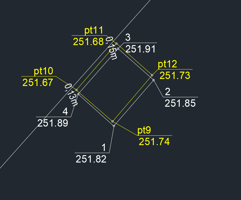
Yelow polyline is HI TARGET and white polyline is Reach Rx
When it’s a systematic error like this, I would look towards CRS issues. The RX seems perfectly capable of sufficient precision, but there is obviously an issue with the datum.
Was this test done in the Emlid Flow app or in a third party app?
Well, I would not give certainty to the hi target without first checking with a topographic device such as some cairns placed with a total station, I have carried out tests and I have had up to 6mm difference in points between an emlid reach rs2+ and my geomax zt20r total station, me first I would check by placing some fixed milestones with a total station, I would verify the measurement time with the emlid reach at 4 or 5 minutes and later in the same time with the hi target, from the results I would define which would be the most accurate.
If you have government monuments in your area with known coordinates, you should test it against those instead of your own or at least test it against your own that you set using a PPP provider like OPUS or CSRS. Just outside of my town, there’s a flange-encased deep rod monument that I use to check my GNSS equipment for horizontal and vertical. I’m grateful to have it because there are fewer and fewer in my area that are in good condition and have exact coordinates and elevation.
I agree with the suggestions above. The best way to understand what is going on is to do a test on a benchmark with known coordinates. Do you have one in your area?
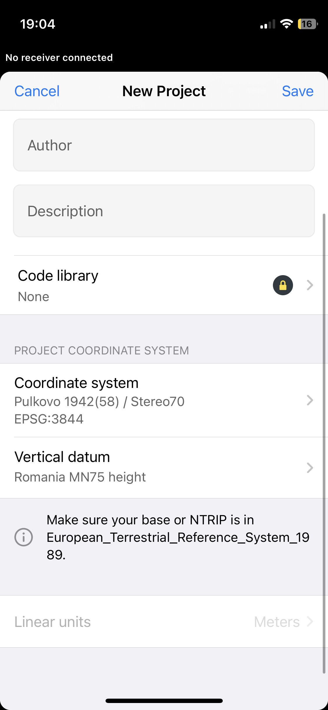
Also, I see that your coordinate system requires the base corrections to be in ETRS89. Does your NTRIP service provide the data in it?