Is any one here using reach RS+ as a rover in the state of Utah? I’m trying to get set up for RTK with corrections from the state operated VRS (http://turngps.utah.gov/)
I cannot for the life of me get the receiver to receive corrections from the Utah network. Some information about their mount points is listed on the link I included above. I’ve exhausted the technical support who supports the Utah network and they now tell me I should talk to the vendor of the receiver. Do anyone have any ideas on how I can get this to work?
From the info at the link above I’m trying to use the VRSRTCM32 mount point.
Right now I am in a location about X km from the nearest base station in the Utah network. do I need to be closer than 10 KM for the Reach RS+ to even receive corrections? In the reachview settings page, it just always says “Waiting for Corrections” and never receives a base station coordinate.
I have used the local city of St. George’s CORS over NTRIP just fine. but I cannot get the statewide net work to work.
Struggling big time. I have a drone flight I need GCPs for and I need to deliver it within a week. Not sure what to do.
Without seeing your settings, I would have to agree with PotatoFarmer.
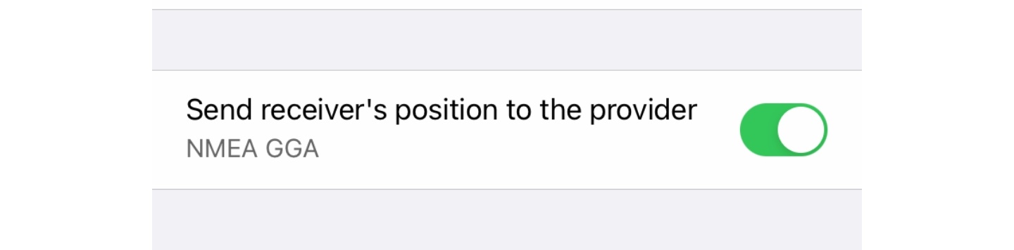
In your NTRIP settings of your receiver there is a box that needs to be checked for send GGA if that isn’t checked with VRS you will not get corrections. VRS requires your location to set up its Virtual Reference Station
Are there ways to send the position back in something other than NMEA GGA format? Maybe the VRS is not getting my position?
If it’s a VRS and I am about 12 km from the nearest base station, could the problem be I’m farther than the suggested 10km baseline distance for the RS+?
VRSRTCM31 works with non-Trimble units
GNSSVRSRTCM32 works with all other units capable of using a full GNSS solution.
have you given these a shot? maybe your rover does not like those corrections for some reason. Any way you could view whats received through snip? then you would know what messages they are sending.
I use a Trimble base with reach and they seem to like trimbles rtcm3.0 setting
VRS is a very good/accurate system. Even though you are 10K form the nearest base, it creates a virtual reference station one meter from the GGA LAT/LON that your unit sends and provides a network solution. It isn’t using just one base station for the corrections.
I tried to set up the Utah VRS as a Relay stream in SNIP.
I’m using a demo Username and Password that the admins that manage the Utah network gave me and I get the following response in SNIP (I replaced the Username and password):
[VRSRTCM32↑]: Connection string for [R009, USERID : PASSWORD @ 168.179.231.9: 2101 / VRSRTCM32] (05:00.000 MIN:SEC) is:
Yep, the credentials the admins gave me for a demo were not right. I got update credentials and no problems. It would be nice if reachview would have told me that somehow, or given me some sort of indicator as to why it wasn’t working…
I use Lefebure NTRIP quite a bit with Trimble equipment. The one thing it does is it displays the connection info. It would have came back with the 401 Unauthorized message in the window. This would be another tool you could use to see connection status otherwise SNIP is a very robust tool to do so.
I am not sure if the Emlid NTRIP tab states anything like that. I would have to put a invalid username/password in mine to see what it does.
Thanks for the Tip on Lefebure NTRIP. I will take a look.
As far as I can tell, Emlid’s app just give an alternating message of “Waiting for Corrections” or “Receiving Corrections”. With the incorrect credentials, my app was only reporting “Waiting for corrections”
I was under the mistaken assumption that because I could see all of the mount points on the server, my credentials were working. Apparently you do not need valid credentials to see the mount points.
We’ve done the research. It seems we will be able to show more detailed error messages. I cannot name the exact firmware version when it is implemented, but we’re taking it into work.
Very nice update! Like I said above I know I have gotten a “bad username/password” message in the Lefebure NTRIP app. Lance Lefebure is a GPS genius in my book though. He should have charged $1 to download his app though. He would have made a lot of cabbage with that app.
We’ve just released the ReachView 3 6.16 version: it adds special warning messages if there are issues with NTRIP credentials or the selected mount point. Hope that’ll help in your future work Feel free to share any feedback!