Hi. I am having trouble getting Emlid Studio to PPK my drone surveys.
The Studio version is 1.6. The drone is a DJI Matrice 210RTK. The survey is completed with RTK turned off in the absence of a phone service.
The files created on the drone SD card are Rinex.obs, timestamp.MRK and PPKRAW.bin. Studio seems to need me to convert the PPKRAW.bin file to RTCM3 format, which I have done with RTKCONV. This creates the file PPKRAW.nav. The native converter in Studio does not work with the DJI .bin file, but RTKCONV does.
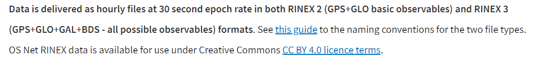
I am using a CORS file from Ordnance Survey GB with the format .rnx.
Studio accepts these files but only processes for a short period ending with the message “something went wrong” and I can generate a report log.
I think the salient part of the error log is as follows:
“Post-processing finished: [rtklibwrapper::Result = status:Error, value:[rtklibwrapper::SolutionFiles = solutionFile:, eventsFile:], errorMsg:MRK processing failed: Failed to get solutions from ‘C:\Users\Sarah\AppData\Local\Temp\PostProcessor-b2b501399a10e464\100_0003_Rinex.pos’ (InvalidInputFiles)]
[14:40:32.113] [post-processing] [I] Shutting down the server”
Are there any suggestions as to where I am going wrong?
Could you please post your files in this thread or send them privately to support@emlild.com? I’d like to check them myself to figure out what might go wrong with processing.
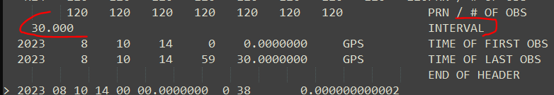
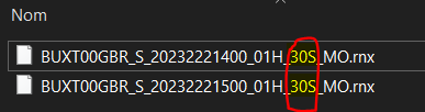
Which you can also see in the file name for RINEX v3 standards
I rebuilt a 1 Hz file with my interpolation tool. This is a workaround and should not be done in production. This is just a test so see if that can help pointing the issue. You can get the final base file here.
Hi Florian, a good point, which I hadn’t thought of. However, the test file you posted also failed to process in the same way, so whilst the recording interval of the base may well be another issue, it’s not the current blockage in processing. Thanks for taking the time to look at that though.
Ian
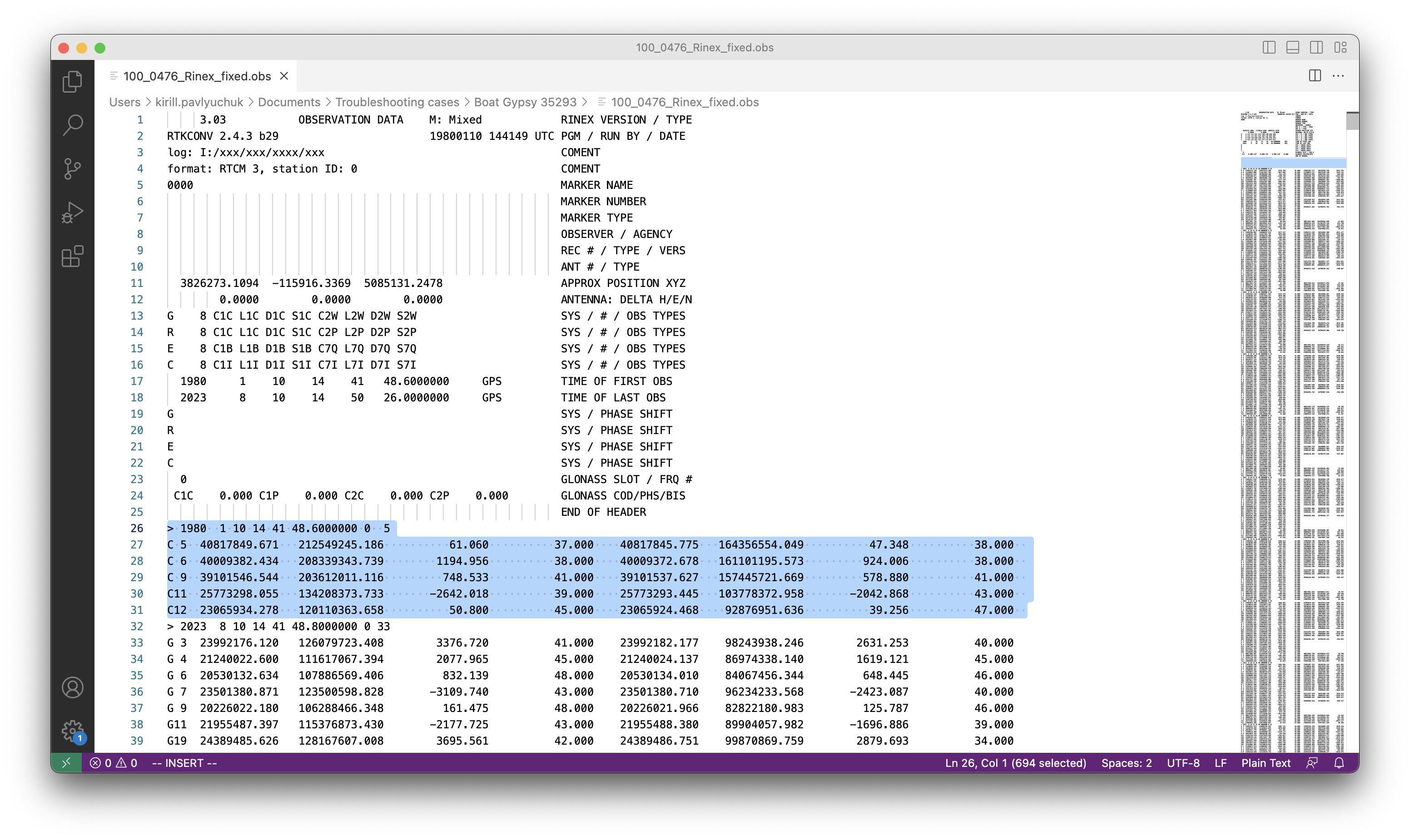
Most likely, it occurred because the DJI drone’s receiver hadn’t passed the time sync before the log started. I removed this epoch from the observation file to process the data.
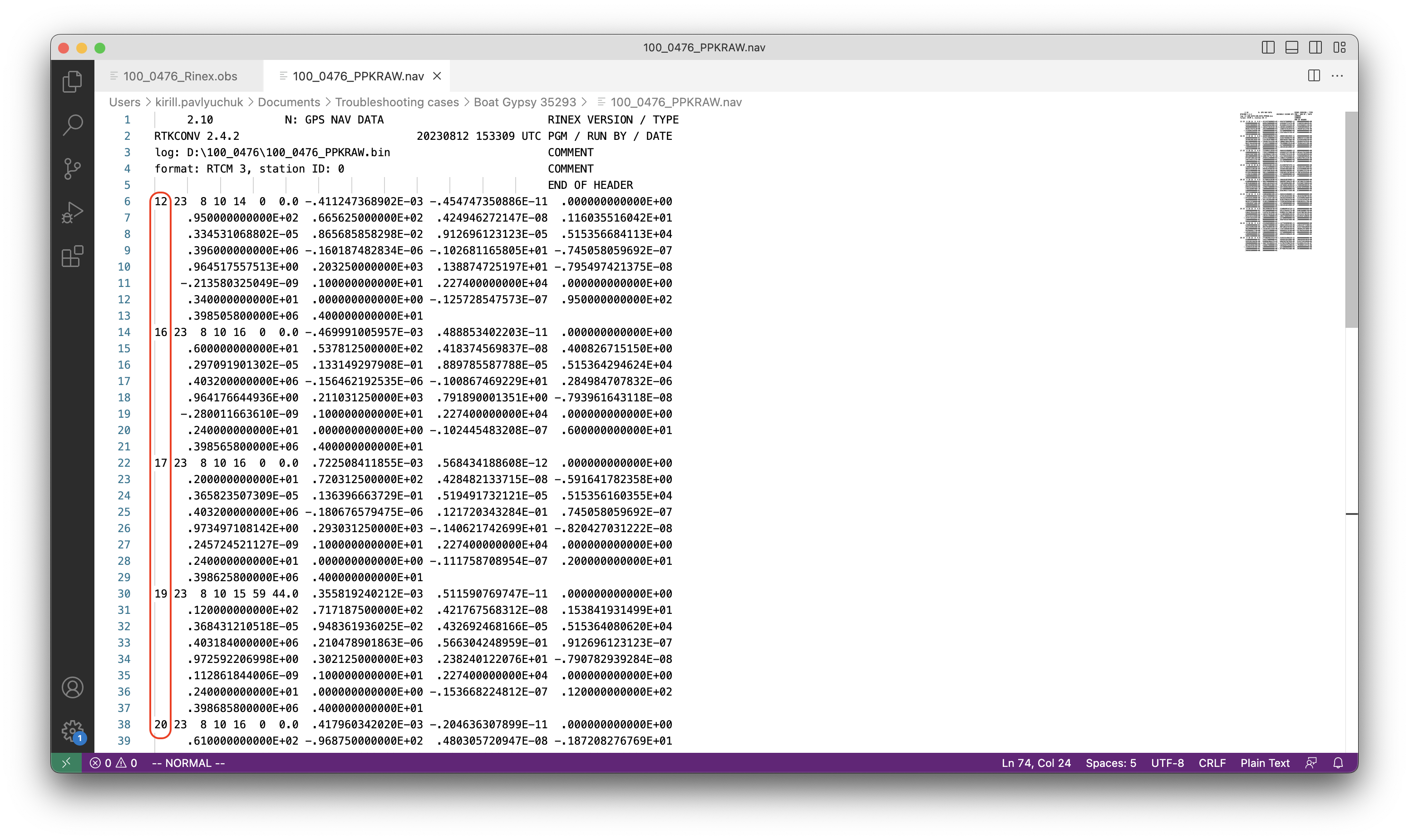
Then, the navigation file from the DJI drone contains quite weird data. Satellites’ affiliation isn’t specified in this file: they are marked just with numbers, whereas they must have the letter G, R, E, or C before:
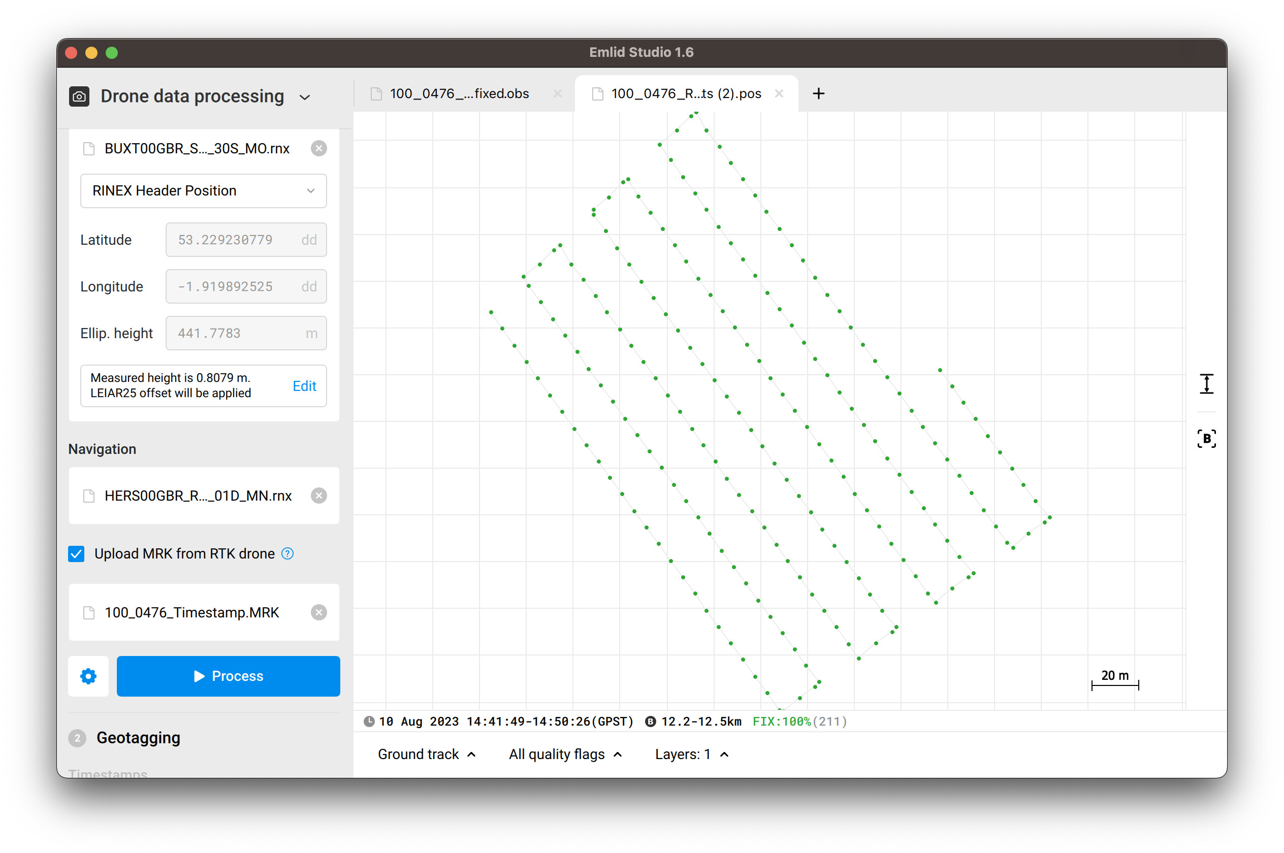
I’ve downloaded daily ephemeris data of the HERS00GBR IGS station from the NASA website in the .rnx format. Using this file and the Combined filter type in Emlid Studio, I’ve successfully post-processed your data with 100% of FIX solutions:
The reason for the missing elements in the nav file may be something to do with RTKCONV converting the proprietary PPKRAW.bin file improperly, but hey, you have given me a good workaround. Incidentally, I processed a batch of data without removing the odd 1980 epoch data and Studio just seems to have ignored it.
It does produce a nav file, but it is in some sort of proprietary format PPKRAW.bin. Its clearly intended to hold the nav data as RTKCONV produces a file that has most of the nav data. However data headers are missing from each line which prevents Studio from processing it, as you have seen. I suspect it is something designed to get people to buy the DJI-RTK module. Of course Im not going to be doing that as I have two RS+'s!