


Dear Tatiana and Emlid forum,
here I am again with some new results from my tests on field. I have tried to estimate the coordinates of a know points (trig point of Military Geographical Institute or IGM) by recording UBX raw data for 3 hours with my Reach Rs+ in static mode and then I have post-processed the data with the Rinex file of a CORS (Elba Island, 75 km away from the trig point).
I get good results (< 2 cm) for Lat and Long, however when I compare the ellipsoidal height I noticed a difference of more than 2 m with the data reported from IGM. I reported, as follows my workflow, so I would be grateful once again to anyone who could identify some possible error in my process.
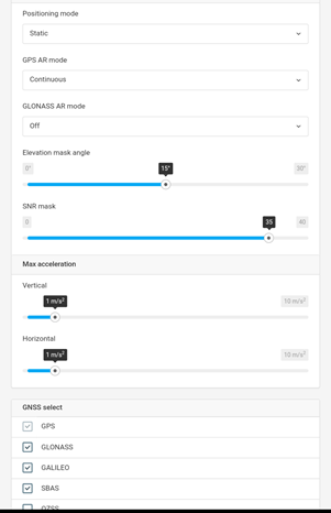
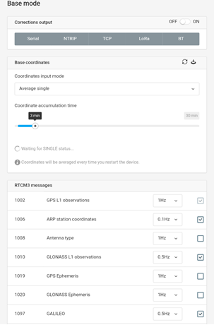
Here it is the settings chosen under RTK and base tabs of my Reach RS+ Unit:
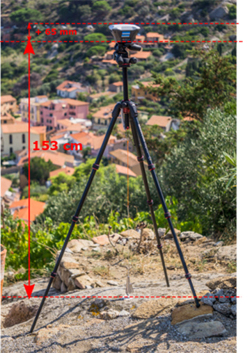
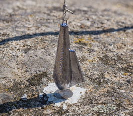
Then I placed my unit on the know point with a photographic tripod and I have measured the antenna height (153 cm + 6.5 cm = 159.5 cm).
After 3 hours of data acquisition with clear sky I downloaded the UBX file and converted it with RTKCONV (Ublox format, Rinex 3.03), getting the following 3 files:

The next day I have downloaded the .crx file from the CORS of Elba (EUREF Permanent GNSS Network) and I have converted it to .rnx format with RNXCMP software (CRX2RNX)
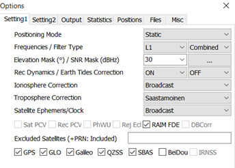
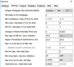
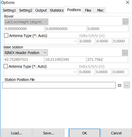
Thus, I have post-processed the data with RTKPOST with the following settings as confirmed in the previous post, considering my Reach RS as the rover and the CORS as the base:
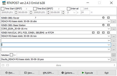
And these are the settings used during post-processing:
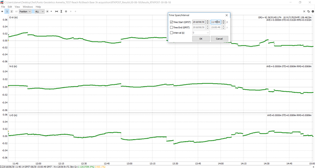
Finally, I have obtained the .pos file and I have drag and dropped it into RTKPLOT for visualization and analysis.
First of all, I have sorted out fix from float observation, keeping only Q1 (fix) observations with time span/interval panel, as suggested by TB_RTK (Setting up Base- Using CORS data in RTKPOST - #24 by TB_RTK).
And I got the following result to be compared with the coordinates of the trig point from IGM:
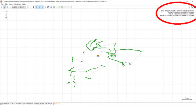
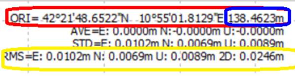
I noticed small errors (much better for lat = 69 mm compared to long = 1 cm, yellow circle) and also the WGS84 geographic coordinates are quite similar to those reported by IGM sheet (differences are only for seconds, red circle).
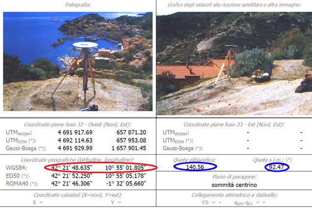
However, despite the small RMS also for the height (= 2 cm) the reported ellipsoidal height (138.46 m, blue circle) is quite different (~ 2m) from that reported in the IGM sheet (140.56 m).
I converted my ellipsoidal height to orthometric height above msl (I used UNAVCO online converter: Geoid Height Calculator | Software | UNAVCO) and I got 90.08 meters:

Then I added to this value the height of my antenna (= 1.595 m) and I got 91.67 m above m.s.l. which implied a difference of 80 cm (92.47 m from IGM - 91.67 m from my data).
I suppose that these differences may be due to a different geoid models however if I convert the ellipsoidal height reported in the IGM sheet (140.56 m) I get with UNAVCO online converter a quite similar value of orthometric height of 92.181 which imply only 29 cm of difference. Then above cited 80 cm of difference seem to me too much.
So, my final questions are:
- I have committed some mistakes during data collection or post processing that have led to this height differences?
- This difference could be linked to the conversion? And if yes there is a more efficient converter/tool/method to know the orthometric height?
- Since the trig point has been defined in March 2004, it is possible that now my estimated height is more precise of which estimated at that time?
Again, sorry for this very long post but I have to make much clear as possible my thoughts. I hope that this discussion will be helpful also for other new entries in the amazing word of RTK GPS.
All the best,
Daniele