I recently discovered, that my NTRIP provider delivers in ETRS89. While ETRS89 and WGS84 are pretty similar, they differ around 0.5m here in Germany.
Since I get the corrections only on my base (RS2) and not on my M+ on the drone I wonder, if that has any effects on my post-processing in RTKlib or if the corrections themselves do not differ that much to be of importance.
In RTKplot, all image locations are fix when corrected as “normal”…
I will open my book today and read that up. Thank you. I thought a datum is “the relationship between a local and global geocentric system” to quote the “Essentials of Satellite Navigation” from ublox…
True. This one is a tough nut to crack. The lat/long Reachview shows you could be tied to anything.
If i drop a PPP session of 3 hours down on my map, its not going to be MY absolute position. Its going to be according to the WGS84 something. Not ETRS89 which in some way I use too.
Hence the " around the seeing word.
Yes and no, you can choose. With PPK you can do any thing you like. If you use the same settings and values for base positions etc, its going to be the same yes.
I see might have jumped to the conclusion a bit soon.
There is one more thing. If you fill in coordinates for the base where it’s placed over a e.g known local monument and does the coordinate transition from the local datum to a datum Reach would accept, the small difference in the native coordinate output on rover and datum that it is actually should show, is actually rover being shifted relative to the base by the RTK or PPK thus rover outputting the datum the base is set to.
Now what I am not sure of is how much the rover can be of from the true position and the shift applied at the base…
I am a bit confused now. How can I check what CRS the rover event file is in? WGS84 and ETRS 89 are so similar (0.5m) that I cannot determine it by looking on the map…
The easiest way is connect rover to your NTRIP and survey over a known monument.
The coordinates you get out of the rover should be in the same datum provided by NTRIP and line up with coordinates for the monument (assuming monument and ntrip use the same datum).
Had to google for while, not easy finding numbers.
According to Trimble: ### Base station coordinate accuracy
The base station coordinates should be known to within 10 m in the WGS-84 datum for optimal system operation. Incorrect or inaccurate base station coordinates degrade the rover position solution. It is estimated that every 10 m of error in the base station coordinates introduces one part per million error in the baseline vector. This means that if the base station coordinates have a height error of 50 m, and the baseline vector is 10 km, then the additional error in the rover location is approximately 5 cm, in addition to the typical specified error. One second of latitude represents approximately 31 m on the earth surface; therefore, a latitude error of 0.3 seconds equals a 10 m error on the earth’s surface. The same part per million errors apply to inaccuracies of the base station’s latitude and longitude coordinates.
So shifting base around 50cm in either direction to make it line up the datum for your area doesnt affect the accuracy. Which make sense cus using average position on base might get alot more then 50cm of the true position.
How do you project this in Qgis?
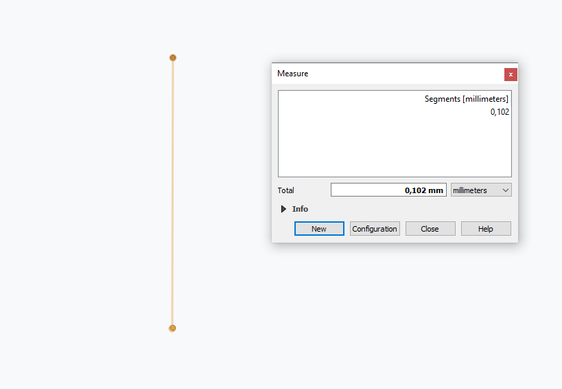
I mean, i am not sure you can take one copy of rover points into Qgis and say its ETRS89 and then import a second copy into a separat layer in WGS84 and draw a ruler between.
Edit: I also think the OnTheFly function is going to line them up as well, as best it can and the difference you see (0,1mm) is transformation deviation.
I could be wrong, but i think you need to import one copy and export/save to desired datum and them reimport those again.