I’m a bit rusty on the PPK process and need to get my head around the workflow. I’m using RS2 Base and Rover. Both recording logs, I’m measuring GCPs with rover as well as 3 “known points” throughout the project area.
My current workflow is that at the end of the day I follow the “stop and go” workflow in Emlid Studio. I exported the csv of the day’s data that has the PPK process corrections’ applied. How do I now do a site localization / site calibration to the PPK corrected dataset? I noticed that if I do localization in the Flow app before having the PPK process corrections applied the data is exactly the same as if localization hasn’t been done.
Can I ask for more details about your workflow? If you are working with your own base station, why would you need to post-process your points? Can you use RTK in the field and get FIX? It would make your job easier with the Localisation. If you can’t work with RTK, we’ll try to find a workaround for you!
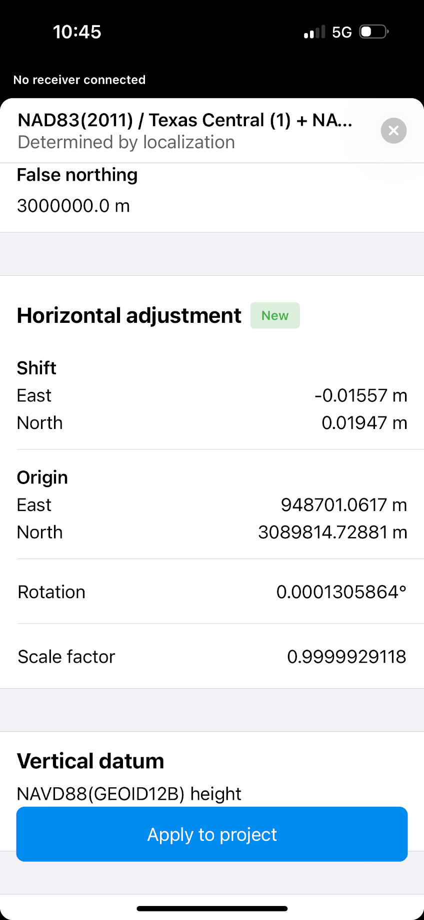
Hi Riaan! This could be because your CAD/Design coordinates match your source of corrections. The effects of localization is most noticeable when there is either a scale factor applied to the CAD/Design files or the base upon which the original Survey was collected was an averaged single or “I’m Here” point. It can also be noticeable if there has been an arbitrary shift to the data. If your corrections are the same as the CAD there will be a very minute adjustment that may only be hundredths or millimeters.
For example, we received data from the Engineers and Surveyors that had a scale factor applied to the CAD. I worked with the Surveyor contracted for construction to shift the data back to true State Plane Grid so when I did the localization I had a very small adjustment. It was within our construction tolerances but it was different nonetheless so the localization was still beneficial. Notice how small the scale factor adjustment was. In our area it is typically 0.99988 or inversely 1.00012 as dictated by the State which make a big difference when your coordinate basis in is the millions of feet.
Thank you of this. It makes sense. The data that I received for the known points are in UTM coordinates and I suspect either EGM96 or EGM2008. Trying to get in touch with the original surveyor to confirm this. If this is the case, how do I get the coordinates to WGS84 Lat/Long and ellipsoidal height?
They can convert the coordinates using GIS software, but they may not have GIS software, and they may not have any idea what you’re talking about. I’m guessing you don’t have ArcGIS but you can try QGIS. I’m sure there are guides for converting coordinate systems. But you have to be careful to do it exactly right
For now, we don’t have any tools to perform such a transformation, but as @daygeckoart suggested, you can use GIS software to do that. QGIS is a proper choice for similar tasks since it’s free and has great documentation.