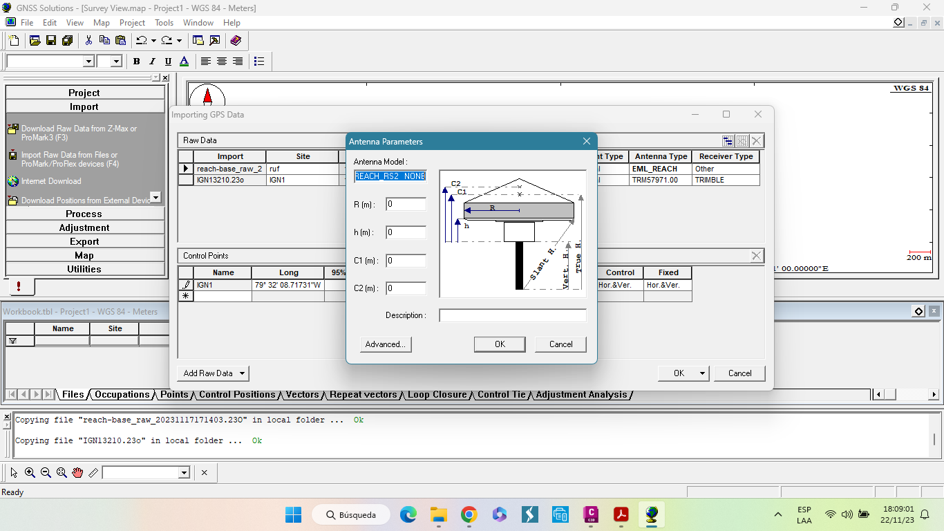
Good luck getting the C2 (m) parameter as that appears to be the L2 Antenna Phase Center (APC) height from bottom of receiver (Antenna Reference Point (ARP)). I’ve asked about this EXACT CORRECT data and no answer.
As for the rest probably the following based on the SUPPORT DOCS REFERENCE for the RS2:
R (m): 0.0637m (63.7mm)
h (m): the diagram isn’t completely clear for lower case h. Vert H appears to be to bottom of receiver from the ground point being measured (tip of rover pole)(True H appears to be APC (C1 / L1) already accounted for to the ground point being measured (tip of rover pole)?
C1 (m): (probably L1 APC) 0.134m (134mm)
C2 (m): (probably L2 APC) UNKNOWN(Emlid help?)
Not sure if the 134mm APC is an average of L1 and L2 or just L1 only?
The ANTEX calibration file suggested by @EBE111057 states:
-0.98 +1.92 +134.92 NORTH / EAST / UP (prob GPS?)
-0.44 -0.06 +137.10 NORTH / EAST / UP (prob GLONASS?)
The L1 and L2 APC measurements actually floats electrically above the mechanical antennae.