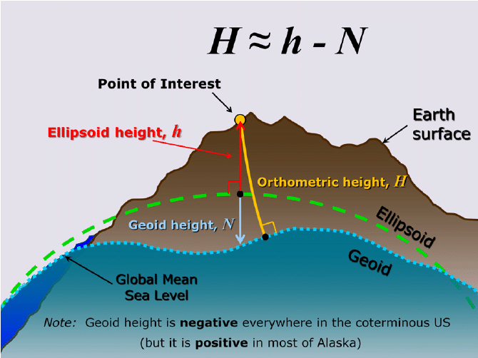
Yes I think that, too. But which kind of geoid hight, or which geoid?. The differnce between original point hight an calculated point hight in position streaming is 44cm. We have to know which kind of geoid is fundamentaled or fixed by nmea gga output, or how we can change it?
We use the EGM96 (1 x 1 deg grid) geoid for NMEA GGA. NMEA GGA message includes orthometric heights and geoid undulation in relation to EGM96. There is no way to change the geoid here, but you can transform the elevation values in third-party software.