Hello, Emlid Community!
I was hoping someone in this community could help point us in the direction of some guidance on how best to diagnose and troubleshoot positioning discrepancies between GNSS manufacturers’ units.
In this case, we are working on a project in Northwest Texas, USA. Our client is working with us at the site and they use Trimble VRS units (not sure of the model) connected to an NTRIP caster. We use Emlid Reach RS3s both in RTK and VRS configurations (depending on the scenario).
We first needed to relocate a buried object that others had recorded several years ago. Here was our configuration: RS3 Base - Averaged position from Fix with same NTRIP caster. Broadcasting corrections over LoRa to RS3 Rover. Rover connected to ESRI Fieldmaps. Their configuration was Trimble VRS connected to same NTRIP caster.
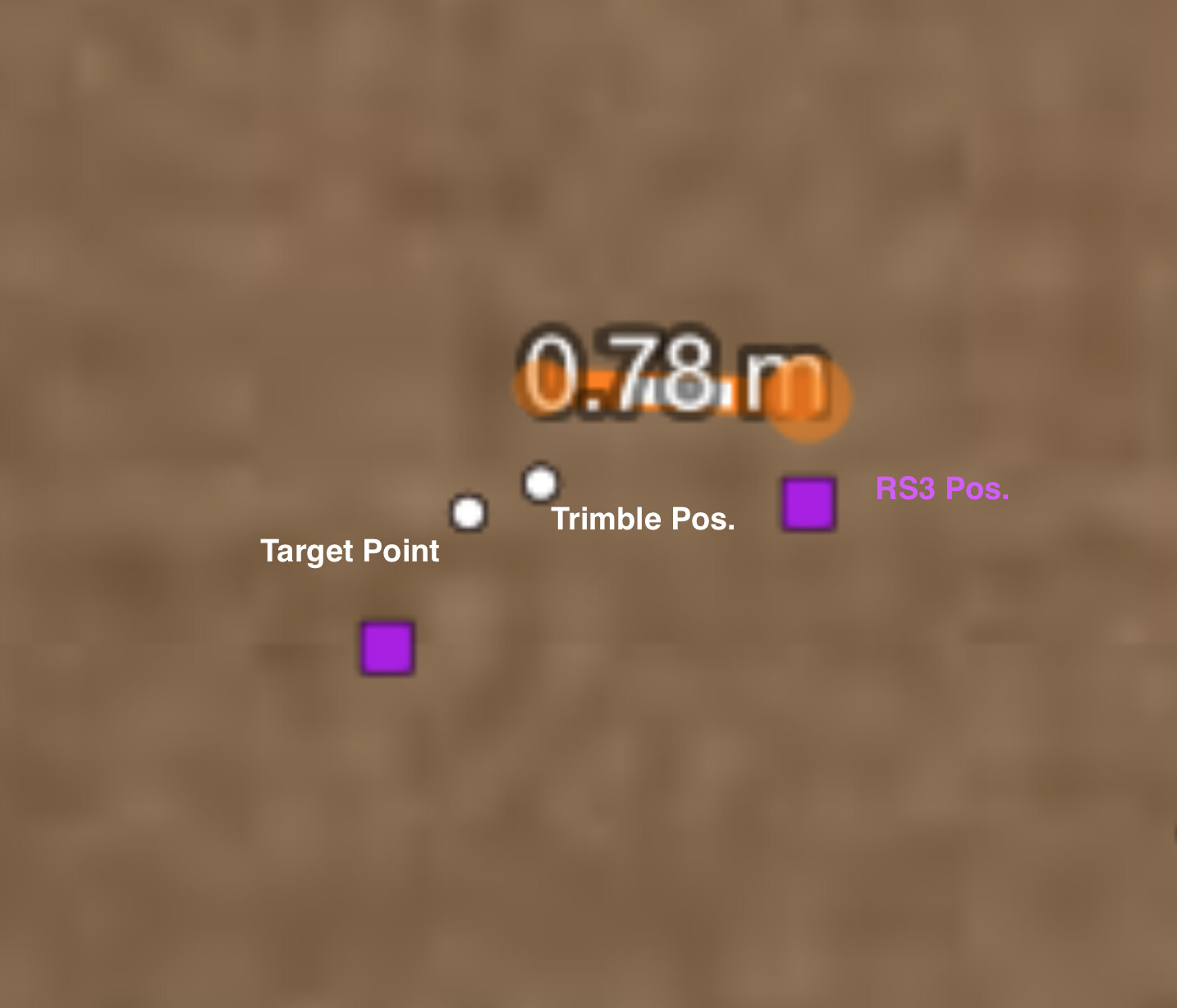
We both staked out the target point and the Trimble was dead on (within a few centimeters) and ours was coming in 78 cm off. We shot in a different target point and their Trimble was again dead on and ours was off by a little over a meter. Here’s a screen grab depicting the differences.
We tried without the base, connecting the Rover to the NTRIP caster and wound up being off by essentially the same amount.
We can set things up pretty consistently at this point. We can establish a fix predictably. We do struggle with troubleshooting when things go wrong. This is a case in point.
If we both are using the same coordinate system and connecting to the same caster, how can we be off? How does one go through a process of troubleshooting to isolate and correct discrepancies like this? Any help would be greatly appreciated!
Hi, Michael -
I’m probably mixing up my terminology, to be honest. We’re both connecting to the same NTRIP caster network and I believe the same mount point. Is there a difference that we should be looking out for?
This is a perfect example of the type of troubleshooting context and guidance assistance I was looking for. Thank you so much.
VRS is just a technique the RTN providers can use to place a simulated base closer to your position by triangulating using multiple CORS. They should be able to give you a single-base mount point that does not use it. I think the majority of the problem I have with it is because Texas’ infrastructure isn’t near dense enough for the size of the State so even though I had VRS it was still 30km+ baselines bouncing around. I could literally sit there and watch stakeout and baselines move. Now on GEODNET I rarely get outside of 15km in Central Texas. So many are being added that I am starting to wonder if you can have too many. There’s almost 50 from Austin to San Antonio.
This sounds like an issue with coordinate system configuration as the difference is almost exactly WGS84 to NAD83. Not sure how it works with Trimble, but it’s possible that the Trimble companion app makes some transformation before sending the position to FieldMaps.
The best way to isolate the issue is to configure the coordinate system in Emlid Flow and then check if there is any discrepancy between Flow and FieldMaps.
I would suggest a test point transformation as well. Both systems (flow and Trimble access) enter an identical geographic point and see if they both land on the same transformed coordinate. That’s a desktop study which proves the two software sides are at least making the same steps. We’ve had to do similar a number of times when there is a WGS84 and ETRS89 discrepancy, funnily enough around that 70cm mark. On other occasions it’s a funny transformation with 7 parameter shifts and rotation signs being messed up.
If that comes out good then you narrow down the possible faults.
Hi everyone!
Thank you all so much. These are such helpful suggestions. I will run through these and report back the results.
One thing, though: I’m also interested in taking a step backward to find some resources to be able to identify and troubleshoot problems like these as they unfold in the field. These forums are very helpful, but I’m trying to assemble resources that our team can reference on the fly, without having to search through the forums. (No offense to everyone here! )
I’ll review these suggestions and will report back.
We currently don’t have a dedicated troubleshooting guide page, but I’ll definitely add your suggestion as a +1 for this request. I understand that such a page would be handy for general issues. However, for cases like discrepancies, the solutions might be more unique, and you can always reach out to us at support@emlid.com for assistance. We’re happy to help!