I took my 2 Reach RS out for another accuracy test yesterday. I followed a protocol which has given me great results up to this points. The simple set up entails:
- Set GCPs
- Set up base in single mode, and start raw file logging
- Start rover in single mode, and start raw logging
- With rover, survey GCPs
- Survey GCPs a second time, to verify consistent PPK solutions after processing
- Save raw files on base and rover, and shut down base and rover
- Restart base and rover, and start new rae log files
- Survey the GCPs again.
- Save raw log files and go back to office for PPK
- Use RTKPOST PPK process on each survey - This is a check to make sure I can get a Q1 fix on all GCPs
- Apply base position from base 1 as the base position in the second survey to get all points to very closely overlap.
All of this has worked great in the past, but this time I am not getting Q1 results on my surveyed locations. The track looks like this, with the red circles being the surveyed points:
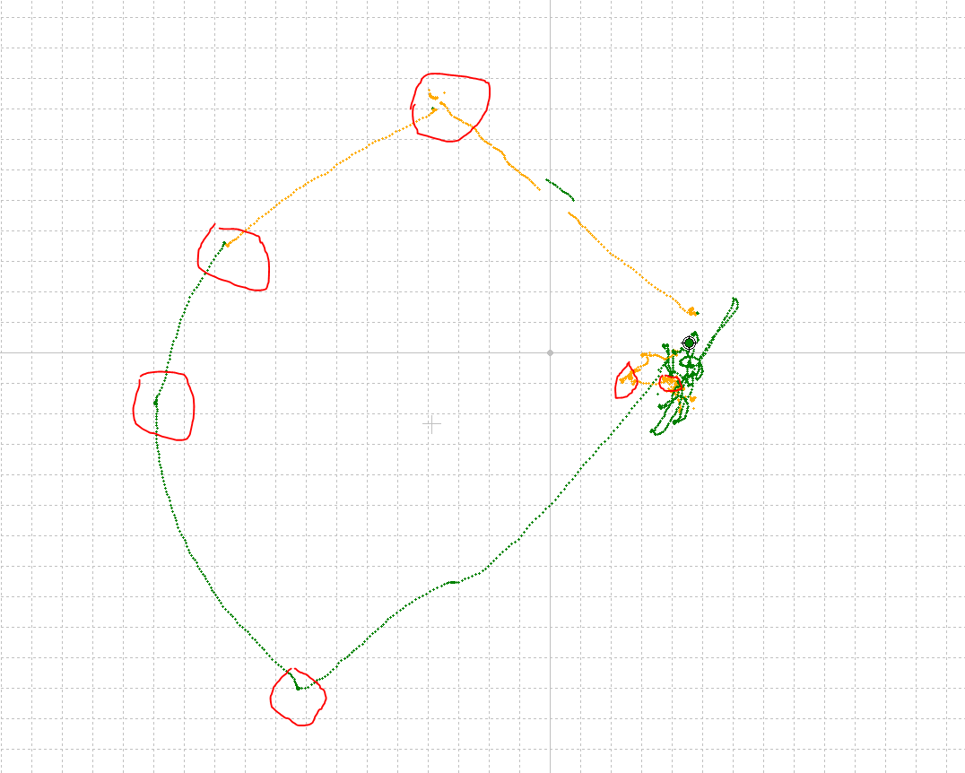
On 4 of them, I am not getting Q1 results.
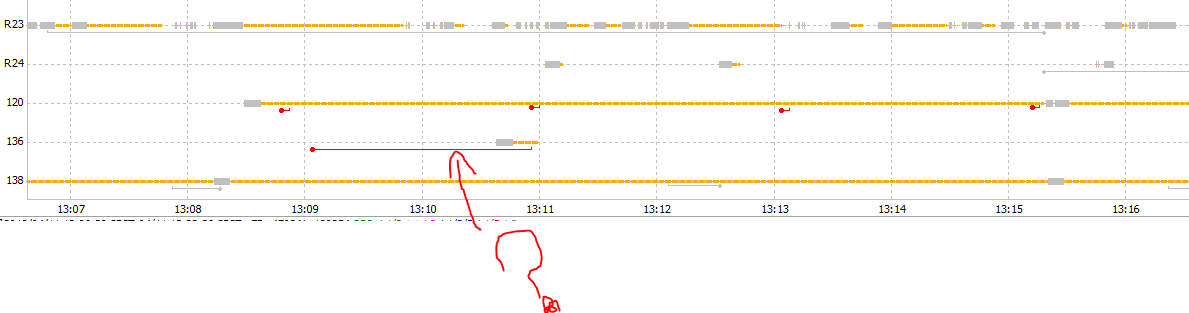
I am trying to narrow down the cause of this. My sat vis graph does show a loss of satellites at the first survey point, as seen in the red circle here:
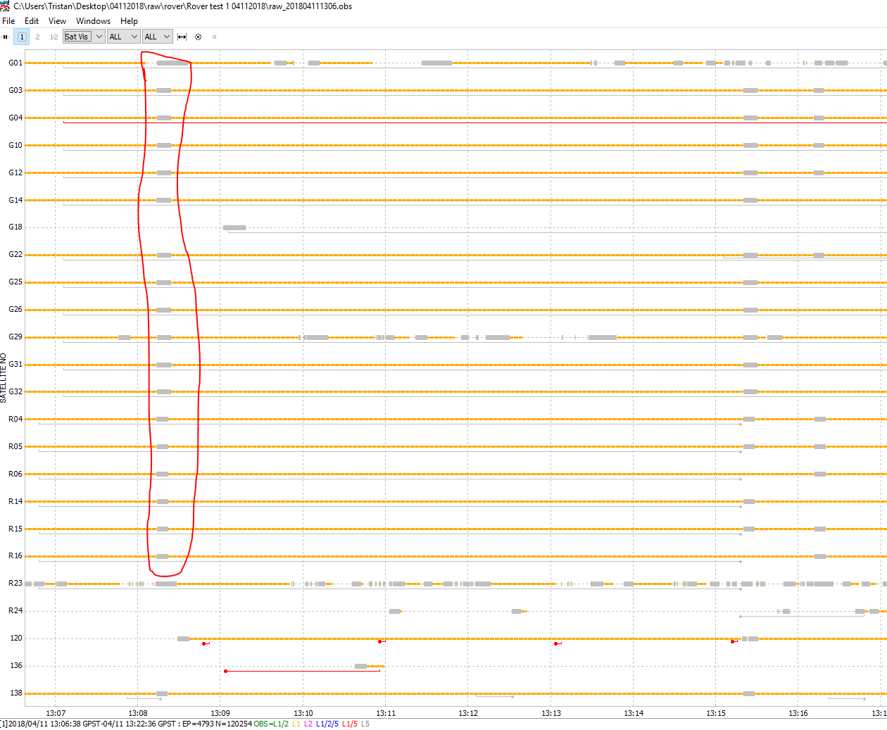
I am not sure why I had the poor signal here, as the sky was very open.
The only thing I did differently this time as opposed to other trials was add Galileo.
Can anyone suggest a means to narrow down the cause of the poor results in this case?
edit: also, what do these red bars mean?: