Hi this question may have already been asked or I am missing something basic.
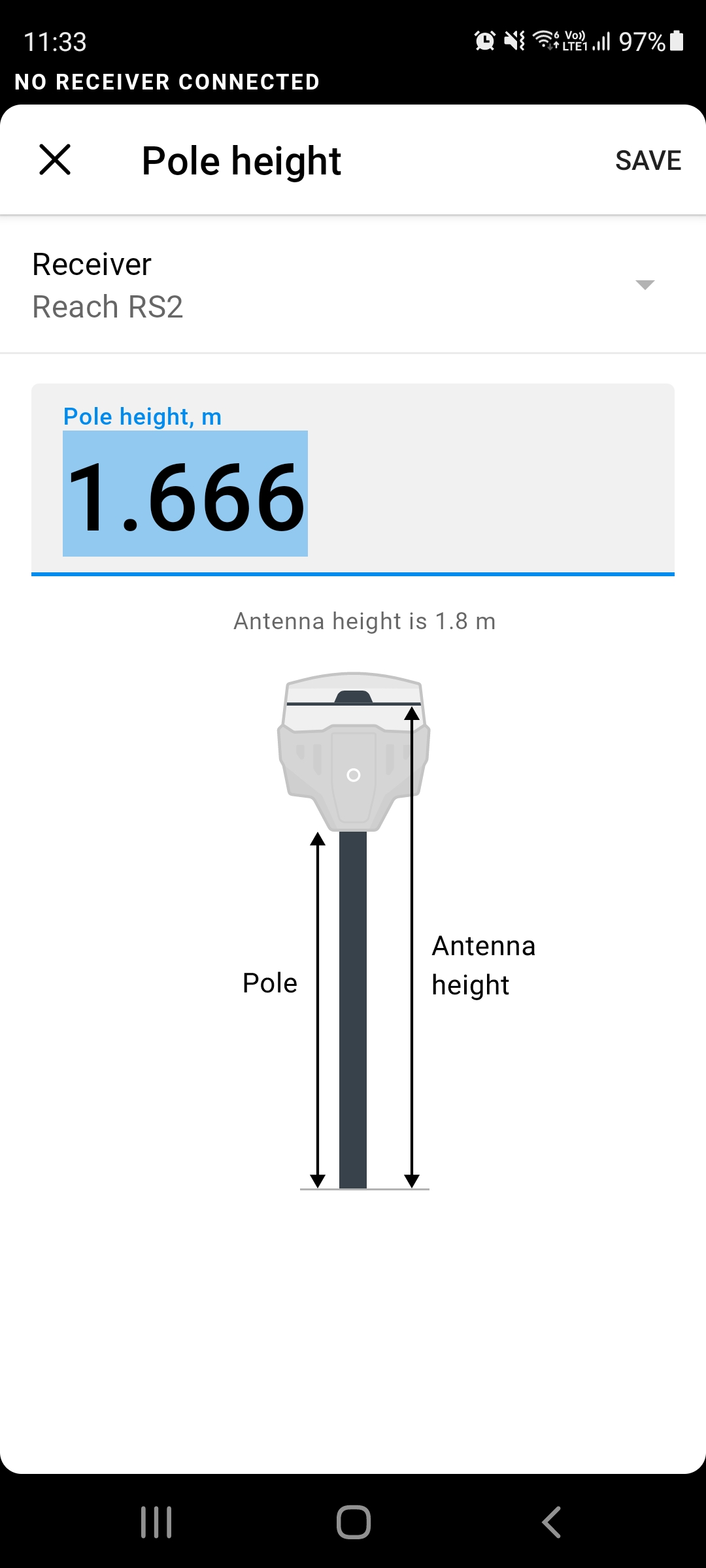
I wonder why I was getting consistent errors in the elevations I was capturing using my RS2. I took the RS2 unit and took shots at survey benchmarks around my local area and the heights were all out by approximately 134mm (i.e. the antenna height of the RS2) To correct this error I now set my pole height to 1.666 m when in reality it is at 1.8m can anyone explain what I am doing wrong
Hmm, it should work well the way you set it initially: the pole height should be entered as it is — 1.8 m. So let’s try to find out why it doesn’t work as expected.
Where did you get the coordinates of the benchmarks? Please share them and your CSV file with the project with me, so I can check it. You can send the data to support@emlid.com if this information is sensitive.
Do you see the same mismatch in height when you work with Reach RS2 base and NTRIP?
Sorry, just to clarify also, during survey should I add the distance to the base? or the distance to the Phase?
when I export the data I can see another 13cm were added to my data, So I assumed that I should all the time add the measurement to the base of the Antenna?
Is it the same also when I log for 24 hours to establish a BM?
Every time you need to enter the pole’s height, you should enter the distance from the ground to the bottom of the receiver. The antenna phase offset is added automatically.
Edited: “base’s height” replaced with “pole’s height”.
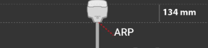
The RS2 automatically adds 134mm to the entered pole height, correct?
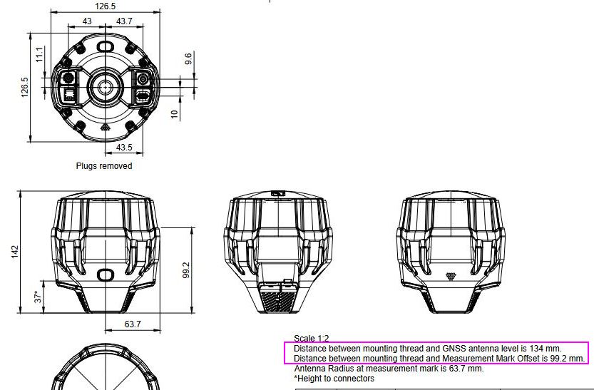
What is the significance of the “measurement mark” at 99.2mm? Kind of confusing.
Also, it might be helpful if you use the word “pole” rather than “base” in this context because “base” is also the terminology used for one of the receivers when used as “base” and “rover” rather than the support of the gnss head.


 Thanks for noticing!