


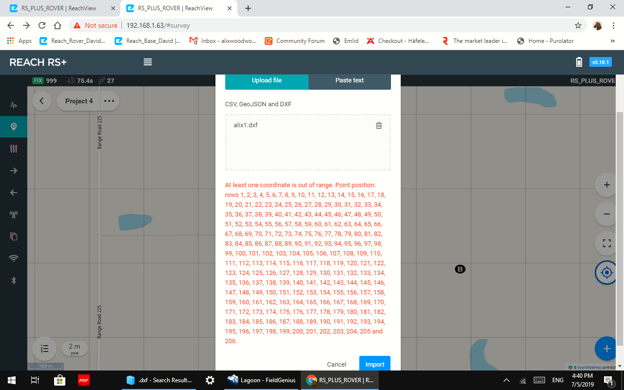
Hello , I got a problem importing points to reachview . This message keeps coming up. Exported from fieldgenius. reachview v2.18.1
!
Hello David,
Can you share your dxf file maybe we can help you
Until you find what the problem may be, maybe try to export the points as CSV from FG making sure the fields are in the correct placement for export/import and see if that works. prob the same for DXF.
http://s3.microsurvey.com/fieldgenius/Help/Content/ASCII_Coordinate_File_Export.htm
http://s3.microsurvey.com/fieldgenius/Help/Content/DXF_Export.htm
1 Like
GREETINGS.
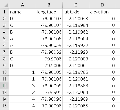
THAT ERROR IS VERY COMMON. THE CORRECT WAY IS TO INCLUDE THE HEADING OR TITLES OF THE COLUMNS IN CSV FORMAT.
name longitude latitude elevation
THAT IS THE SOLUTION TO THE IMPORT PROBLEM.
4 Likes
Thanks I will try that.
The coordinates of the points contained in the dxf file exported by FG are in UTM format not yet supported by ReachView import.
The solution is suggested by timd1971 above.
3 Likes
thank you @Zinou, but if this is a limitation of ReachView importing DXF this way from FieldGenius, then CSV needs to be used instead as also suggested by @jdcf_topografia.
FieldGenius and most software, apps offer import/export of the standard classic tried and true CSV format.
DXF is best if you need to work with “points & linework, arcs, circles etc”. i.e. import from AutoCAD etc a building floor plan into FieldGenius and stake out points (and along linework etc) and also see the DXF linework on a layer (or convert the points along with linework figures) versus just a bunch of hard to distinguish cluster of points and numbers all over the display.
It would be VERY nice if ReachView supported linework (not just points) with DXF, JSON etc. Also layer views, user drone imagery (GeoTif, GeoJpg) and basemaps.
But this is why I use FieldGenius. From what I understand, Carlson SurvCE/PC can laod Bing Maps as a background? ; )
3 Likes
Thank you timd1971 for your clarification, I think these points will be taken into consideration soon by the team, it is even part of his policy.
2 Likes

Is that even possible?
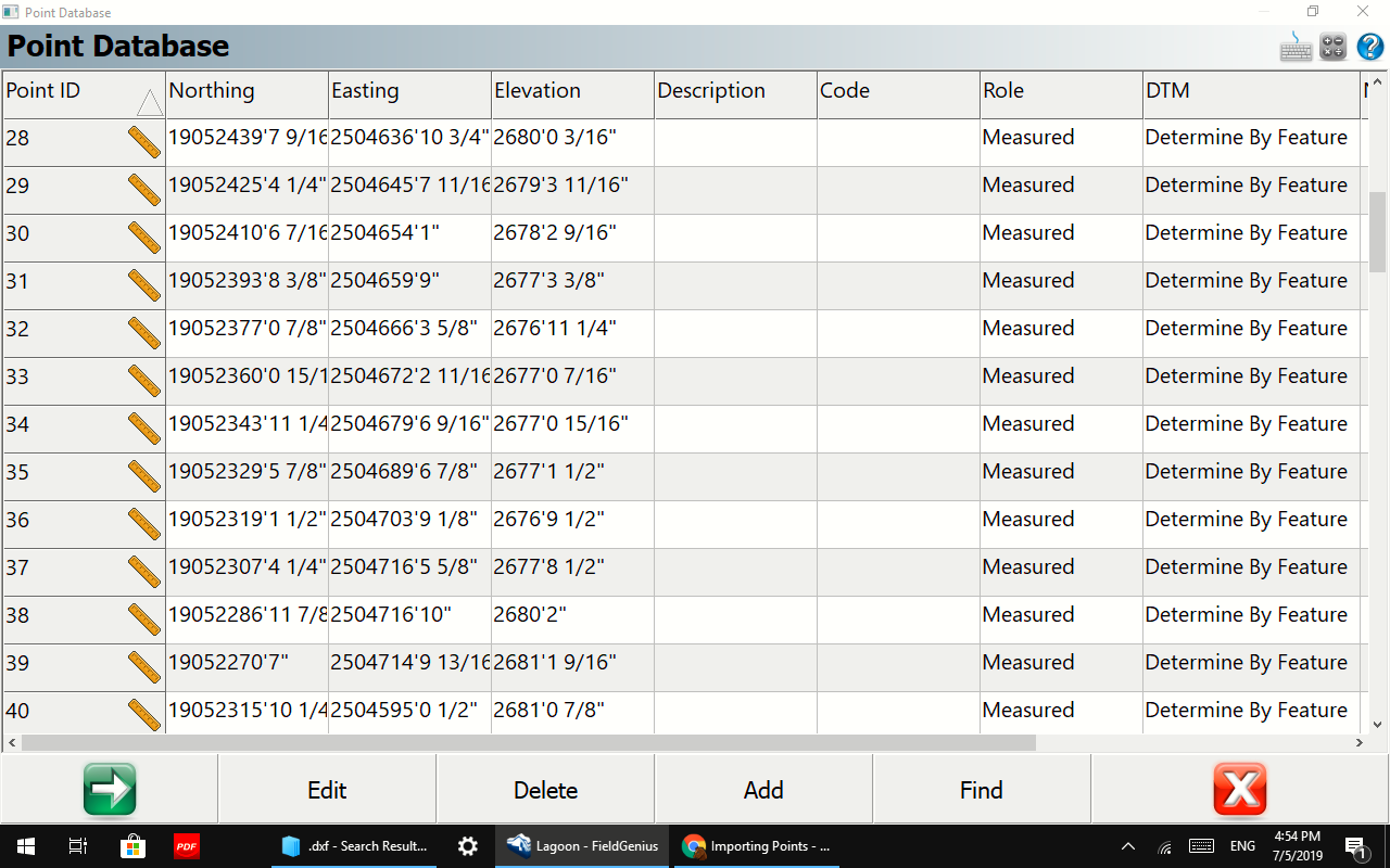
No I have not been able to get the the points imported in any of the formats FG has.
Hi David,
May I ask you to post files you tried to import?
This topic was automatically closed 100 days after the last reply. New replies are no longer allowed.
Hi everyone,
Just wanted to say we now have ReachView 3 that supports DXF import in local coordinate systems. If you want to share any feedback, feel free to start a new topic!
1 Like