Does anybody have any experience using PointMan App with Reach RS+ and what is your feedback please?
Is there a reason the PointMan App isn’t available to us in Australia and does anybody know if this change in the near future or is there a way to obtain it?
If the PointMan App isn’t available what is a good or better alternative to it please?
“Fantastic app . Coupled with the Rd 8100, Emlid Reach RS+ GPS ( and the FDOT FPRN NETWORK) on a 2019 SAMSUNG 10.1” tab A and a Verizon hotspot I am getting 7 millimeter horizontal and 1.2 centimeter vertical accuracy. This setup allows you to collect and create 3 dimensional representations of utilities or infrastructure cheaply,easily, efficiently. Once the data is collected it can be easily shared instantly via email. kml,kmz,shape files photos ect."
Hi andrew.yushkevich I saw the same review which was one of the reasons for my post; I wonder why its not available to us.
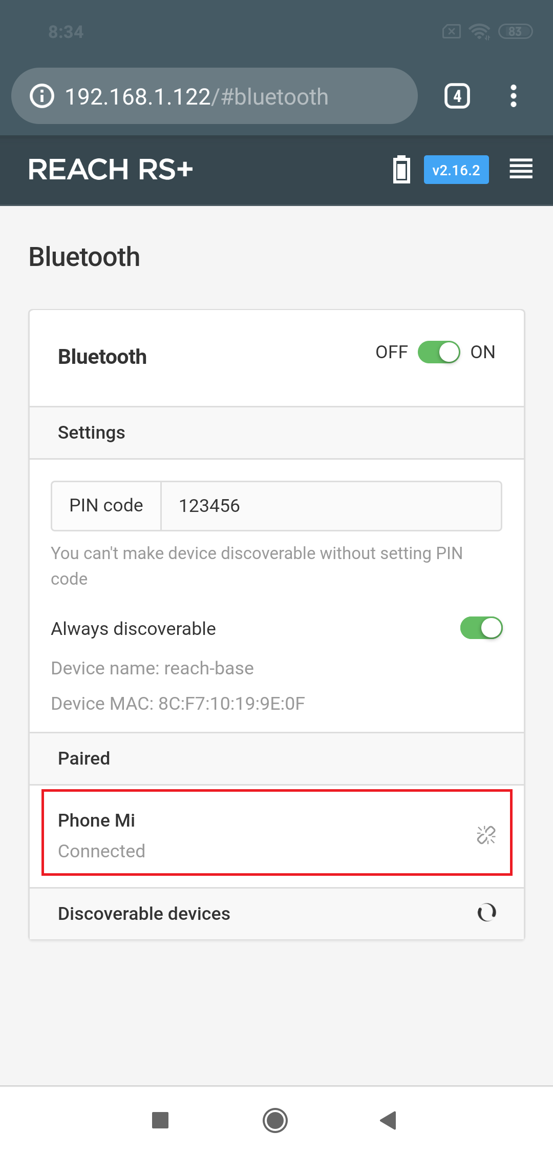
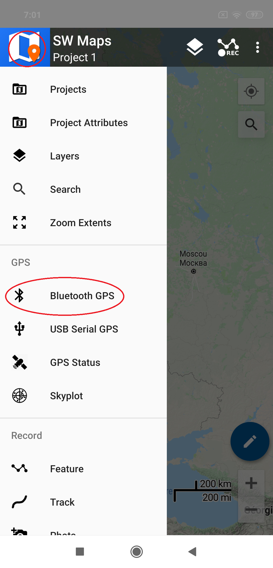
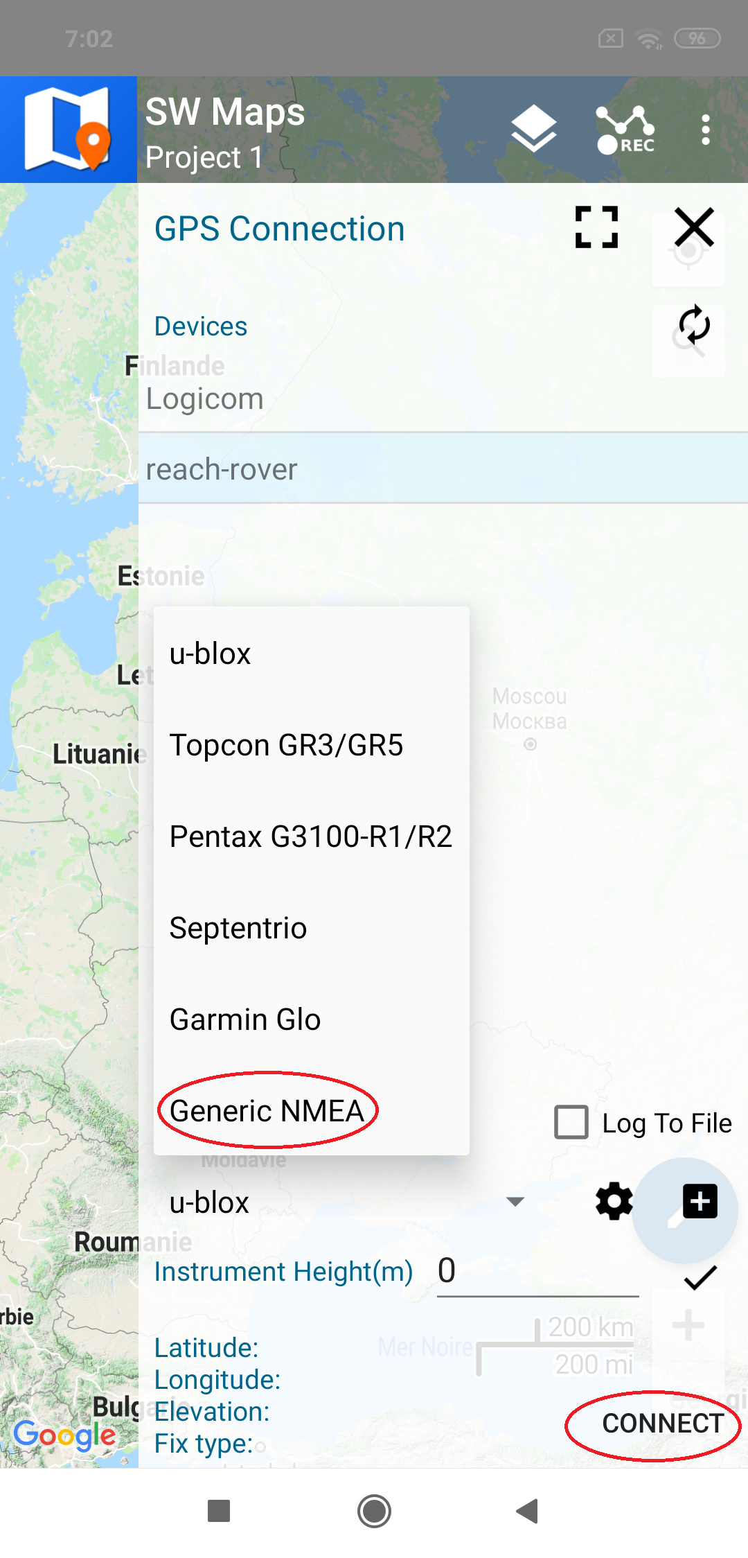
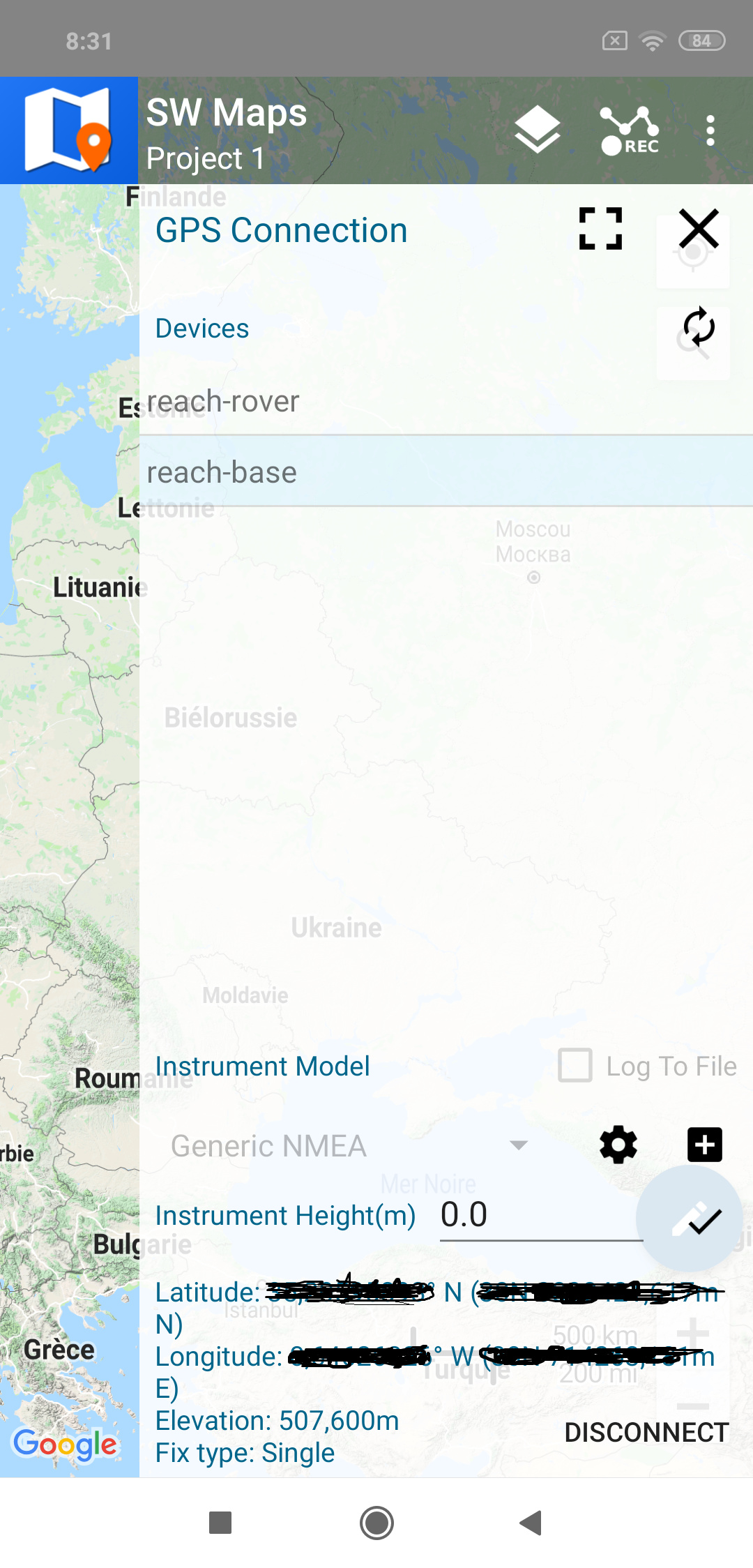
Hi ZinouZinedine, SW Maps description appears to compare well with PointMan and the price is right I’ll have to give it a try I think. Is it easy enough to setup, connect to the Reach RS+ and use in reality and are there process steps for connecting to and using with the RS+ anywhere i can obtain please?
Well that’s subjective… After downloading and going through that app there is no way you are doing a REAL survey with it. Although I am not sure what some of these people are considering to be “full scale”…
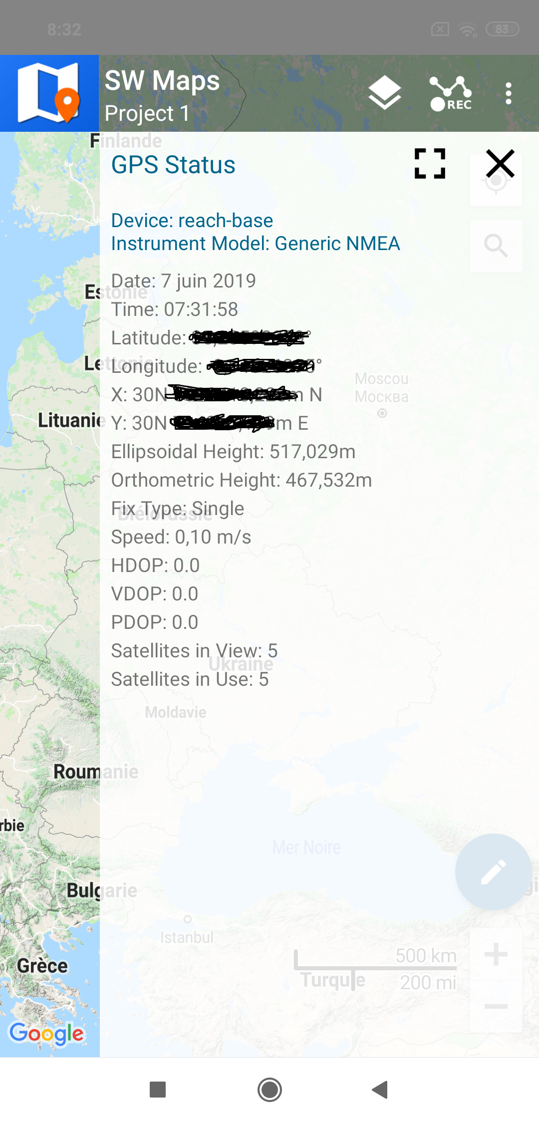
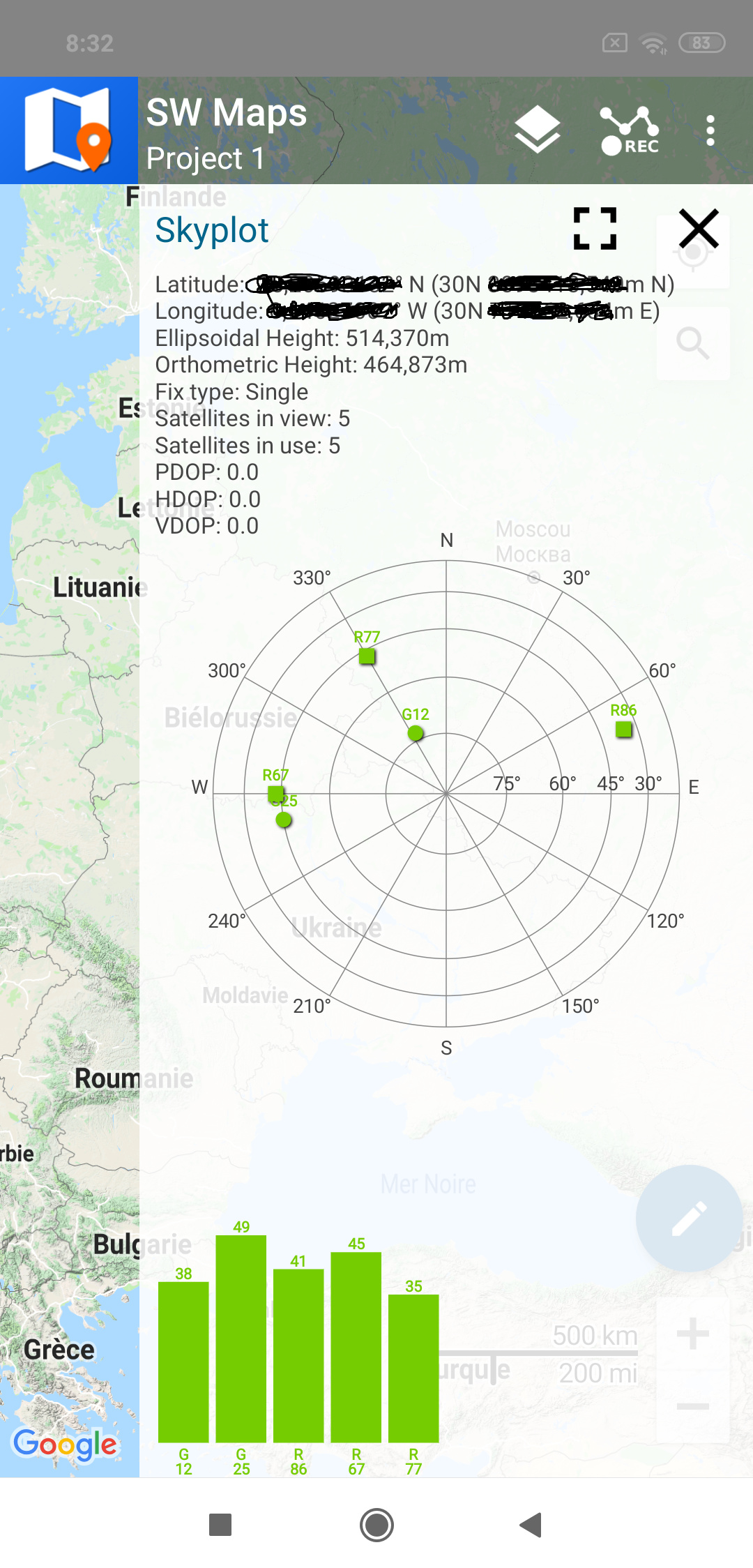
I use a receiver in single mode to demonstrate a connection but you can use it in RTK mode (using NTRIP for example) and get a very accurate location (Fix Type: Fix RTK)…
Don’t get me wrong SW Maps looks great for what it does, but surveying for 15 years and looking at the breadth of the functions it does not look full scale as marketed. It’s not far beyond Reachview, but they don’t market themselves that way. I’ve never used Mapit, but it seems to be recommended very often and has a great support system online. I am more from a traditional land survey mindset and most of these apps appear to be for GIS which is a different in the fact that it is collecting whereas “surveyors” do field calc’s and set controls. If I were doing GIS work I would use Esri Collector, Mapit GIS or Global Mapper. For surveying I would recommend Microsurvey FieldGenius, Survey in the Field or Mobile Topographer. FieldGenius was obviously the most comprehensive, but it does cost. The defining point between these two realms would be “surveyors” need field calculation and analysis. Not having to only consume data and analyze it back at the office.
It is clear, everything depends on the objective of your project, the precision required as well as the means deployed, if the objective is the collection of GIS data SW Maps is the case otherwise for topographic surveys it requires other more suitable applications …
I am one of the software engineers at ProStar GeoCorp who works on the PointMan app. Just ran across this and wanted to let you know that PointMan has been made available in Australia (as well as several other countries) to download from the Google Play Store. I hope you give it a shot!