


Plane (Three Markers) Tracking Quadcopter Using Computer Vision
This project is a final year Electrical and Computer Engineering thesis at the University of Cape Town, South Africa. The goal is to produce a quadcopter with the ability to maintain a fixed height above the ground in the presence of outside disturbances, observe a plane in three dimensional space via three brightly colored markers and computer vision, maintain a fixed distance from said plane, and maintain a fixed angle from said plane.
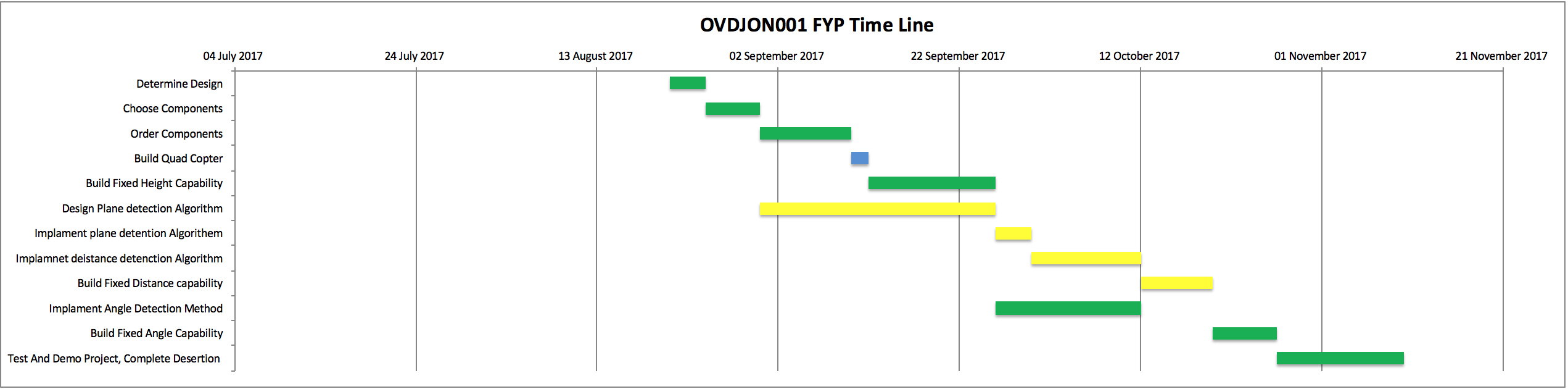
Project Steps
Selecting The Hardware
When selecting the hardware to create a face/plane tracking quadcopter many options were available. Among the potential options were: Parrot AR Drone, Px4 with Companion Computer and Drone Kit, Mvic Pro Mobile Application, and of course the Navio 2. These platforms each have their respective benefits and shortfalls, but ultimately the Navio 2 provides the right balance of reliability, computing power, and flexibility to produce a fully fledged autonomous solution untethered form a ground station for computation.
Bellow is an investigation into each potential platform, said platforms benefits and their ultimate drawbacks making it unideal for such a solution.
Parrot AR Drone
This is a very powerful tool for beginner drone enthusiast looking to create a purely software solution with no hardware additions or alterations. Parrot has provided a very nice programming interface for creating drone applications without having to delve into the lower level functionality of the quadcopter, this is a very attractive feature as it allows software engineers without any hardware knowledge, experience or interest create amazing UAV or drone applications. However it is this sandbox environment that ultimately disqualified the drone from being the platform for this project. Furthermore the Parrot AR Drone does not have enough onboard computation power for achieving the desired level of autonomy and computer vision required by this project ADD SOME AR DRONE SPECS HERE AND EXPLORE THEM MORE. These limitations could have been overcome by using a high speed wifi link (which parrot has made incredibly easy to utilize) and a ground station for image processing and control, but would theoretically tether the drone to the ground station by the maximum transmission distance of the wifi link and would thus not be a completely autonomous solution.