Hi all,
On the M2, does it subtract the RS2 Phase Center-to-ARP height when using the NMEA output (CGA message)?
I am getting different reading on a well-known point using RS2 and M2.
The RS2 seems to output ARP (so subtracting .134 meters) on the NMEA stream, but doing the same exercise on the M2 gives a height that is roughly 11-14 cm centimeters different from the rest.
This is data:
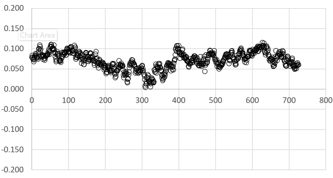
Using RS2 ARP, 6h log (~720 x 30 sec avg positions, Fix only), 0.577 meter from known point to RS2 ARP:
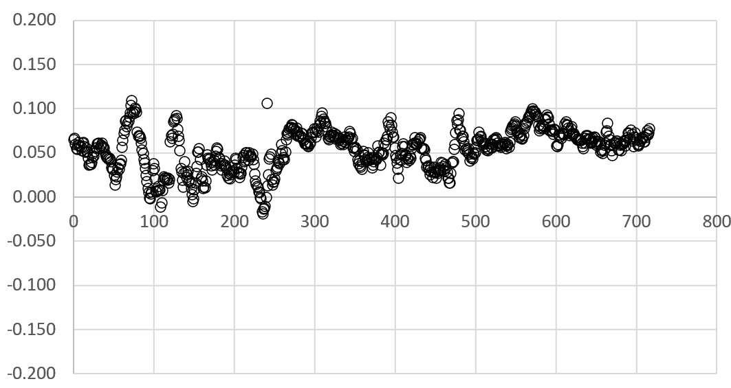
Using M2, 6h log (~720 x 30 sec avg positions, Fix only), 0.577 m +0.0416 m -0.134 m from known point :
I am using a Top106 antenna on 0.500 meter extension, mounted to 0.077 m tribrach. Average Phase center for this particular antenna is 0.0416 m.
What am I missing ?
When I postprocess the M2 raw-data (4*24h), and taking into account L1+L2 phasecenters etc against an official CORS, I get the same (±1 cm) as when postprocessing with the RS2.
So there is something being added to height inside the M2.
The value of the NMEA output and the value displayed in the status-screen are identical, btw.