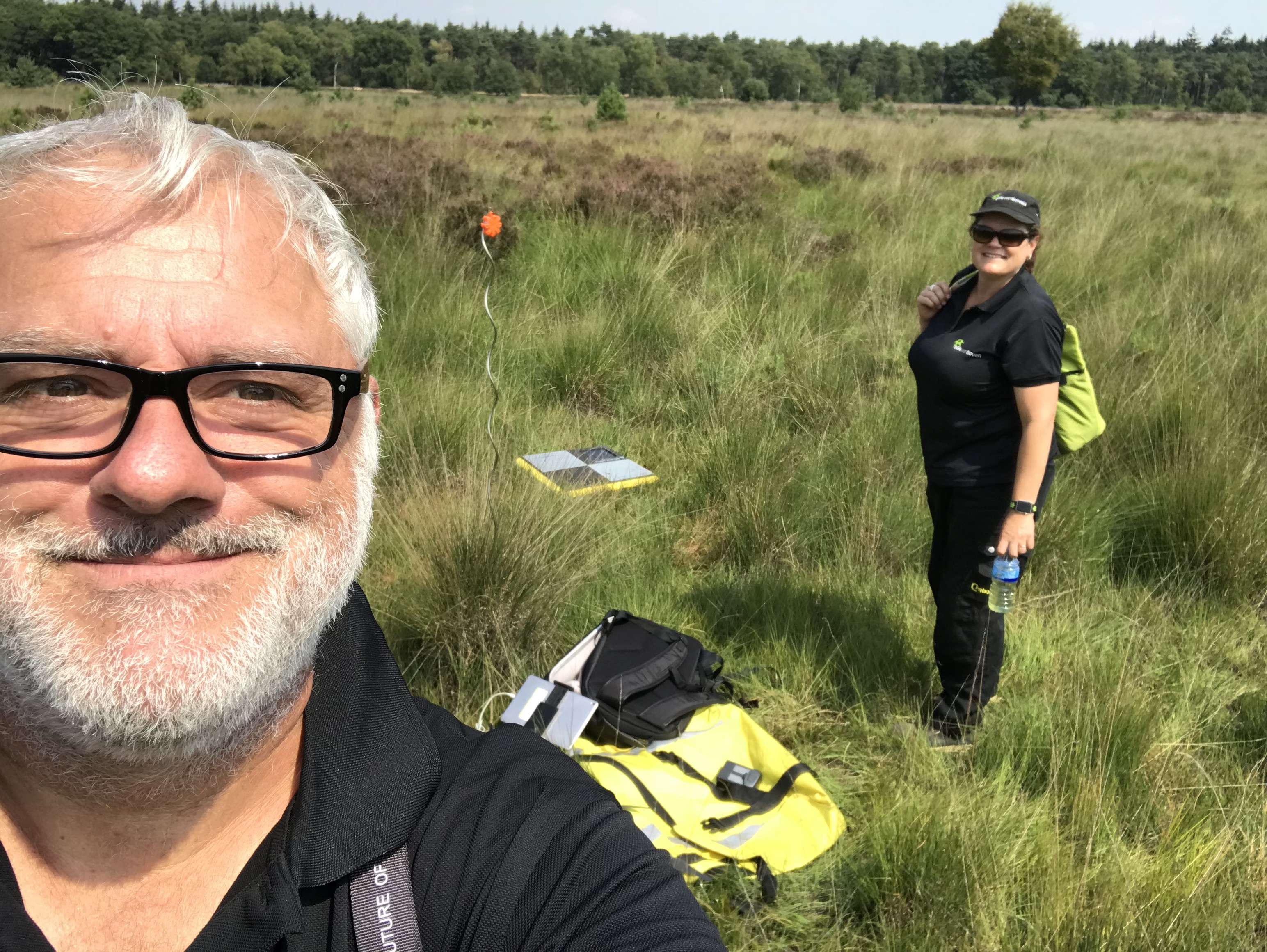
Since a while we make use of the phantastic UAV-Design modified Phantom 4 Advanced and Phantom 4 Pro RTK/PPK solution. We used them combined with the Emlid Reach RS+ as a base station and some Propeller Aeropoints as correction points. All combined gave us really good results.
Working with the Reach RS+ as a base station means that you always have to know the exact gps location and hight of the RS+. You can do that via a (life) NTRIP correction or by measure the coordinate by a 3rd party tool like a Trimble base…
Since a while it is also possible to get the RINEX data from the Propeller Aeropoint(s) you make use of. The main benefit of the aeropoints is that you do not need to now their exact GPS location because they meassure it by themselves. This means. the use of the propeller aeropoints are less time consuming!
Our workflow is that at least 1 aeropoint is used as a base station on which we collect the RINEX data from which we use for the RTKPost tool. We also place some aeropoints in the field as checkpoints to check the accuracy of the PPK flights.
Till now, we got fabulous results with the combination of the Reach M+ on the drone and the aeropoints as RINEX base station.
I am sceptic about these GCP to make accurate measurements, because the antenna is almost on the ground. Have you tried to measure them with RTK Reach standalone?
If you use Phantom RTK, why do you need to use Propeller? Just for comparison and control?
Hi Jurijs.
In the past we worked with the Aeropoints only. Later, we bought the UAV-Design modified Phantom 4 Pro PPK with an Emlid Reach RS+ Base.
Nowadays, we use the aero points as GCP and also some of the kit as checkpoint. 1 aero point is used as Base station for the RINEX files.
So all of the aeropoints collect raw-data, but at the same time communicate with each other to nail down their positions, hence it takes while to get a good enough fix?
I believe they only collect their own coordinate. Not a good idea in our world as there is then no localization included in the network. They do provide a point of reference though and make the maps consistently relative to each other.
As for time saving - having to put them down and pick them up every time, takes allot longer than just setting permanent markers and only having to replace them when necessary. Makes better sense for us because we visit the same locations regularly.
A colleague recently purchased a set of these so I was curious about what hardware was in use for such a long acquisition time. I haven’t found any good, independent studies (only promotional material) but we intend to eventually test them since they are already on their way in the mail. It seems to me it’s effectively a Reach M with a solar panel and a battery but for $600 each.
As we expand our system we’ve talked about attaching Reach units to our GCPs so all we do is set power them on and set them on the ground.
The aeropoints work together as base/rover. The aeropoints are corrected via the Trimble network (based on PPK). With a set of aeropoints 2 ‘markers’ are enclosed so you can paint the aeropoint as a permanent marker on the ground. You only need to put them on once to collect the exact location.
See:
I think you might be misunderstanding the relationship between the points to each other and the “Trimble” VRS. I tested the Aeropoints extensively and they do not fit our workflow. They take too long to provide a repeatable sub-meter accurate point. When you cost enough AeroPoints for multiple sites and the subscription you would be better served with actual survey-grade gear. Plot the ROI and you will pay off in less than 2 years.
One other notable benefit in our program is the fact that we can work with the same files as ground survey and machine control. Topcon.
The topic isn’t about fitting your workflow yes or no…
The topic is ment to explain how usedull it can be to combine the Emlid M+ with an aeropoint as a base…
I agree, as a concept it is a pretty good way to go. The fact is though if it is not useful to a workflow then it is not a viable option for business. An RS+ base can collect just as accurate of a point in 10 minutes that an Aeropoint can do in 45. This has been tested repeatedly on a known control point collected for over an hour with a Topcon Hiper V. Aeropoints also do not allow for localization which is a necessity for repeatable site surveys. Just as my opinion, but if you need more than 5 aeropoints you might as well buy a base and rover and be more accurate more quickly.