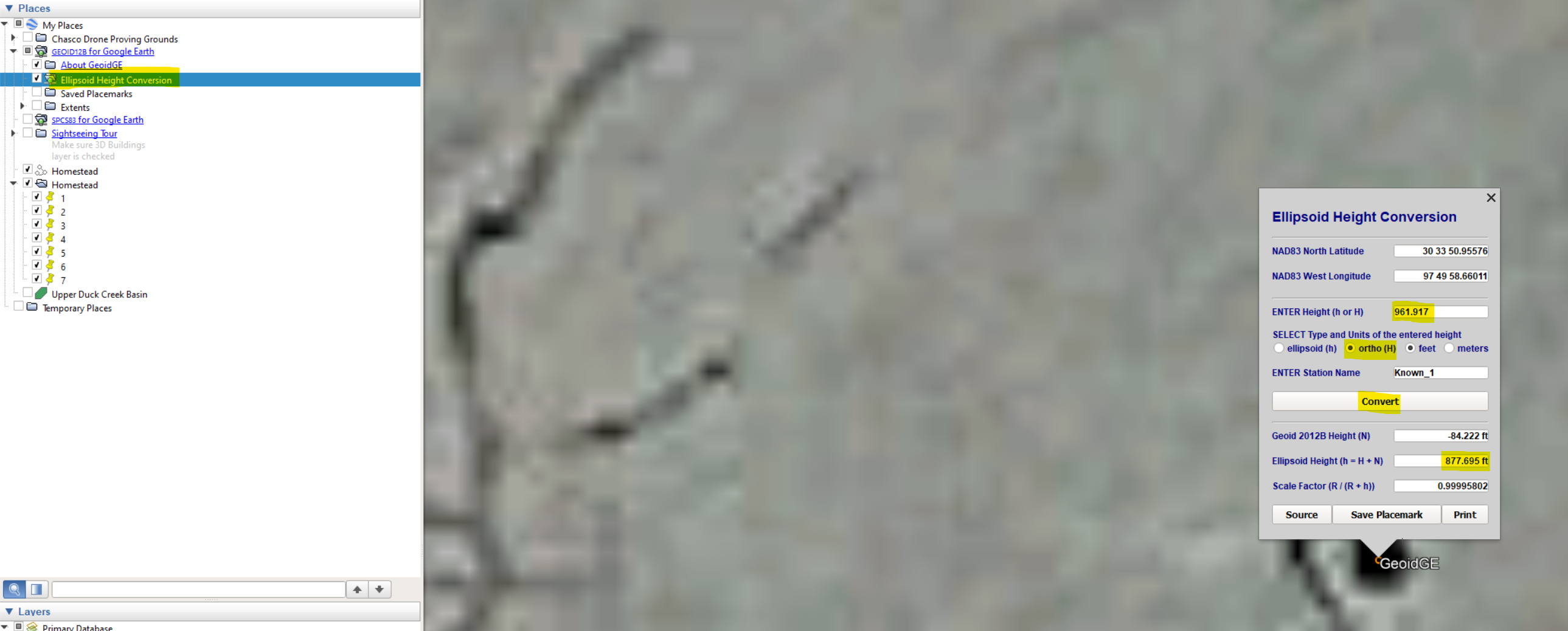
I have a follow up question for you. When setting up the base on a known point. How do you input the parameters from state plane into the Lat Long that Emlid takes? What do you use for the known elevation? Do you use a specific program to transform between the horiz. and vert. datums?
I need to be able to set up on a known GPS tie in NAD83 with a known elevation, and punch that into the Reach RS 2 base. Is there a way to do that via field genius, or does all the base stuff need to happen via Reachview?
I was using something similar with VDatum and wasn’t sure about the reference datum the reach uses. I am assuming it’s just wgs84. I will give these tools ago. Hopefully there is no further Tom foolery with epochs and all that I have to worry about. Worse case I can re-occupy points I shot as a check. Chasco you are worth your weight in gold, thank you!
Thanks dB, just blessed with the right kinds of experience.
You will only see considerable errors in conversion if you are doing very large projects. If you setup your base in the center of a 1-mile radius you could expect to keep your measurements at the edges +/- 0.10ft, but what if you need to traverse 10 miles of roadway? This is where localization comes in. You setup collected checkpoints along that 10 miles maybe every mile then perform a localization and the error of every relationship between point 1 and 10 is prorated across the network and all of your work in between those miles should be within 0.05ft.
Also as we know State Plane is highly accurate in its own zone, but you can’t cross zones. This is where people start using UTM Zones.
Haha, I know MY stuff. As the saying goes - “There’s more than one way to accurately skin a cat.” Ok, maybe it doesn’t go exactly like that and it might upset some people, but I know how to get an accurate solution with what I have. Starting with what an RPLS taught me a long time ago. Thankful for that.
The feature requests can really develop into the true functionality of our app. ReachView 3 is already available with the support of different coordinate systems!
You can now work with the State Plane. Here’s the guide explaining how to set up your project in ReachView 3. If you have any questions or more requests, don’t hesitate to create a new topic in ReachView 3 category.
This has been an awesome addition and has our Emlid gear spot on with our construction sites. Localization would be nice but we have been doing alignments in CAD so shooting straight network isn’t as big of a deal as I thought. Thank you!