


I am processing my RINEX files with OPUS, and getting really high Peak-to-peak errors. Some well over 1meter. Any help to get this down??
Feed us with some details please ![]()
Can you share a link to download the RINEX file ? What are the processing parameters you set ?
Have you check the data quality in Emlid Studio ? For that matter, you can just drag and drop the RINEX in the visualization window of the software.
From that it will be easier to help you !
1 Like
Hi @tcmesserschmidt,
Yep, agreed with Florian. I’d like to take a look at your logs as well. Can you please share them? If you want to keep the data private, you can send files to support@emlid.com.
Attached is a link with the RINEX files and OPUS output. Hope that is what you need
https://drive.google.com/drive/folders/1bSckgTpovlQ4eifN-Oc_2CUzm-dtxmTk?usp=share_link
Hi Tyler,
Thanks for sharing the data. I’ve uploaded your files to OPUS and achieved the same results with errors of several meters. I also noticed that OPUS used just 48% of the data in calculations.
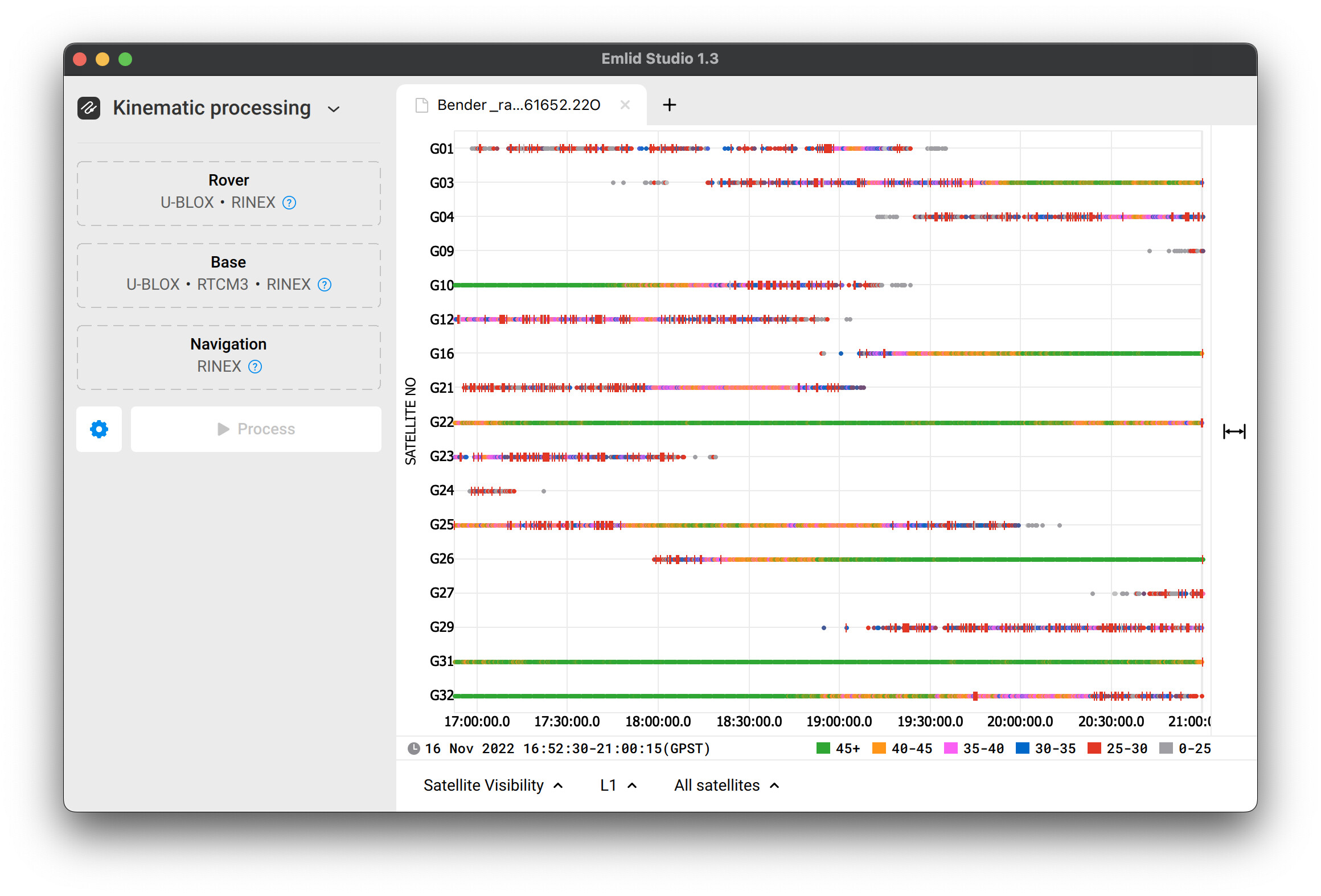
So I’ve opened the observation file from your base in Emlid Studio. You can see a lot of cycle slips here—red marks that occur when the signal is delayed or disrupted.
Are there any obstacles in your area that block the sky view for the receiver?
That is a possibility. It was in the corner of a field, with nearby trees but I also unfortunately have another one that was at the corner of a different field, with little to nothing that should have been blocking anything within a 15degree mask, which is I believe what I have it set at.
I have used an old topcon system in each of the same locations successfully with a 15degree mask over a similar time frame. Is it possible there are some other settings I am not optimizing
Hi Tyler,
Sorry that my reply took that long!
Many factors can affect the log’s quality: the location of the satellites at the exact time, the receiver’s placement relative to the obstacles such as trees, the height of its placement.
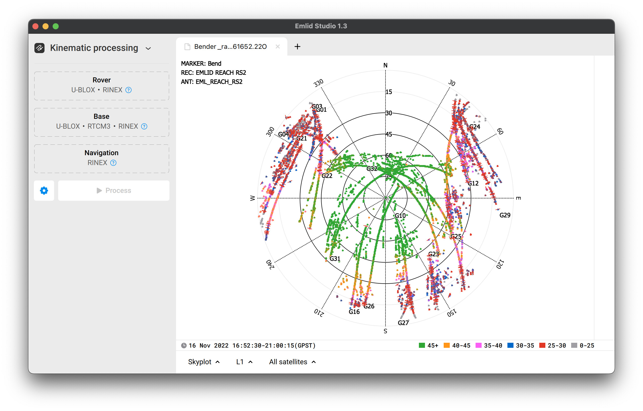
In the logs you shared, I see that the receiver had few satellites in view with SNR higher than 45. Also, in the skyplot, I see that some cycle slips occur at a 30-45 elevation angle. So I’d say that the RMS is so high due to environmental conditions on your work site.
Let’s try recording the raw data log for OPUS in an area with no obstacles nearby. You can follow the tips from this guide to place your Reach.
1 Like
This topic was automatically closed 100 days after the last reply. New replies are no longer allowed.