Finally got fix working not sure if it was correct but I switched the base rtk mode to static instead of Kinematic.
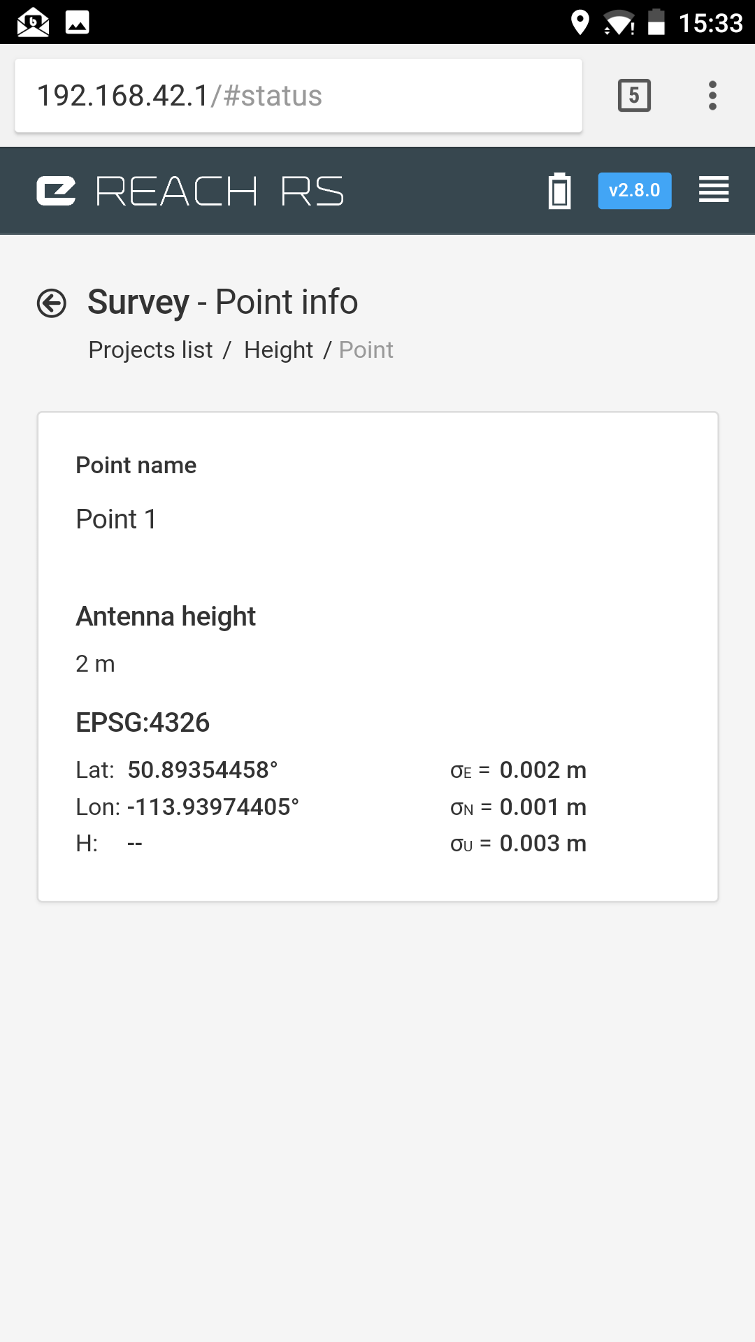
When I go to survey to save a few points if shows good data and qualifiers. After I save the point I back out to view the points data and the height is not recorded.
Also is there a way to export the saved points as something like a csv, where we can see lat, long, height, and deviations. I have tried the dxf and esri files and cant find a program that will tell us simply where the points are. or the exports arent working properly, one of the 2…
This appears to be a small bug we have with displaying big heights. Your data is fine, just won’t show right. I’ve added the issue to our tracker, should be fixed in one of the next releases.
For this, I can recommend the excellent geojson.io service. Just copy and paste the contents of your exported project there.