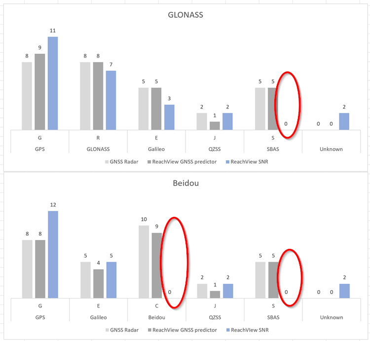
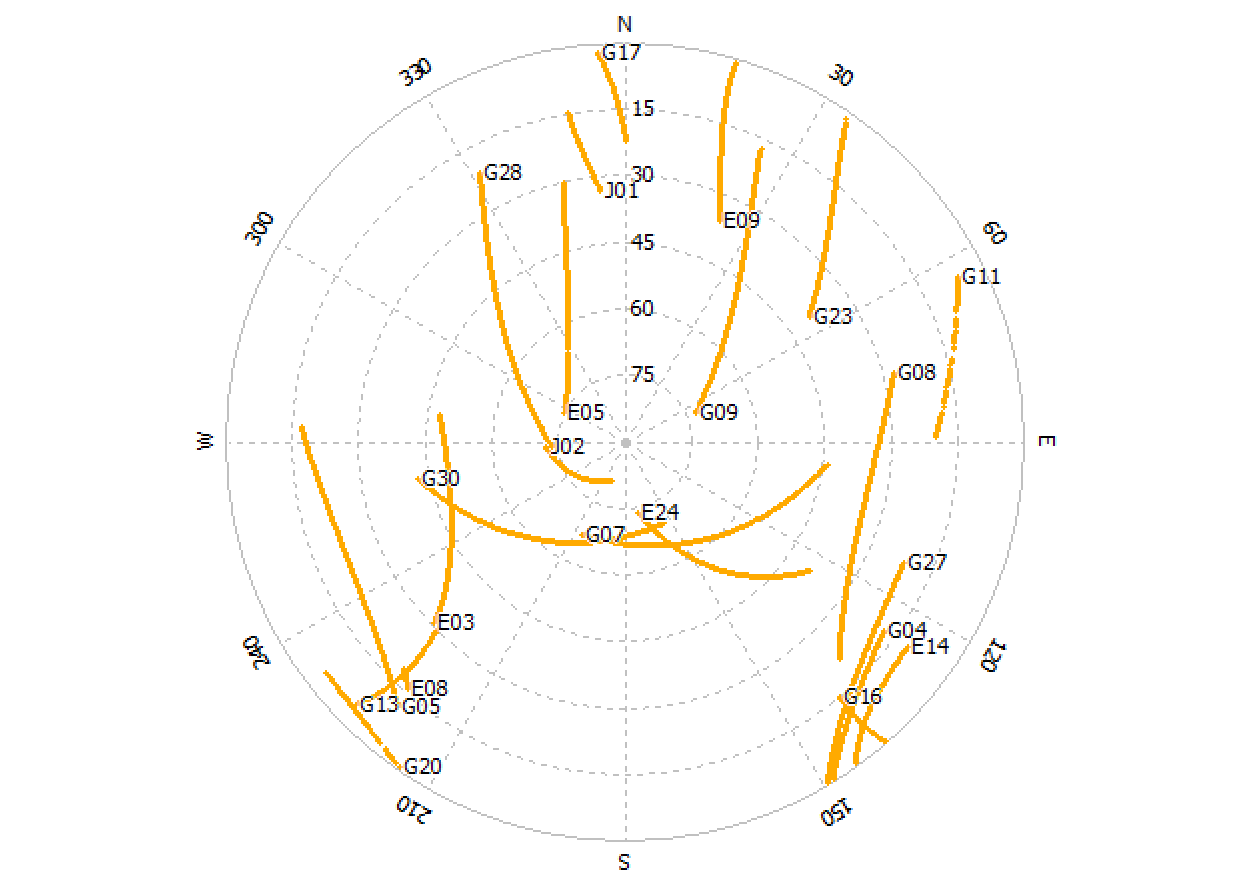
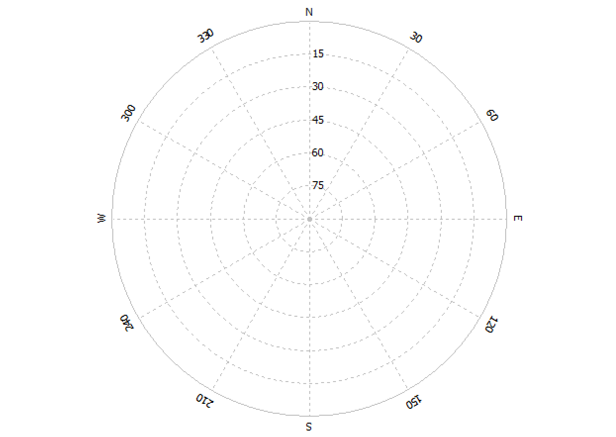
Here is a summary of the satellites I can see when configured for Glonass (top) Beidou (bottom). Note, there are no Beidou and SBAS satellites visible when they are expected to be.
I understand that I can only use one or the other when it comes to Beidou and GLONASS. When I disable GLONASS and enable Beidou I still do not see Beidou satellites.
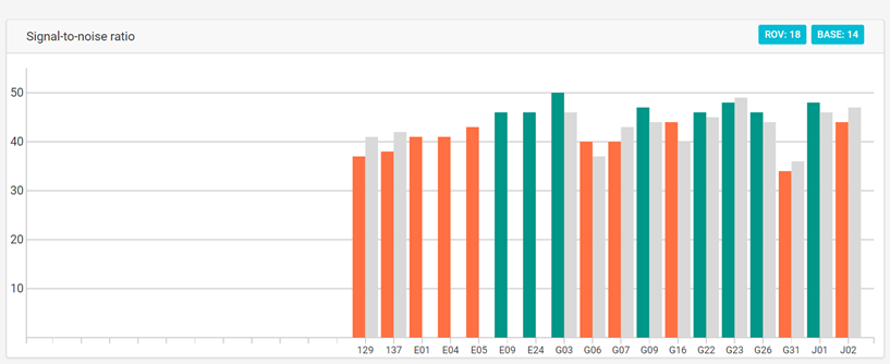
I’m struggling to maintain a reliable fix with GLONASS. Since you are able to see both GLONASS and Beidou which do you choose to use? Which is more reliable?
Is this between two reach units or between a reach and another (say ARGN) reference station?
I use GLONASS primarily because all the Auscope and ARGN reference stations are GLONASS enables, but only some are Beidou enabled.
No idea why you are not seeing Beidou, but I am getting good results with GLONASS + all the others.
If it is between reach units. I know it sounds obvious, but ensure the base really does have that clear sky view. and has a good 20 mins to settle.
See those trees…
Seriously, They are a problem for the base!
I had/have the same issues. I spent ages waiting to get a fix with my base in a similar location to you. If I used the ARGN reference I got FIX in minutes, even seconds. Moved my base way out into the open and bang far, far better results.
With your base in a really, really clear area the rover can cope with a few trees, with both around trees, welcome to FLOAT.
Windy days make it even more critical.
Hope this helps.
If you record raw and proces it, you will easily see if your spot where reach is placed can see satellite systems.
(that crosshair icon at the end of file path in RTKpost)
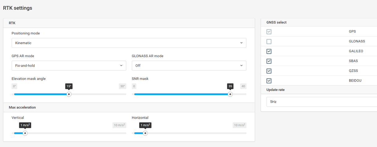
I am pretty sure rinex will only record what’s within the setting set in RTK setting menu of Reach.
If. Raw. Ubx is used, everything is saved.
You might wanna check that
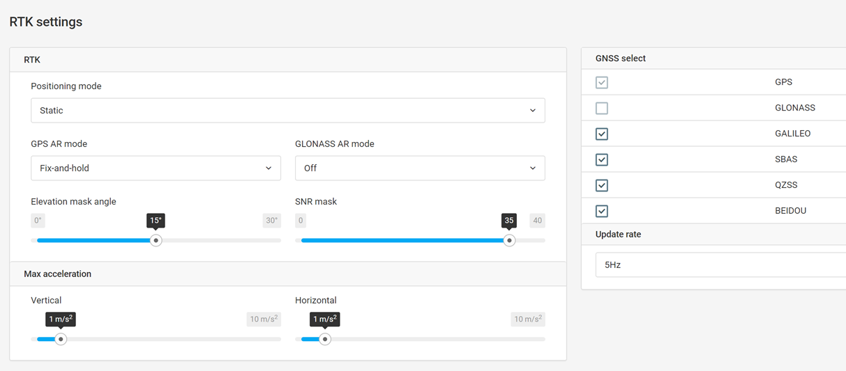
Can you please check one thing in the field? It seems our settings do not handle a certain scenario properly. When you are disabling GLONASS and enabling Beidou in one setting apply, it will not work. Can you disable both, then enable BeiDou and see if it will show new satellites inside ReachView?
Indeed, if I disable both GLONASS and Beidou and apply, then enable Beidou and apply, Beidou satellites are visible. However, after a restart Beidou satellites are no longer visible and the procedure must be repeated again.
This workaround does not work for SBAS satellites.
Space Based Augmentation System SBAS signals come from geostationary satellites, they broadcast corrections which are optimised for a specific region, the European EGNOS or US WAAS, but while transmitting their corrections they serve as additional satellites in the constellation, which is how they are used in RTK. If I remember correctly they have their ID numbers of over 100 to identify them in any GNSS. So as they already have a unique ID (of over 100) sticking an S in front of that number is superfluous.