Greetings, just trying out my new RS3. I have an NGS survey marker not too far away where I can get just enough cell phone signal to get NTRIP corrections over the Internet from a site about 25km away (run by SparkFun I’m pretty sure).
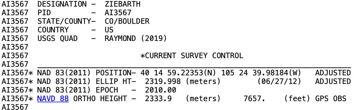
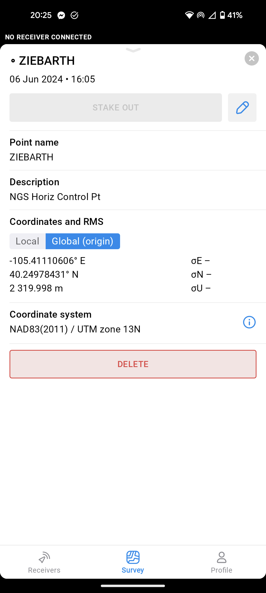
I created a project in Emlid Flow, set the coordinate system to NAD83(2011) / UTM 13N. I then input the coordinates from the NGS datasheet as a point. Then I went out into the field, setup the RS3 to receive (and confirmed it was getting) the NTRIP corrections, and recorded a 60 second averaged point (albeit handholding the rod).
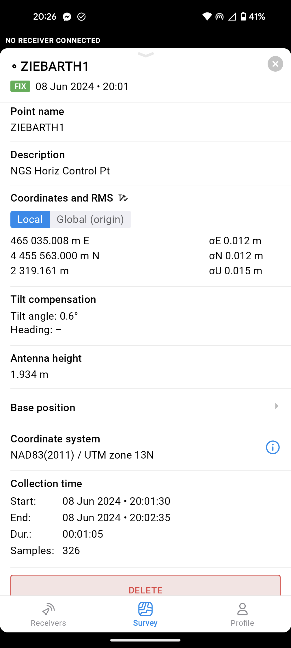
Unfortunately, the recorded point was ~1.5m away from what the coordinates gave on the datasheet. I’m guessing I must have entered the wrong coordinate or needed to convert, but I’m not sure exactly what.
I’d check with the Spark Fun people concerning the horizontal and vertical datum they are using for broadcast. If you are using any private RTN’s, you’ll need to verify what they are broadcasting
I’ve seen this so many times, wrong RTN datums not based on the NSRS vs published datums.
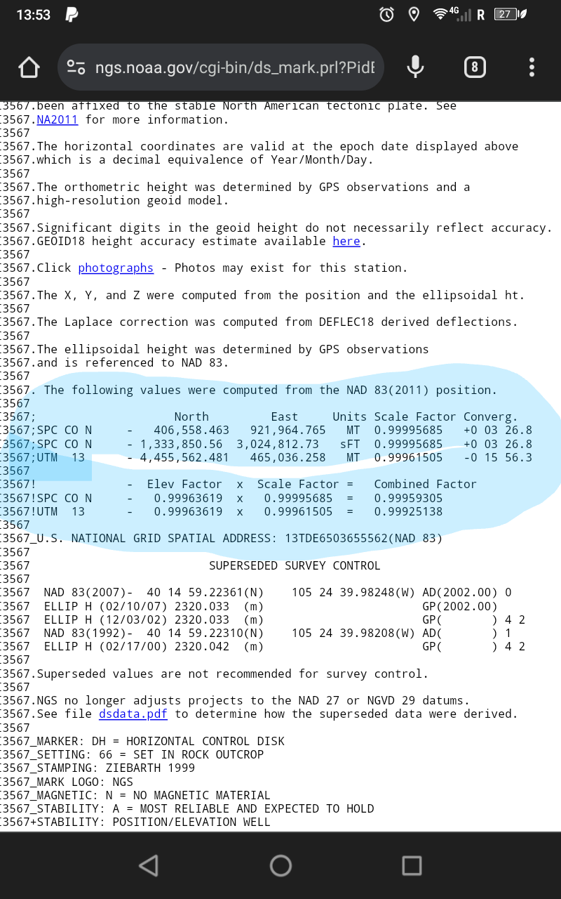
The attached indicates in UTM ZONE 13
UTM13_ 4,455,562.481 465,036.258 MT
Looks like a classic NAD83/WGS84 difference. For ZIEBARTH there’s approximately a 1.398 meter horizontal and 0.859 meter vertical difference between NAD83(2011) epoch 2010.0 and WGS84/ITRFxx epoch current. These numbers look pretty close to your inverse numbers.
Is your NTRIP provider sending WGS84 (current epoch) corrections?
Poking around Sparkfun a bit they did describe setting up a basestation with ITRF14 coordinates.
Your output UTM coords are correct for ZIEBARTH in a WGS84/ITRFxx reference frame for the current epoch.
All above is just approximate to cm-level checking and not rigorously done.