HI,
Just ordered a Reach RS3. I’m new to GNSS and am trying to understand the workflow.
We are performing utility installations in a large (half square mile) industrial site. our goal is to:
Stakeout existing subsurface utilities (to avoid them) using as-built data points provided by the customer
Collect as-built points to provide to the customer for underground utilities we are installing
The customer has provided a dozen+ control points surrounding the perimeter of the site.
The control points, as well as the as-built points, are in the NAD83 New Hampshire state plane, which is available to select in Emlid Flow. The vertical datum is in NGVD29, which is apparently not available in Emlid Flow.
We do not have our own base station. The customer has an on-site Carlson NTRIP base station we can connect to.
What is the best workflow to deal with the NGVD29 vertical datum?
We do not support NGVD29, an old and obsolete vertical datum in the USA. Since you have the control points, calibrating the site is the best solution in this case.
You can read more about Localization in Flow here.
Control Points - WSP.zip (2.4 KB)
I went out and shot some of the control points. I was not able to use a local base station, and needed to use a commercial subscription NTRIP service (28km away). I’ll be able to set up a local base station next week once the equipment arrives.
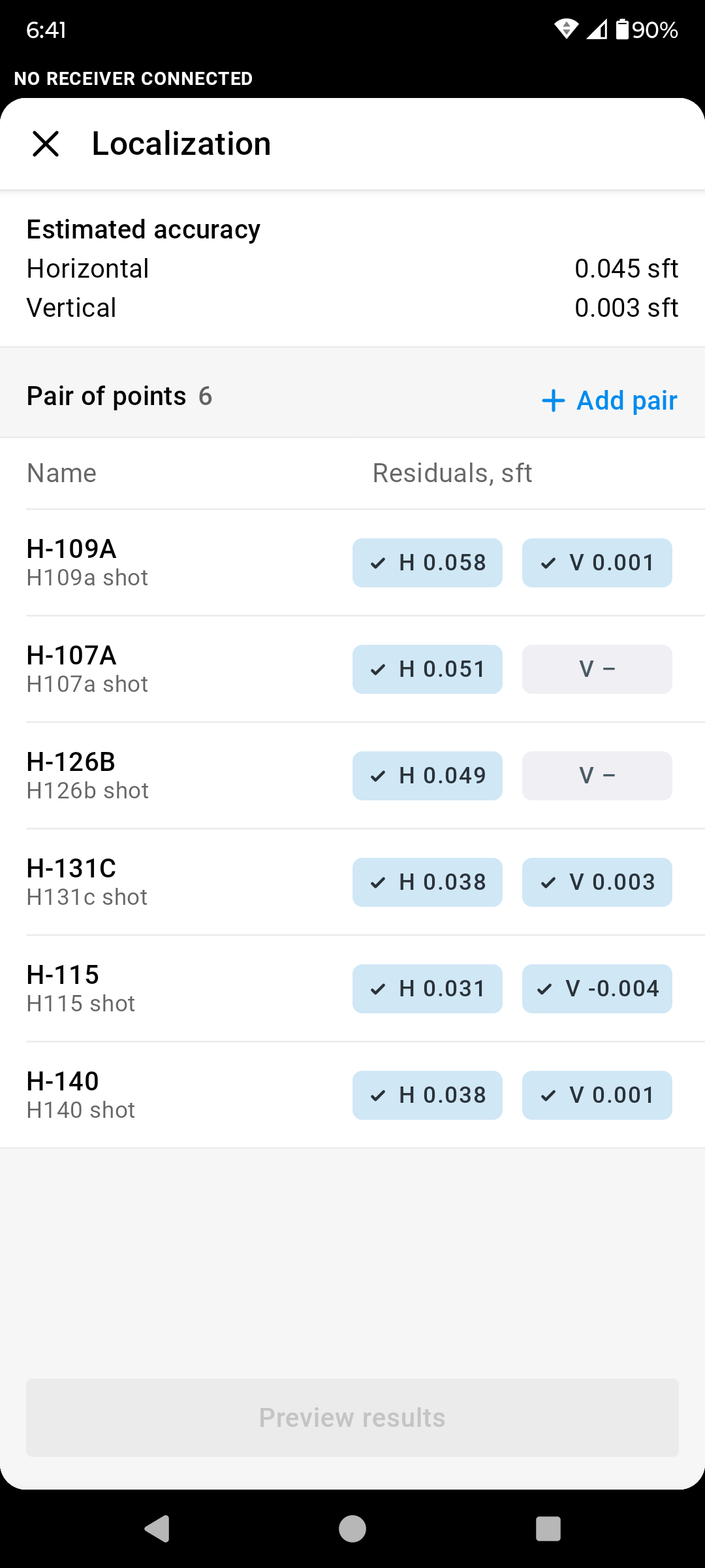
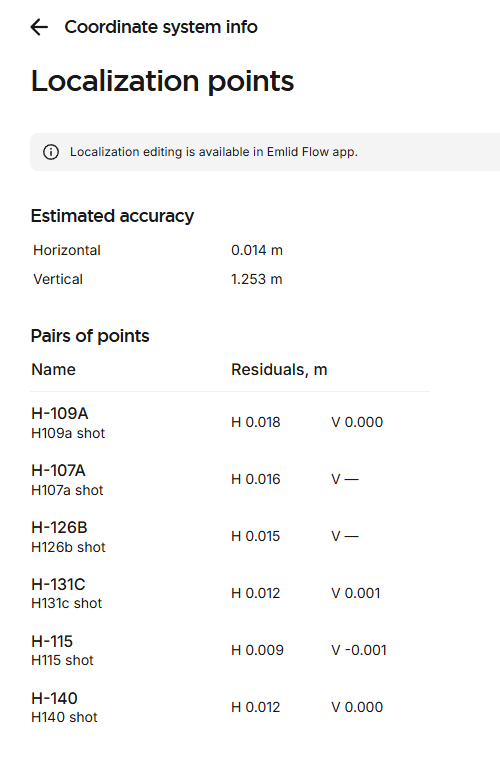
I’m a bit confused by the initial results. For 6 points, the average difference in the shots vs. the control points was .045sft. which I thought was pretty good.
The verticals, however are all over the place. I expected the shots to be about 3.5 feet below the control points. In reality, some were above, some below 1-2.7 feet in each direction.
I played around with the localization, and noticed that the results are different when viewed in flow vs flow360. The units are different (meters vs sft). The conversion is correct for horizontal, but for vertical seems way off (by feet). What am I missing here?
You could use NGS NCAT (NGS Coordinate Conversion and Transformation Tool (NCAT)) or NOAA’s VDATUM (https://vdatum.noaa.gov/) to transform the heights from NGVD29. If you have the ability to make recommendations to the client, I’d suggest updating their project from NGVD29 as it’s quite limiting to find good control in that datum. It’s obsolete now and will become even moreso when NAPGD is released. I’ve been in this boat in the past, so the transformations might be the best way to go for now. Good luck!