I am new in collecting ground control points for aerial surveys.
Right now I am using a matrice 210 with pix4d capture. I am wondering the best ways to capture the ground control points. I have received me Reach RS and waiting to get started. My questions are as follows:
Can I collect points with just a single Reach RS unit? Or do I need to set up a base machine and rover?
How long should I stay at each point to collect data?
How do I know the accuracy?
To help answer. I am located in the Midwest of the United States. Any help is greatly appreciated.
Can I collect points with just a single Reach RS unit? Or do I need to set up a base machine and rover?
Yes, you can collect points with just a single Reach RS unit. If you want to do this without paying for live RTK data then you will need to log data on each point for 5-15 minutes and then post process the data. The important part is whether or not you have access to such data. I don’t know what’s available where you live.
Google free CORS networks. This could give you live access to the data.
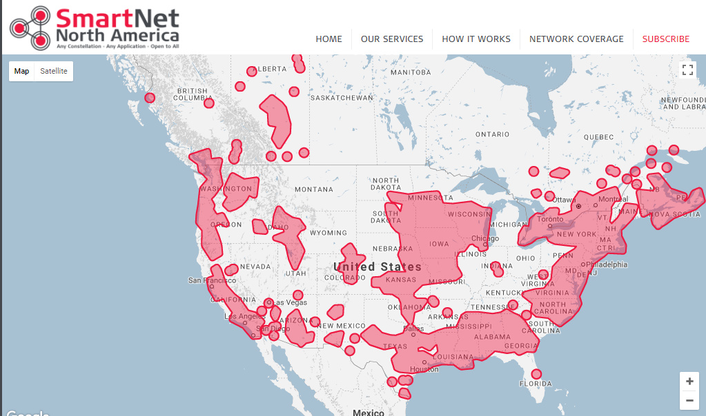
Here is an example of one network that supplies free data for post-processing. I use it with good results but it’s the only option where I live in Canada.
That’s a good question. I’m not sure how to recommend confirm the accuracy of your fix but when you post-process you will see a collection of fixes that should all be located within a small block about 1 cm by 1 cm. Now if you only see one or two fixes I wouldn’t trust this but when you see hundreds of fixed points and they are all all within this 1 cm block you can have a high level of confidence in your positioning data. This is written as an amateur. Let’s see what the big boys say
Good luck!