I wanted to get back to you with a question on cloud compare. I am attempting your method, I removed all rows from my file except LLH rows, but when I dragged the file into cloudcompare, it isnt showing any points. Do you have any idea of what might be causing this? I know its kind of vague, sorry about that.
Because X and Y are in angles while Z in meters
So use QGIS to convert from EPSG:4326 (LLH) to UTM zone (XYZ) im meter
in qgis Use add>>deleimted text layer
Make sure that :
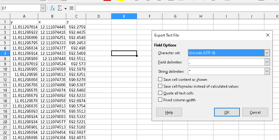
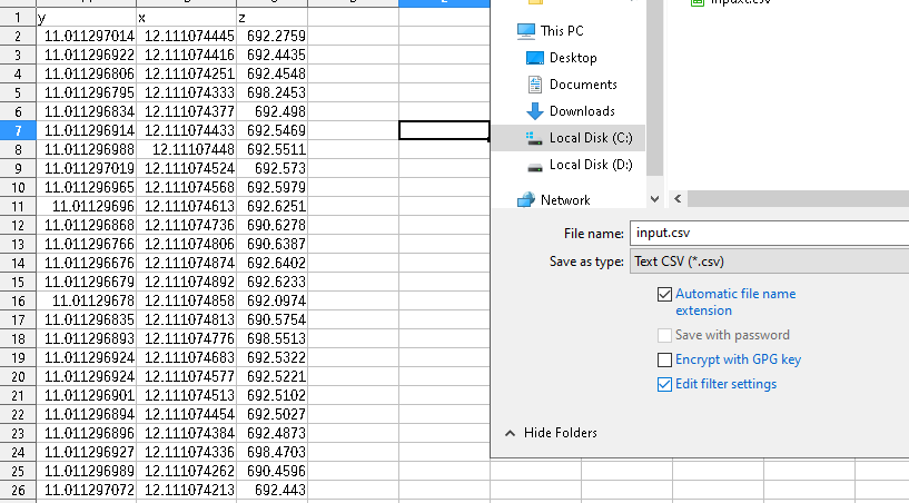
1-When you save by libreCalc to choose comma as a separator by choosing filter in saving dialogue
2- put y,x,z heading line so QGIS can understand
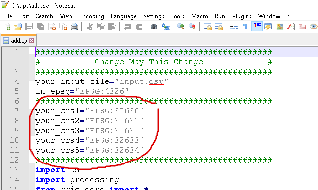
3- In add.py change your_src variable according to your zone area
.
.
What are you telling CloudCompare to do with the coordinate system?
CC is notoriously troublesome when using a projected CRS with large coordinate values (i.e. UTM) and needs to apply a reduction factor to work properly. If you prevent it from doing that, you can end up with what you describe.
This is very helpful, thanks, is this also possible in ArcGIS Pro? or only in QGIS? The reason I ask is because I am using a work computer and every time I need to download something I have to get the IT guy to input a password, so I’d rather work with the programs I already have installed if possible.
Im not sure, I was just opening the csv file using cloudcompare and it did that. I am untrained in a lot of these programs so I’m kind of just trying to learn enough to finish this project haha! It has been proving a lot more difficult than I thought it would be so I appreciate the help!