I’m new in the emlid community but not new in using rtk gps and drones.
I read lot of intreasting article on the blog and on the forum.
Nevertheless, drone is beautiful but drone can be a problem when you want to create lot of data in a city (not enought battery, authorisation…)
So, i would like to know if it’s possibile to use the navio system to only make a flight plan and geotag photo in a real aircraft.
My objectif is to :
create a box with my canon eos + Navio + reach + rtk fixed under wing
use qgroundcontrol for flight planning
Taking off from the airport and when i’m on the line of the flight plan start to take automatically photo.
If everything is fine, i’ll buy a better canon camera to map large area.
Do you think that can be possible?
Thanks a lot for your advice and sorry for my poor english.
Be aware that (in my area ), you are supposed to obtain a STC (supplemental type certificate) which will cost $$$$ in engineering and paperwork before you are allowed to modify an aircraft (or bolt things to it ).
For something like this, I think the first question is: Who will strap your box to their aircraft? If it is your aircraft, maybe you can just ‘do it.’ Or maybe your pilot is willing to do it for you and somehow consider it as ‘cargo.’
All I want do to is make sure that you think about obstacles that may exist even if you build a nice sturdy box and mounting system for your design. (I have done it myself , but it was not for commercial purposes and I made sure nobody was watching me install it on the aircraft , plus I was lucky it didn’t fall off and hit someone in the head from 5000 feet )
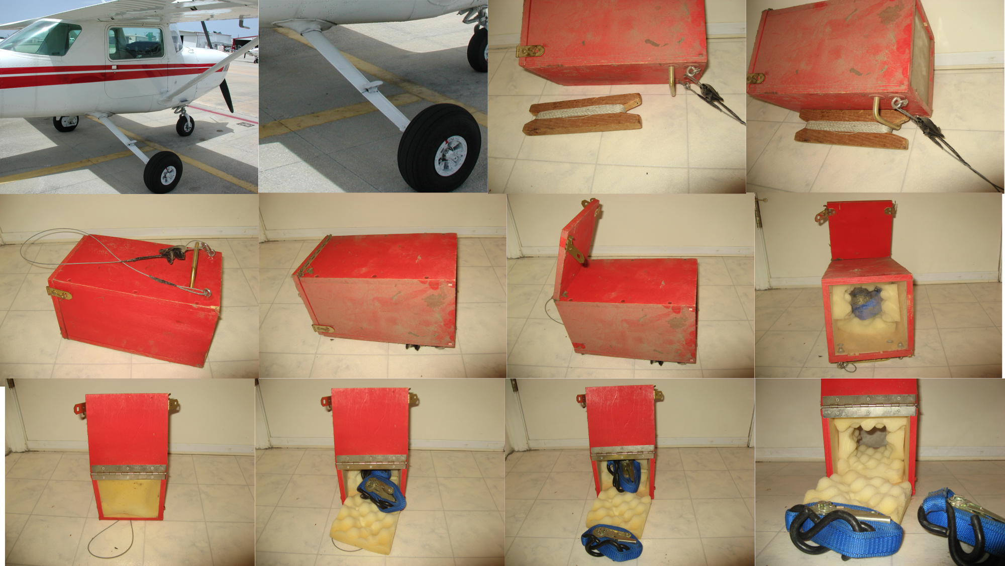
edit: Sorry for hijacking your thread @Gwen, but the nostalgia is too much. I found the original box in the garage just now. It has been sitting there up high on a shelf for 17 years. Originally used for recording digital video on 8mm tape .
In the upper pictures I demonstrate with a piece of wood to show how the metal handle was hooked over the front edge of the landing gear step. Then 2 ratchet tie downs were criss-crossed tightly around the landing gear and box, plus the steel aircraft cable was also wrapped around the landing gear as a safety line. I should add that, looking back, I will not be defending the ‘safety’ of this attachment method .
I work with a little team in that project and we can have all the authorisation and it is our plane
Before doing paperwork we have to create the process entirely (secure box, flight plan, flight log, post treatement for picture…)
For each step i have a special person:
Box and fix specialist with plane mechanician
Flight plan a pilot with 30 year of experience
And me for process the data, gis man
Today we can trigger manually the camera, to respect the distance and overlap but nothing very professionnal…
Very impress your system of 8mm, for me it was use for souvenir of familly not for an aircraft when i was young
@bide do you update your old system with navio arduplane or other technologie to create large map area?
I want something very easy for the pilot, just to see and follow the line to trigger and geotag photo on a tablet.


 ), you are supposed to obtain a STC (supplemental type certificate) which will cost $$$$ in engineering and paperwork before you are allowed to modify an aircraft
  (or bolt things to it
  ).
). , but it was not for commercial purposes and I made sure nobody was watching me install it on the aircraft
  , plus I was lucky it didn’t fall off and hit someone in the head from 5000 feet
  )
) .
.
 .
.

