I am testing out my ability to create my own “known location” using PPK.
I am using a reach M unit with the base station provided by the state of TX thats about 12km away.
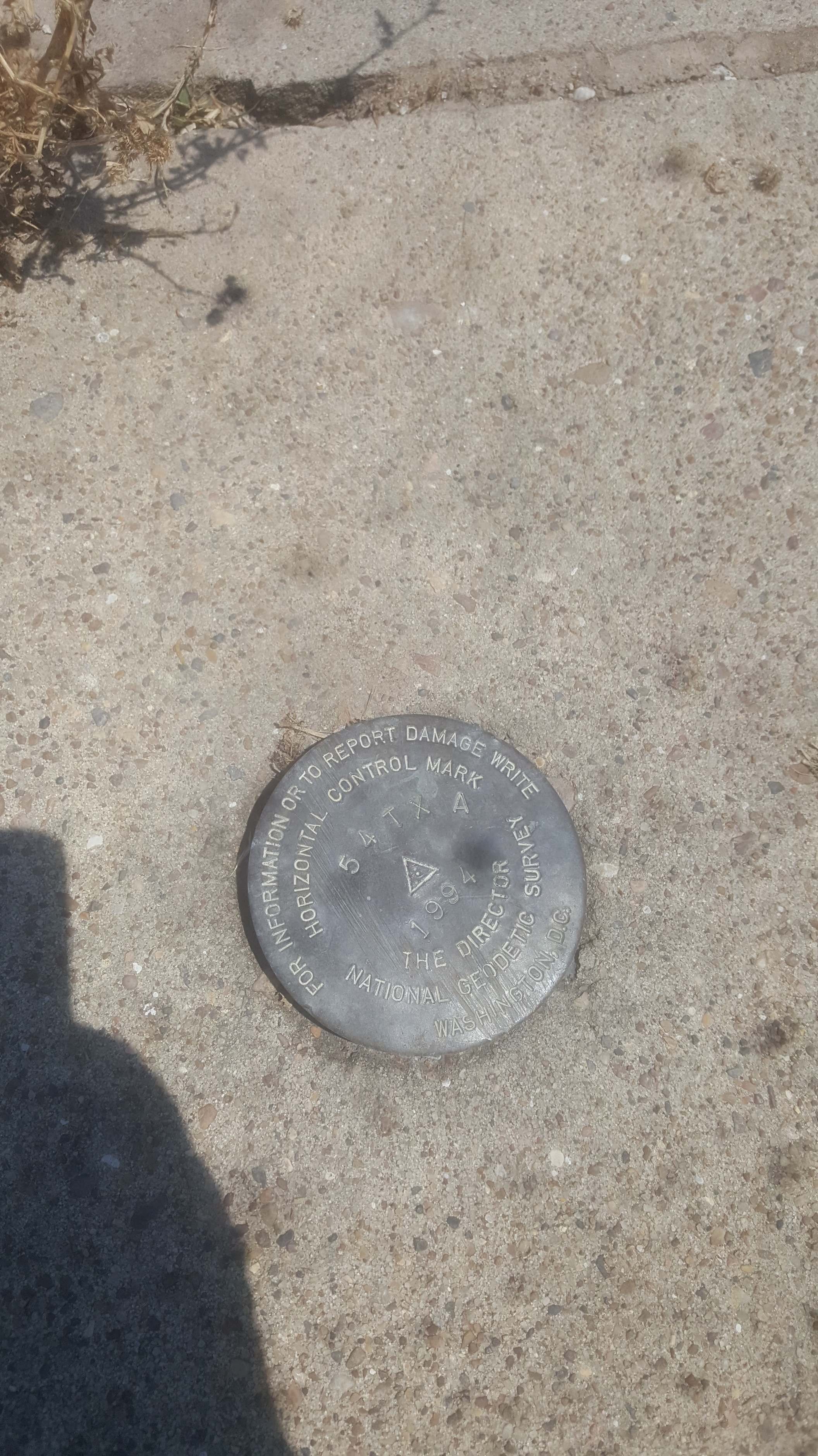
I found a monument which is in the concrete. I placed the antenna directly on top of it.
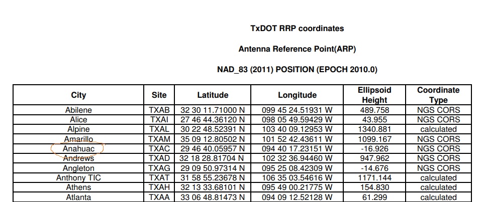
I looked up the monuments GPS coordinates to compare them to what I got with PPK. https://www.ngs.noaa.gov/cgi-bin/ds_mark.prl?PidBox=AC8380
It shows
AC8380* NAD 83(2011) POSITION- 29 45 39.55155(N) 094 50 13.53912(W) ADJUSTED
AC8380* NAD 83(2011) ELLIP HT- -19.267 (meters) (06/27/12) ADJUSTED
The lat/long was pretty close. It was off by about 4 inches maybe. The elevation however was off by about 1 meter. The plot was all FIX. My question is are the monuments sometimes not perfect to what they have listed online? That seems like a lot to be off on the elevation.
NAD 83(2011) POSITION- 29 45 39.55155(N) 094 50 13.53912(W) ADJUSTED
Those coordinates are given in NAD 83(2011). Is that what the state of TX is using for the corrections they are providing you?
AC8380 Accuracy and standard deviation values are given in cm.
AC8380
AC8380 Type/PID Horiz Ellip Dist(km) SD_N SD_E SD_h CorrNE
AC8380 -------------------------------------------------------------------
AC8380 NETWORK 1.77 13.31 0.63 0.80 6.79 +0.00667741
That horizontal network accuracy is under a centimeter, so if everything is done properly then you should be able to get closer than the 4 inches.
NAD 83(2011) EPOCH - 2010.00
Also, it looks like the coordinate is adjusted to 2010, so I wonder how much horizontal drift there is per year at that location? 8 years of drift could easily amount to a couple of inches.
I see. Continuous mode would be better for a static (stationary) observation. If you saved your log files, then maybe you could re-process in continuous mode and see if you get the same result or different. Otherwise you could just try it again.
New realizations of WGS84 based on GPS data, such as G730, G873 and G1150. These new WGS84 realizations are coincident with ITRF at about 10-centimeter level.
For these realizations there are no official transformation parameters. This means that one can consider that ITRF coordinates are also expressed in WGS84 at 10 cm level.
So running it in “static” mode with “continuous” resulted in the correct coordinates of that marker. But from a 1 hour test I only got about 2 mins of FIX. Does that sound right?
If you are doing RTK, then set it in ReachView. If you are doing PPK, then set it in RTKpost. (Set it wherever the processing is being done.)
You can let it go as long as you want. If you only do 5 minutes, then you might be uncertain of the outcome. If you do 30 minutes or longer, or even better, do it twice on different occasions. Then you will be more certain of your result.
Ideally you will get a fix in the first few minutes. If you log for an hour and only get 2 minutes of fix, then you must have some obstructions in the sky or not enough satellites for good ambiguity resolution.
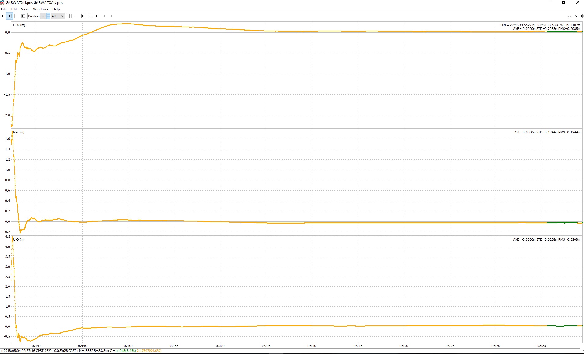
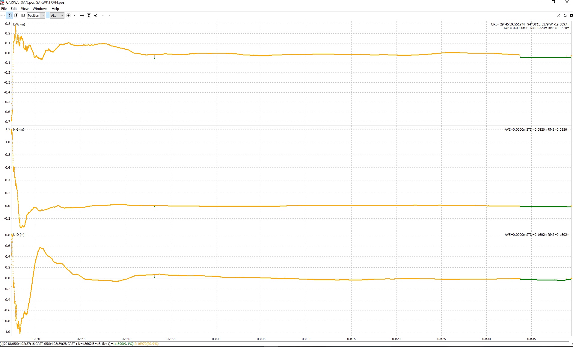
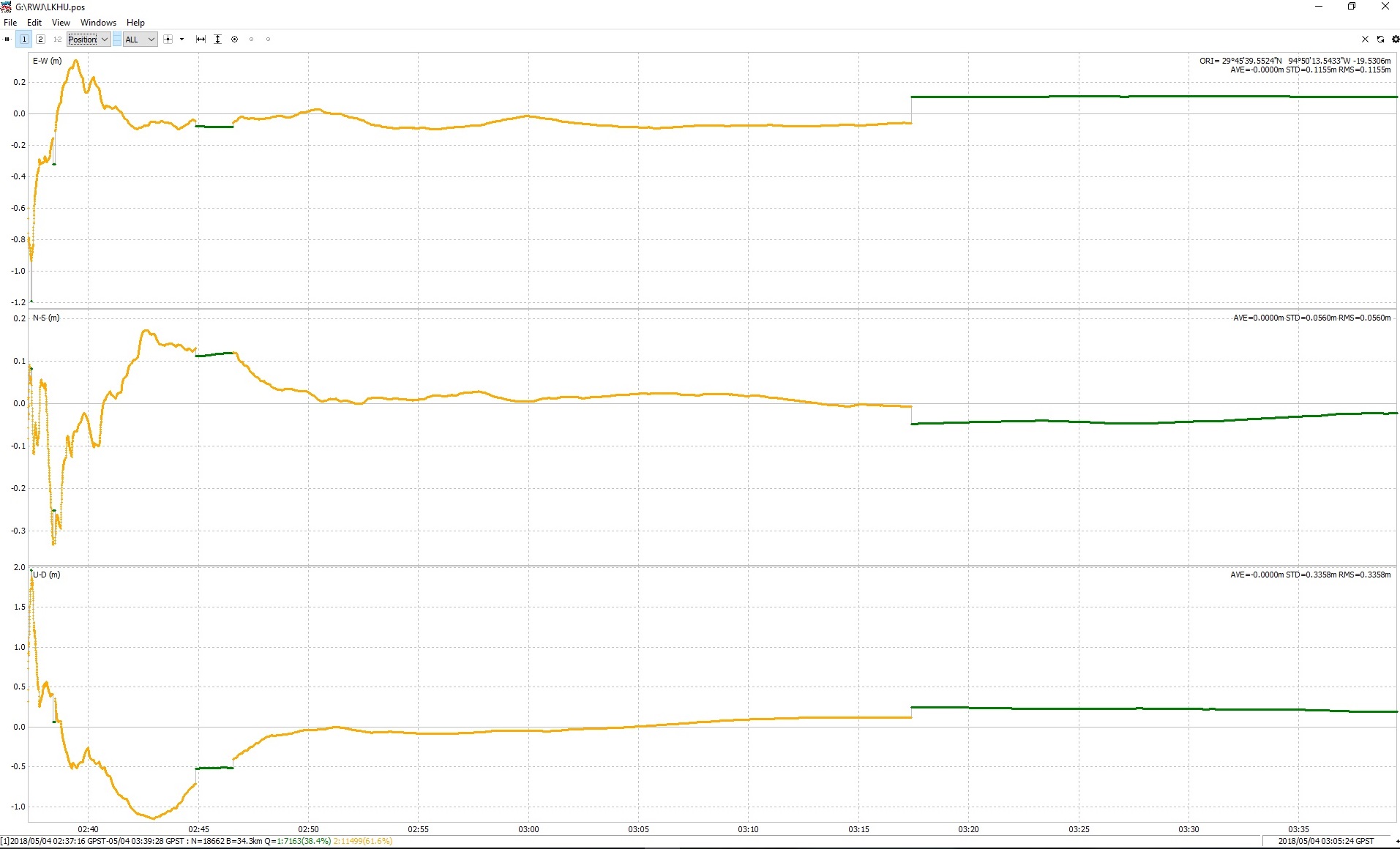
This is from 3 different base stations located around me between 16-30km away.
There was no obstructions. Its at a small airport and basically very open field.
There is only minutes of FIX but it seems accurate. Was at the end of the (hour test) it got a fix not at the beginning.
When surveying with the Reach, you are obtaining WGS84 ellipse heights, not NAD(83) ellipse height
Here is the transformation information:
TRANSFORMING POSITIONS FROM NAD_83(2011/CORS96/2007) (EPOCH = 01-01-2010 (2010.0000))
TO WGS_84(G1150) (EPOCH = 06-14-2018 (2018.4500))
AC8380 NAD83(2011) WGS84
LATITUDE 29 45 39.55155 N 29 45 39.56745 N -0.06 mm/yr north
LONGITUDE 94 50 13.53912 W 94 50 13.57409 W 1.81 mm/yr east
ELLIP. HT. -19.267 -20.585 m -0.84 mm/yr up
The Ellip. HT. under WGS84 should have been what you were reading.


 With (epoch 2010)