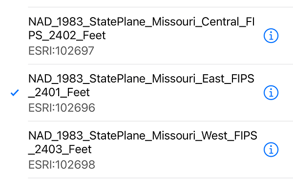
I can start a project in Flow and pick the Missouri State Plane coordinate system , but if I start the project in Flow 360, the coordinate system is not there to select. Is there any way to add those to Flow 360?
Hi @MWilco77,
Which CS do you need? We support Missouri Central, Missouri East, and Missouri West projections in the NAD83(2011) datum.
What was the EPSG code that you’ve chosen in the Flow app?
Got it. Is there any reason why you want to use an older version of the NAD83 datum? NAD83(2011) is the current realization used in the USA.
According to our PLS, this is dictated by the state surveyors board as the CS to use until the new low distortion zones are put into place.
This is brutal. I started a project in January of 2024 that was on original NAD83 TX-C (USft) and GEOID12B. Obviously NAD83(2011) replaced the original a LONG time ago, USft has been deprecated since January of 2023 and GEOID18 replaced GEOID12B in 2019. This is what we are dealing with now, just imagine what’s going to happen and how long the lead time is going to be to transition to the Datum of 2022 (2026)… Luckily I see the light at the end of the tunnel as most of the drone surveys I am doing for new work are not only on the latest available datums but on the network. Huge difference!
Oh, I see. The CS that you chose in Emlid Flow is from our legacy system. This is why you do not see these CS in Emlid Flow 360, as only the ones we officially support are in the web version.
On the other hand, do you receive corrections from MODOT? If so, I see they broadcast their corrections in NAD83(2011) epoch 2010.0. Then, choosing NAD83(2011)/Missouri East in Emlid Flow should work for you.
I’m not sure how it will work for you, though, when you need to submit the data, as your data will have a different NAD83 realization than the one required by your State.


