Emlid adds high precision to WingtraGROUND, a new kit for survey-grade aerial data capture with the WingtraONE Gen II—VTOL drone widely regarded as the industry benchmark.
The kit features Emlid-powered GNSS receivers with automatic connectivity to the Wingtra ecosystem and step-by-step guidance via the Wingtra tablet. A single guided workflow makes it easy for drone surveyors to set up base stations and checkpoints faster and with a lower risk of errors.
What is WingtraGROUND?
WingtraGROUND is a portable kit for on-site PPK surveys that includes all the GNSS equipment and accessories you need for survey-grade aerial data capture:
- 2 Wingtra GNSS receivers powered by Emlid;
- 2 small tripods;
- 6 checkpoints (GCPs);
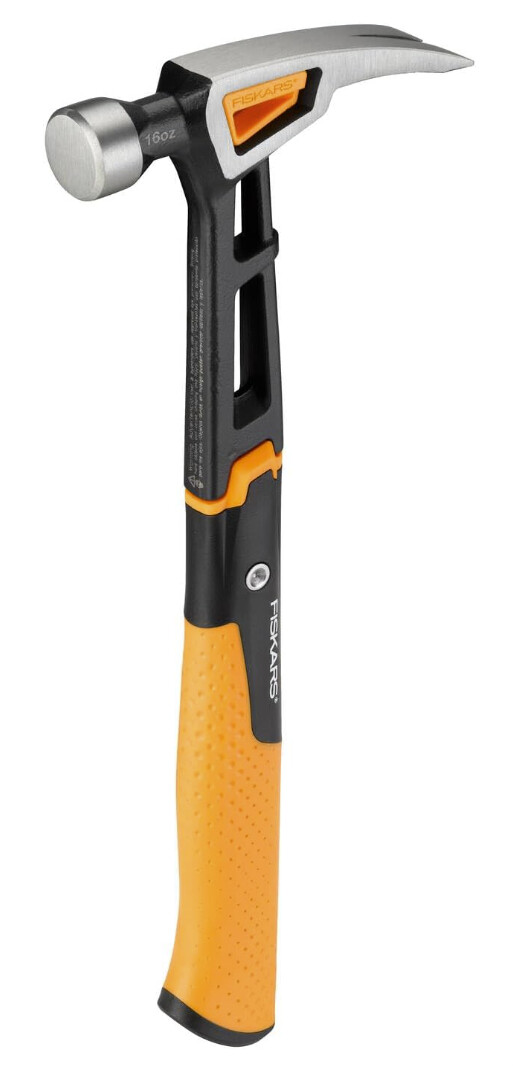
- a hammer and nails for securing GCPs;
- a portable carrying case.
Apart from bringing all the hardware components into one handy set, WingtraGROUND helps manage the surveying workflow via the Wingtra tablet interface. Automatic connectivity between the tablet and the receivers and real-time sync with WingtraCloud ensure precise data collection at all times.
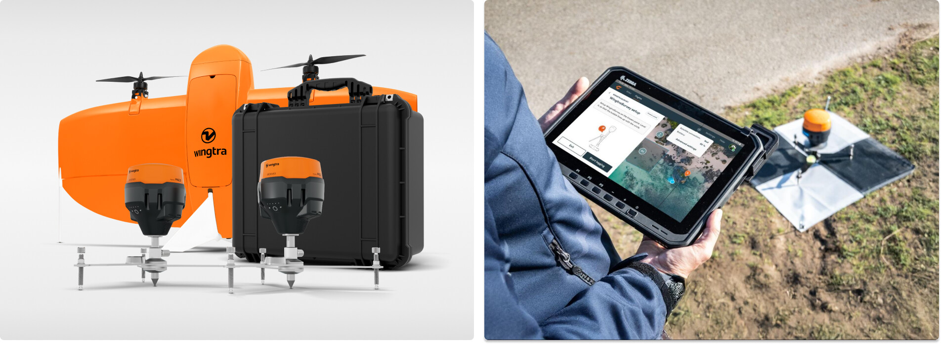
GNSS receivers connected to the Wingtra tablet, tripods, and GCPs in the WingtraGROUND kit
Unlocking the full potential of drone data
Ground control complexity has long been a major barrier to harnessing the power of drone data, even with advanced technology like Wingtra’s.
“Until now, even with the best drone, you needed to know how to operate base stations, rovers, checkpoints, and survey nails—all from different manufacturers,” said André Becker, Senior Product Manager at Wingtra. “These disconnected components created fragmented workflows, increasing the risk of faulty setups, inaccurate data, and wasted time. This part of the process was begging for simplicity and seamless integration, and that’s exactly what we’re delivering with WingtraGROUND.”
WingtraGROUND removes traditional ground control complexity by combining all necessary tools—GNSS receivers, checkpoints, and tools—into one portable set and unifying previously disjointed workflows. Thanks to step-by-step guidance via Wingtra tablet, surveyors can proactively troubleshoot base setup errors before their drone takes off, ensuring a smoother, more reliable survey process.
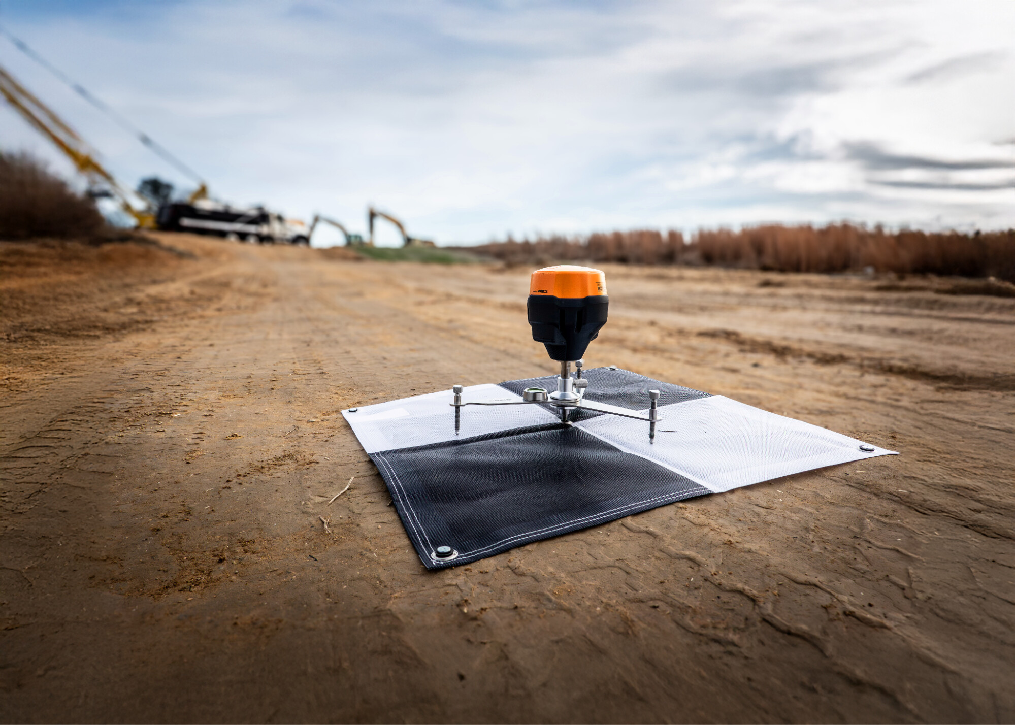
WingtraGROUND checkpoints setup