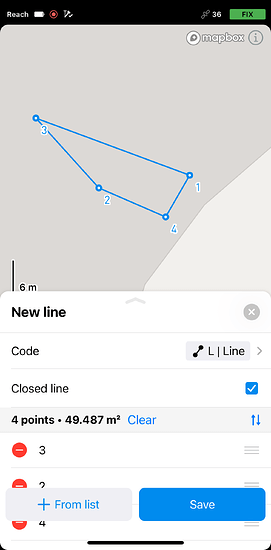
I have recently bought emlid RS+. I only want to measure the field as a polygon. How to I do that? I need the monthly/annual plan?
Emlid has some great tutorials on their devices and on procedures for use.
Even though I’m pretty familiar with the M2 and RS2 I have, I still occasionally read their info.
The tutorials can be used for all receivers basically, except for the different capabilities of each model.
Very good tutorials !
No. You can totally just measure your corners etc with the basic Flow. Export the points and connect the dots using polygon tools in most CAD software etc or free Qgis CAD software… FreeCAD also…but I do not think has Coordinate Systems if you need that.
But if you “HAVE TO” create linework (not just points) in Flow, then yes, subscription.
Check out MicroSurvey FieldGenius Windows (fully established) or Android (work in progress). They have 30 point max fully functional demos you can use for EACH new file if you don’t need more than 30 points per file. Best field survey software out there I feel… next to the $$$$$ Trimble, Leica stuff of course.
We don’t support closed polygons at the moment, but we have it on our roadmap. We are collecting such cases for consideration and I’ll add yours as +1.
As Tim mentioned: you can work with lines and points in Emlid Flow/Emlid Flow 360. You can collect corner points and export a file to work further with CAD software or create a polygon using lines. The option to collect lines is available in our Survey plan.
+1 for closed Polygons, I really like what Emlid are doing in the industry but it’s a key reason I haven’t yet moved off legacy Trimble TerraSync.
The current Flow choices are not ideal for many use cases.
-
Either pay the subscription and for every area polygon still have to walk the last segment of a Line, which in the bush here may not be easy, and in any event, it still remains a line, and possibly with a large gap if you choose not to or can’t walk it.
-
And/or sift through the spaghetti in GIS to sort it out. Workflow example, in the GIS some lines could really be polygons, e.g. structures, dams, heritage foundations, whatever, and some could be the fences or boundaries around them with small gaps for gates or roads so need to remain lines. But unless you zoom in and pan around, the polygons without the last segment may look much more like lines than the lines that really are lines.
Yes, feature coding helps but visual correctness & maintaining appropriate categories (points/lines/polygons) make it a whole lot easier to do the bulk of the work, much quicker, and ultimately with less error and rework.
Otherwise, it’s a like buying a sheep dog but it’s only got three legs because the left rear is still on the roadmap.
Thanks
Thank you for explaining your case! I’ve added your request as well. I agree that this is a useful feature, and I’ll let you know once we have any updates on it!
Hi everyone,
I have good news! Starting from 11.3, Emlid Flow supports closed polygons with Survey Plan.
Here’s our guide on working with them. If you don’t have a Survey Plan yet, feel free to check out our 30-day free trial. Let us know what you think!


