What if we could use the RS2 that we use as base as one of the ground control points visible from the air? That point is comparatively well known, wont have to be sprayed on the ground, and should provide a good check when used in photogrammetry software. All it would take is some visible marking on top of the unit.
Imagine spray painting a nice checkerboard pattern on the top. It is slightly domed, and the visible point would have a slight offset wrt to antenna position. The possible error is however slight, and the offset is easily checked in the cad-files emlid provides.
Would spray-painting the gray dome interfere with the reception?
A proposal for emlid for the RS3: make the top dome a bit planer, without the embossed logo, and colour it in two distinct colours. Perhaps sell it as a special-edition.
I don’t think I would paint the top (antenna). There’s really no need. I’d just put a 2 cm black marker dot on top. Make sure you use the ground elevation in your processing though. There’s enough contrast in the black dot and white top to pick out in the imagery. I’m sure others have done this.
Some paints have a metallic component and may reflect the received signals, remember the signals are around 0.1 watt and aren’t very strong. It’s the processor in the receiver that can use the clean-no multipath signal to determine it’s accurate location. Anything interfering with reception is not good.
Perhaps Emlid can design something that’s embedded in the case. That would be cool.
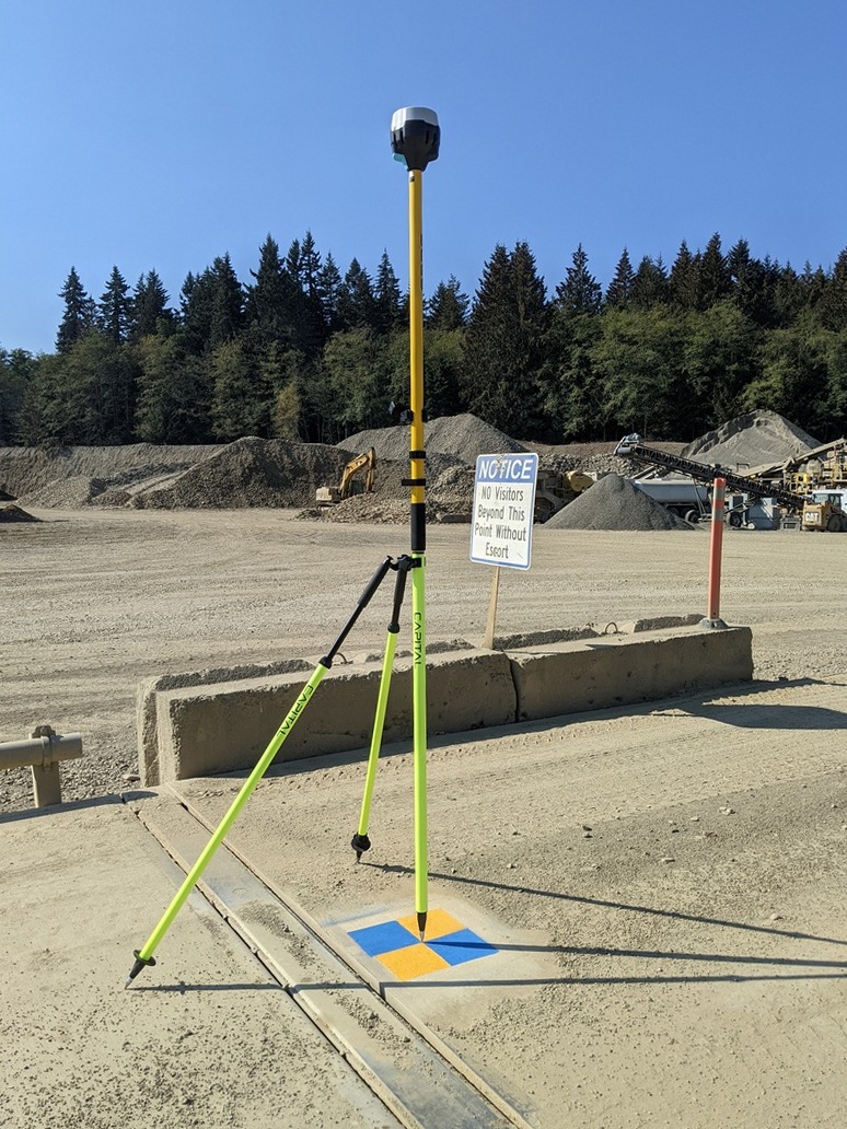
We use 16" square checkered targets and usually put one under the base and use it as a GCP, as long as the base isn’t placed over an existing medallion. Works fine for us. I guess we could make one target with a hole large enough to be able to align the base on a known point. I’m not particularly enthused by using the top of the receiver as a GCP for photogrammetry.
I don’t believe you will even get enough points on the rover head to do that. Just use the target it is sitting on. Unless your at 50ft it won’t reconstruct the pole and legs. Even safer is you calibrate using the DTM.
I agree with Gabriel_C, dpitman, wizprod and chascoadmin that the best practice is to set a GCP target below the Base at ground level, at least that’s what works for me.
This particular picture was taken at 135ft AGL and you can clearly identify the #0 on the 24"x24" target and I have flown higher and was still able to identify the target and center point. This was a test mission, as you can see I flew a little later in the day then I should have. These particular targets have an center opening flaps so they are able to easily fit over a monument if need be.
Lots of interesting thoughts. Thanks for all the ideas. I understand that this would not suite everyones workflow. Regardless if you agree with me on if it is wise or not, how would you mark the top?
EBE111057, Good input. A small black marker dot does have the problem of glare from the surrounding light gray however. I am convinced of the visibility advantages on using colors such as green/purple used by aerotas GCPs, or dpitmans photo. Also, Ive found a cross form to be a bit easier to mark. Why would you wish to use the ground elevation?
Gabriel_C - Yes, thats a setup we have used as well. Could you elaborate on why you think its a bad idea?
dpitman - Thats some beautiful colors on the marker. Could you elaborate on why that is advantageous over using the reciever as reference?
wizprod - Im not following your arguments about cohesion and stuff floating in space. Its all pixels, and the SFM process of calculating a suitable interior/exterior orientation does not care about whats a surface or not. Perhaps you have confused it with the process of checking the produced DTM? The top of the lid is plenty big for marking as long as you fly with a high resolution sensor. Finding the distance is easy - just check it in the emlid provided STL files. Finally, regarding using a stencil instead - yes, thats useful for marking check mark. It does not solve the pr.
chascoadmin - Nothing has to be reconstructed for it to be used as a marker.
We are working to produce a DEM. So it only makes sense for us that a reference point is also on the surface. In addition, if/when we return to a project site and set up on the same point, we are again referencing that same point even if the pole or receiver is different. Also, we can use that point even if we’re not set up on it.
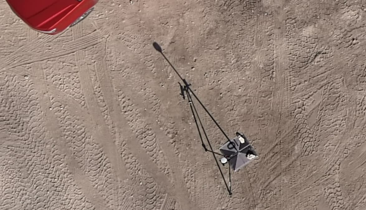
The top of the receiver is not suited to act as an aerial target. It is also too small for the typical AGL that we operate.
In my experience, even with high resolution sensors and suitable flight altitude, reconstruction of slim, tall, and partially solid objects (like a tripod, football goal/net, etc.) is always problematic. It’s far more robust to clamp your GCPs to the actual ground.
I also think it’s better to use points on the ground as GCPs. The receiver usually is about 2m higher than surrounding surface and it’s unnatural drop, which may lead to inaccurate results. GCPs should be more stable and predictable.
Interesting to hear your thoughts Anna. I must admit, the consensus on this forum confuses me. Sure, if youre checking it against a DTM - fine. But why does the geometry of the target surface matter? I have done many years of terrestrial photogrammetry with targets shot with total station on ground, roof, floor, trees - its all pixels.
Nothing is stopping you from using the top of the receiver as a target if you are set on it. You’ll probably have to figure out the distance from the top of the case to the APC.
Everyone just thinks it is a bad idea is all. If the top of the receiver was the only option, that would be one thing. But it is clearly not. You could get yourself some Propeller Aeropoints if you want something designed to be the receiver AND the aerial target.
I’m curious what your end product is that gives you the idea that this is preferable to either a target placed on the ground, or some existing infrastructure clearly visible from the air?