


Hardware: Emlid Reach M2 reciever
Software: Ubuntu 20.04, connection via USB and TCP NMEA Position Streaming, NTRIP real-time Correction via WiFi Hotspot to use in ROS Application
Reach Firmware version: 31.7
Hi everyone,
I successfully connected the M2 device via TCP position streaming to my ROS environment using the following community-provided ROS node: GitHub - rpng/reach_ros_node: ROS driver for the Reach RTK GNSS module by Emlid.
Now, I was trying to get a bit more information on the recieved signal quality from the device. I compared the different NMEA messages and decided to get the following criteria from different messages:
- number of satellites in view from GGA
- pdop, hdop, vdop from GSA
While looking at the GGA sentence in more detail, I noticed that the values don’t entirely match with the Status overview provided by the M2 Web interface.
I have attached a screenshot with the received NMEA sentences as terminal output with the GGA sentence roughly at the center of the terminal window with the content parsed to variables according to the official NMEA definition as output below the original sentence for better readability.
If we compare the coordinates with the Status overview you can see a slight offset in latitude and longitude and altitude, but also a completely different number of satellites in view. First, I thought the no. of satellites in view only displayed the amount of GLONASS satellites, but the number kept changing to different values. Also the “GN” in “GNGGA” indicates that it should display a solution for combined coordinate systems.
For the dilution of precision parameters it turned out that the GSA message are separate for different coordinate systems so instead of recieving overall dop values I get them seperately and I can’t really calculate average dop-values without the number of viewed satellites for each system, or am I thinking falsely?
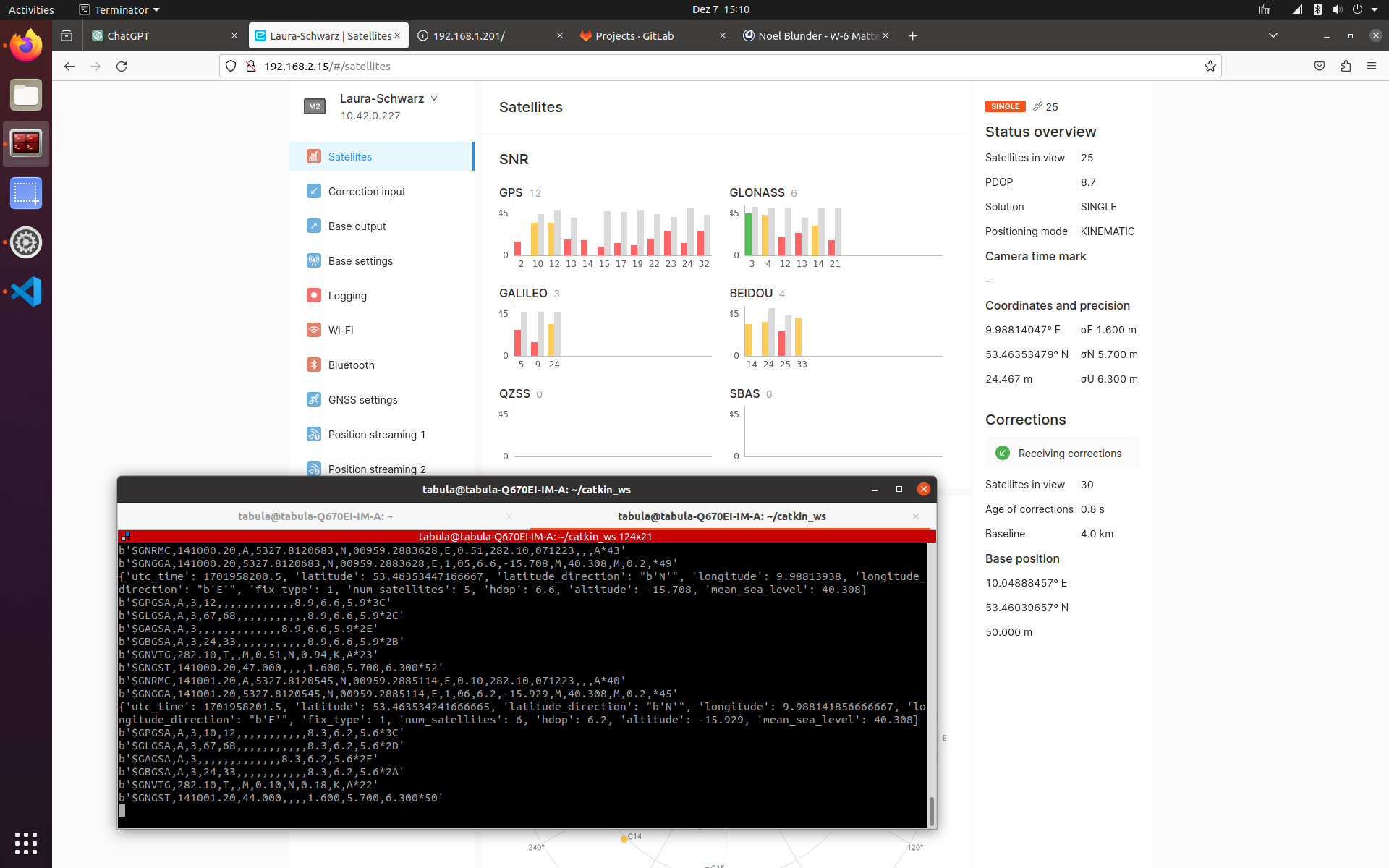
So, I’m wondering now, what the GGA output actually shows compared to the Status overview and if there is any other way to recieve the position, number of satellites and dilution of precision parameters that match the values represented on the web UI as these seem to include the recieved NTRIP corrections.
Thanks a lot in advance for any thoughts put into this and looking forward to your replies
Best,
Noel