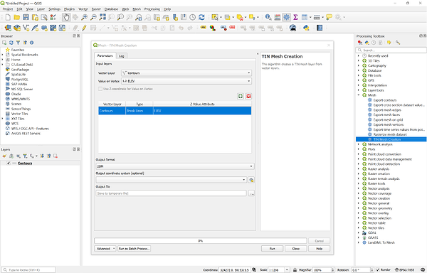
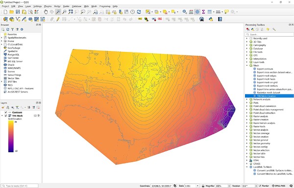
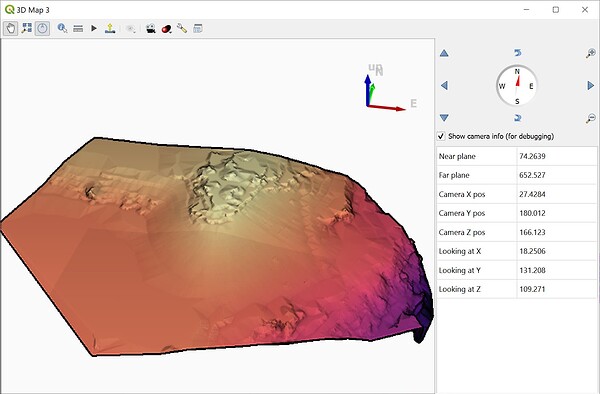
Yeah, QGIS isn’t constantly calculating the elements and rendering. It doesn’t do much of anything until you are interacting with the objects unless you have a background or are in the 3D viewer and even then it’s not really rendering with very dense shading.
I just opened in QGIS and there was no elevation. Same in Agtek.
There is an elevation field but nothing renders in 3D?
Have to use .shp file. .dxf, no 3d Z data.
Coordinate Reference System (CRS)
| Name | EPSG:7855 - GDA2020 / MGA zone 55 |
|---|---|
| Units | meters |
| Type | Projected |
| Method | Universal Transverse Mercator (UTM) |
| Celestial Body | Earth |
| Reference | Static (relies on a datum which is plate-fixed) |
Interesting. I’m not a QGIS user but will try to check this out later. Processing a 100ac study for a local university and a Surveyor friend of mine. I’ve been shooting in GCP’s and checkpoints all morning and am ready to sit down and crunch some data.
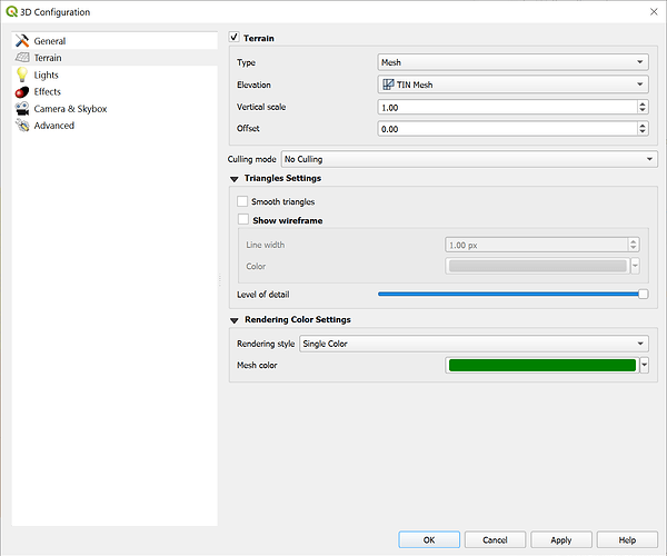
@michaelL sorry to not reply before now - sleep time here ![]() but @timd1971 was correct on the CRS. And a really interesting settings tab for 3D…a place I usually don’t go in QGIS. Some nice surfaces @timd1971
but @timd1971 was correct on the CRS. And a really interesting settings tab for 3D…a place I usually don’t go in QGIS. Some nice surfaces @timd1971
I’ll have to go exploring more!
Curious, what was the origin of your 3D .shp contours data?
I used the Raster → Extraction → Contour command on the DEM.
The underlying data was a Mavic 3E ortho mission with a reported GSD of 1.08cm
I started using Global Mapper from the early days, it was called “dlgv32” and you could download for free from the USGS site. It was one of the few early GIS packages that could import USGS file formats of DRG’s, DOQQ and the vector data “SDTS (spatial data transfer system)”. I think the guy who developed it was with the USGS at the time. It was free then but it matured into Global Mapper I think in about 1998-99. When I first bought the official GM package, it was about $100. I’ve seen it matured into what it is today (v25.1) It’s a great tool for land surveyors, GIS techs and others .
QGIS reminds me of when Global Mapper started. I’ve just begun to start using QGIS about 3 months ago and I’m impressed in what it can do. I like the style and the technical way if using it. I’m hoping to get familiar enough with it to use the mobile package. It has a lot of great routines. This would be a great addition to Emlid’s mobile app.
Similar here, the USGS specific functionality and formats in dlgv32 limited it’s usefulness here in Australia but I eventually coughed up the cash for V4 and haven’t looked back.
This topic was automatically closed 100 days after the last reply. New replies are no longer allowed.


