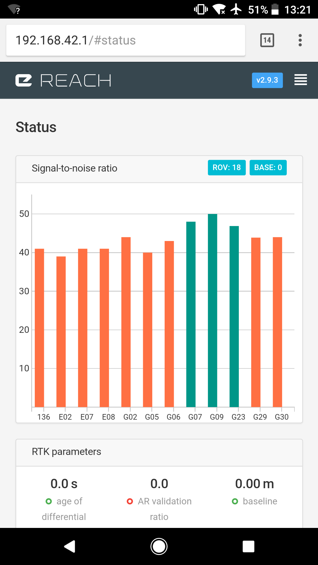
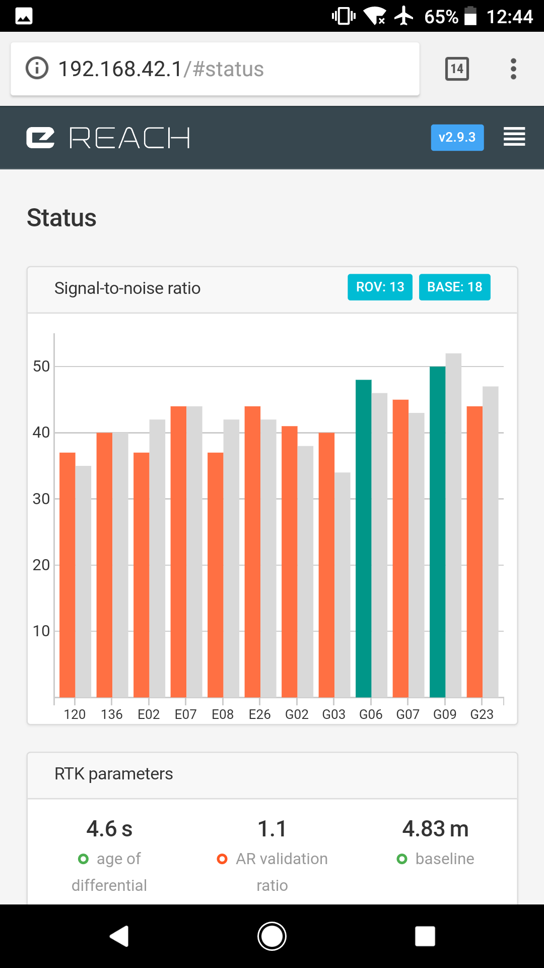
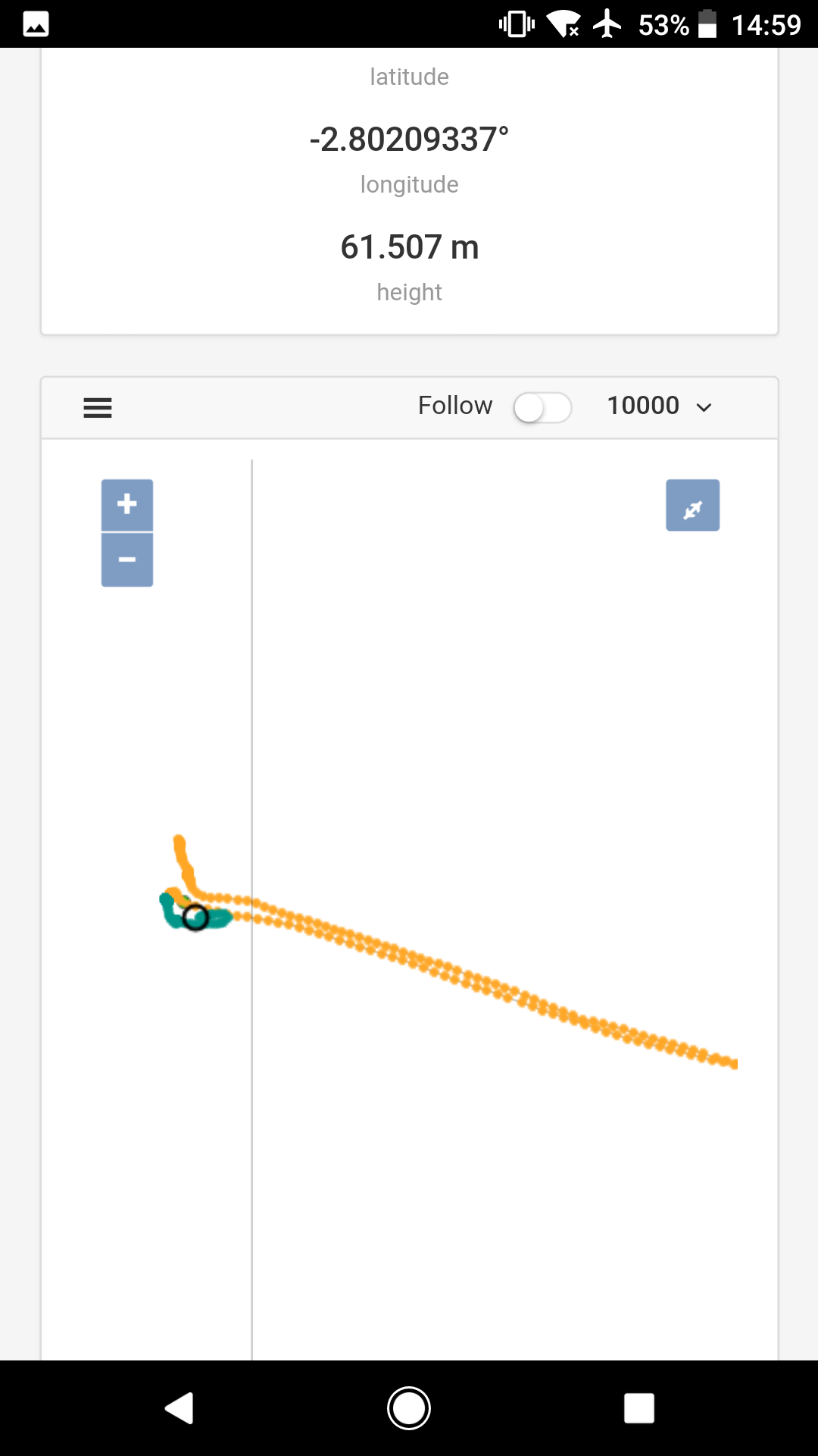
I have my two Reach modules set up with the Tallysman antennas on 100mm square steel ground planes. Both the basestation & the rover units struggle to get more than 2 or 3 satellites >45dB SNR. Is this just because there are too many obstructions of the sky down to 30°?
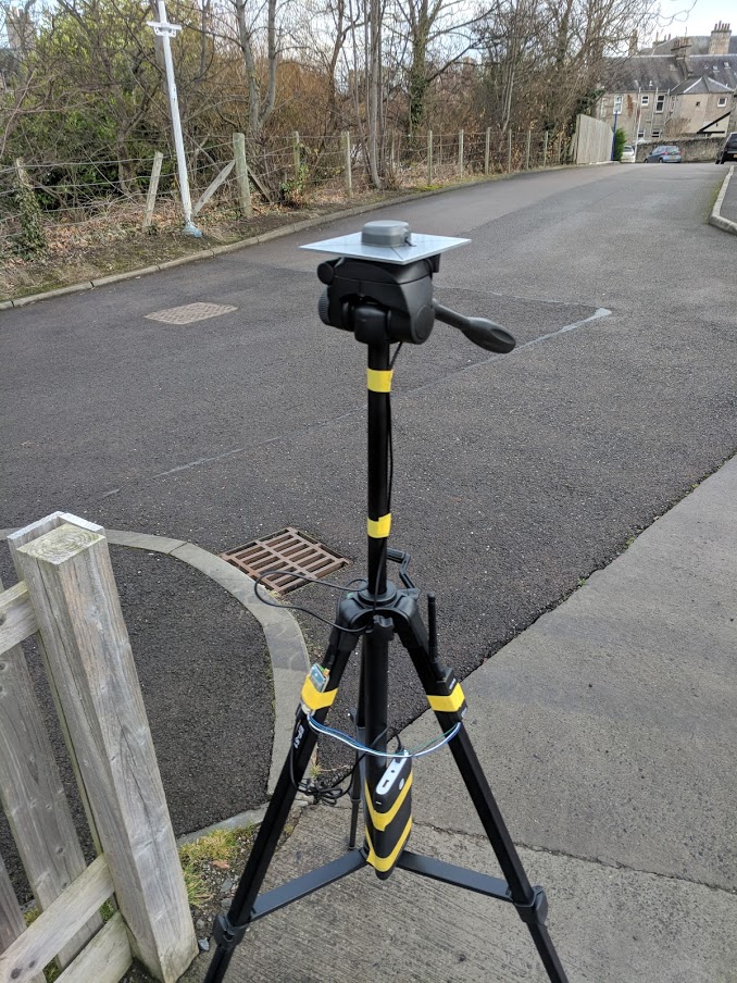
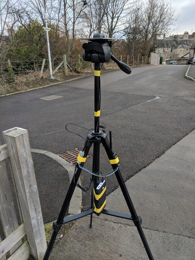
1.I would try raising the antenna up 1m.
2.Keep all RF and other noisy equipments at a minimum and below the ground plate
3.Enable Glonass, i cant see any in your status
4.Do you share battery with other usb device? you could get interference from other units connected. If not, you could also get interference just by leaving a other cables influence the Reach antenna cable.
5.You hav buildings nearby that could easily give multipath. If els fails, try in a more open area
This made a big improvement immediately. I had it disabled for testing the higher frequency updates (10Hz/14Hz) which require GLONASS to be disabled, but obviously the higher frequency doesn’t help if it cannot get a fix!
Zen Philosophy Time:
When starting out aim for perfect. Once you have achieved perfection you can start making compromises and see their impact.
End Zen.
I would borrow a ladder and put your BS on the roof in a little tupperware box, with a chunk of something to stop it blowing a way. This would give you a very clear skyview and remove any questions about multipath/ blocking impacts.
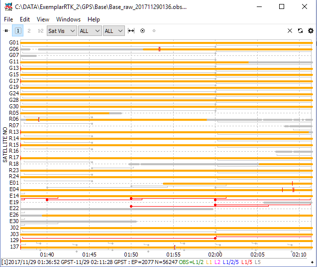
If you open rtkpost and load your files in there then the little target symbol above the file name allows you to look at the raw data.
The Satviz plot shows all the satellites and their unbroken records:
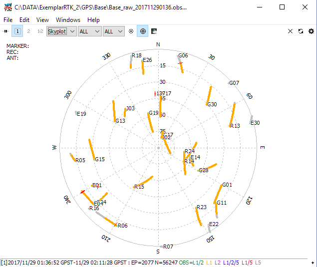
This is a good base staion, each little red crossline is a loss of lock on the satellite. Remember how long it takes for the solution to converge, too many breaks and it never converges. This is especially important for the base. This was a short occupation. The skyplot allows you to see the data in context of position in the sky:
All my 'breaks were with very low elevation satellites.
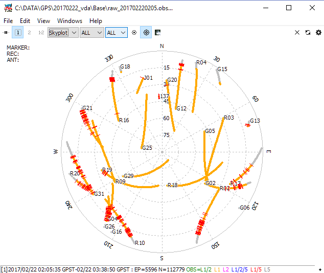
The base below, however, was positioned in a clearing in the trees and I needed to set the base elevation/SNR mask to exclude all the low satellites, leading to poorer geometry and reduced satellite observations: