RE: Emlid Flow v1.5 & Exporting Survey using the DXF option - DXF appears to be invalid
Samsung Galaxy S23, Android v13
AutoCAD Land Development Desktop (2004) on WinXP (VM)
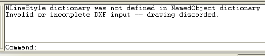
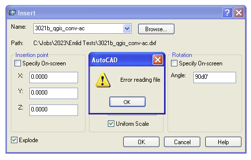
Every exported dxf from Emlid Flow, Survey (free version) fails to be recognized by AutoCAD circa 2004.
FWIW: Autodesck DWG TrueView 2024 is able to open the Emlid Flow dxf, as is Global Mapper v24.1
Thank you for that suggestion. And yes, that workaround appears to work well for this issue.
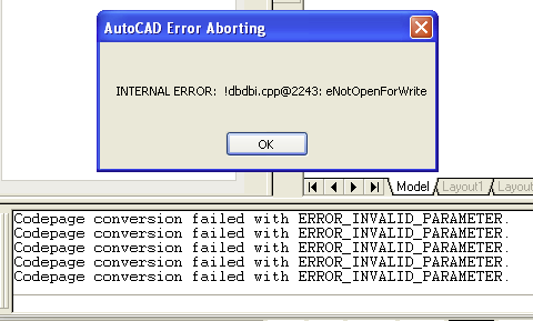
I also tried exporting a .dwg in AutoCAD 2004 format from GM, but AutoCAD still complains and then crashes:
Actually, the main reason for this report was for users and developers as being informational and was a discovery I made while trying puzzle through a separate issue I found. I’ll start a separate thread on that in a bit.
I suspect .dxf parameters have evolved over time. All it takes is one syntax adjustment on a parameter, and an old application can choke on a newer file. Looks like you have a good workaround.
I agree that my AutoCAD version is old and outdated, and not unlike me.
I don’t agree that Emlid Flow should only format the dxf file for current versions of AutoCAD. And that’s fine, and I completely accept that. As mentioned to begin with, it’s just an observation that Emlid Flow’s export failed in AutoCAD 2004 (R18).
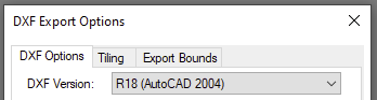
The main reason that the Global Mapper workaround works is because of its DXF Export Options, to format the dxf version to R18 and might be something for EF’s developers to consider.
Thanks for the fun Dave, but no dice in AutoCAD (2004) LDD.
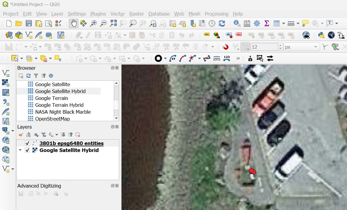
For even more fun, I opened 3021b_qgis_conv-ac.dxf in Global Mapper and see an odd looking doppelgänger of the points off to the northwest. These are likely what the nodes of the labels were reduced to along their journey back to Maine. The real surveyed points fall on the mark, shown here with the photo for 3801 behind them.
I saw that in QGIS as well. I didn’t pay too much attention as I had no real knowledge of what the array of points should look like.
That was just the name I gave it on export, if that’s what your mean?
If you really want to dig into what is throwing AC off, you can compare the file out of ES with the converted file out of GM using a text editor. If you are just turning over rocks to see what might be underneath, then probably not worth the effort.