


where should the instrumental height be entered in RTKLib?
In Pole/antenna height fields?
where is that field ? In RTKlib no ReachView
In the options, but usually less confusing to just add them manually after processing
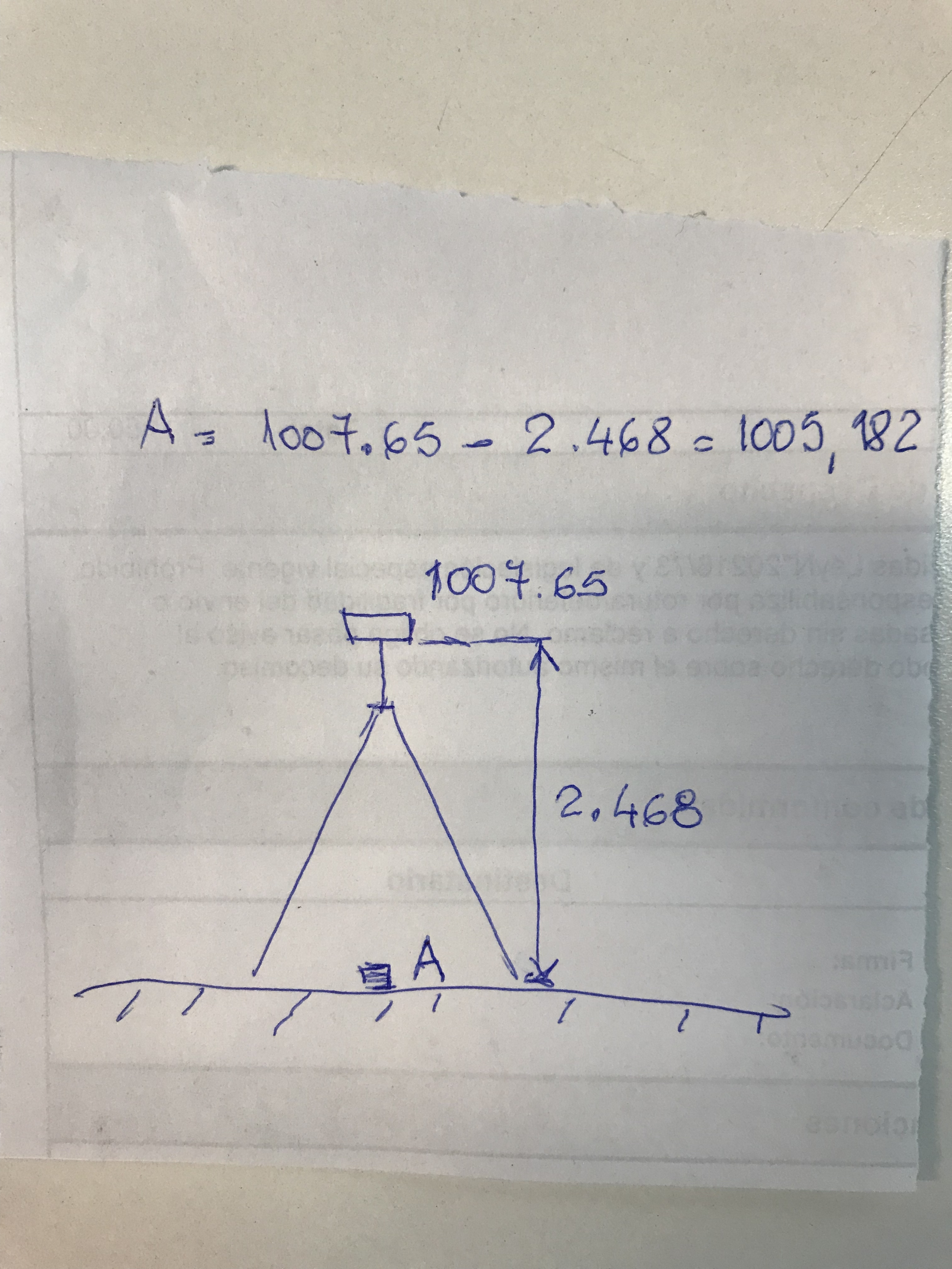
to all the measures I must subtract the height of the instrument. How can I determine the coordinates of the base if I did not write them down on a paper after I made the average?

Hi @agrimgalina,
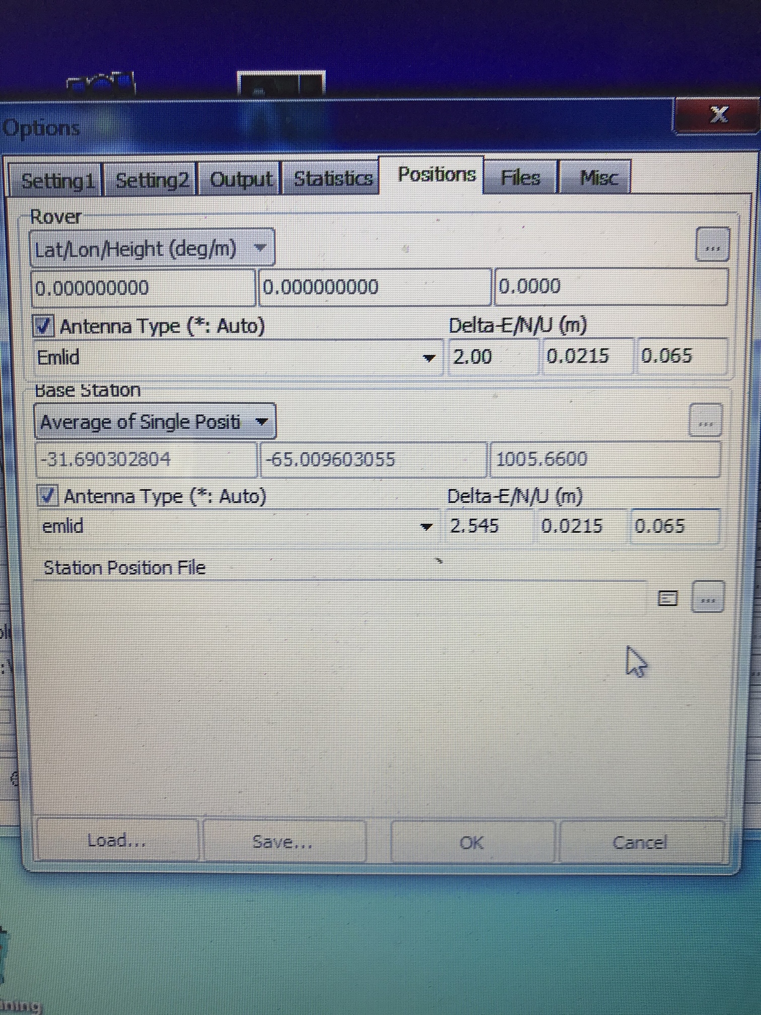
It’s possible to add it in RTKPOST in Options - Positions - Base Station - Antenna Type.
You can open base .obs file in text editor and find APPROX POSITION in the header.
Also, there’s a mistake in your antenna height calculations.
For 2m pole, you should add 0.0215 for the thread adapter and 0.065 for the distance between the bottom of the Reach RS unit and the center mark.
As a result, you’ll have 2.0865m.
1 Like
Hello Andrew, so it must be configured?
If you use Survey tool, height will automatically be used when collecting points.
As for raw data logging, you’ll need to add height during post-processing.
Is it for the case that I have to do post-processing, the image I sent is fine?
For the rover, you should fill in only U field with your_pole_height + 0.0215 + 0.065.
As for the base, you don’t need to enter any values because it’s an average position. Thus, the base value of the height is also averaged.